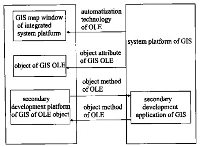
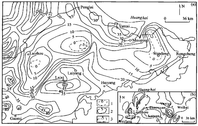
2003 Vol. 14, No. 1
2003, 14(1): 1-7.
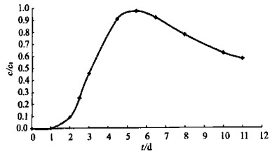
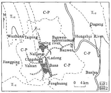
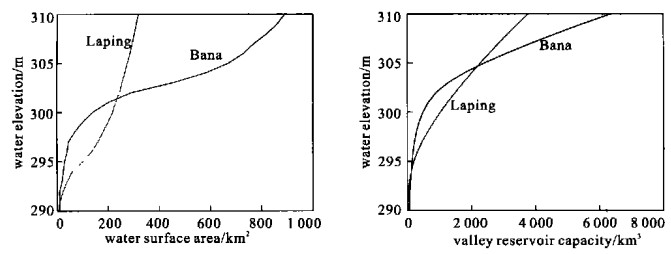
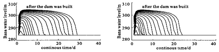
Abstract:
2003, 14(1): 8-15.
Abstract:
2003, 14(1): 16-24.
Abstract:


2003, 14(1): 25-27.
Abstract:
2003, 14(1): 28-33.
Abstract:

2003, 14(1): 34-41.
Abstract:
2003, 14(1): 42-51.
Abstract:

2003, 14(1): 52-58.
Abstract:


2003, 14(1): 59-64.
Abstract:


2003, 14(1): 65-72.
Abstract:
2003, 14(1): 73-78.
Abstract:


2003, 14(1): 79-84.
Abstract:

2003, 14(1): 85-89, 94.
Abstract:
2003, 14(1): 90-94.
Abstract: