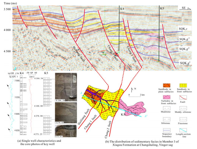
Abstract:
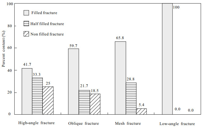
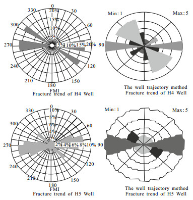
Based on comprehensive analysis of the drilling core, slice analysis, FMI image well logging and other well logging data, the features of the Carboniferous volcanic rocks fracture reservoirs in Hongshanzui (红山嘴) oilfield of Junggar Basin have been studied. According to contributing factor, the fracture reservoirs were divided into diagenetic fractures, tectonic fractures, weathered fractures and dissolving fractures. And the diagenetic fractures were further divided into three subclasses of condensation contraction fractures, intergravel fractures and intercrystal fractures. The fracture reservoirs were also divided into 4 categories, such as high-angle fractures, oblique fractures, mesh fractures and lowangle fractures according to fracture attitude. With the FMI image logging and other logging information, the scale logging by the core method was adopted, our study shows that the fracture of tuff was the most developed, and the fracture density can be reached 11.46 bar/m, followed by the lava, and the sedimentary rock fracture was the lowest level. The fractures thickness in the region of 300 m apart from weather crust was accounted for 80.3% of the total thickness. Because of image logging data is limited, the method of drilling wells trajectory to calculate the fracture trend was proposed. The fracture trend was divided into two groups NE and NW. The secondary porefracture forming and distribution were controlled by fracture system, formed the beneficial passage system of the oil and gas, the fracture system was the key factor in restricting oil and gas accumulation, and was crucial for the volcanic rocks reservoirs.