Advanced Search

Indexed by SCI、CA、РЖ、PA、CSA、ZR、etc .

Current Issue

COVER
2026, 37(4): .
Abstract:
CONTENTS
2026, 37(4): .
Abstract:
Ore Deposits, Geochemistry and Petrology
Gallium Enrichment in Skarn Iron Deposits, Eastern China: Insights from the Hydrothermal Magnetite
Xian Liang, Fangyue Wang, Long Zhang, Taofa Zhou, Yu Fan, Juquan Zhang, Junwu Zhang
2026, 37(4): 1524-1539. doi: 10.1007/s12583-024-0124-y
Abstract:

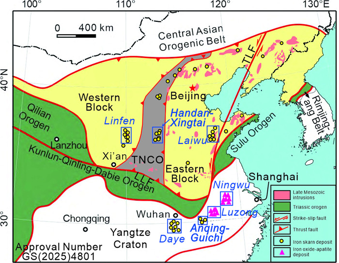
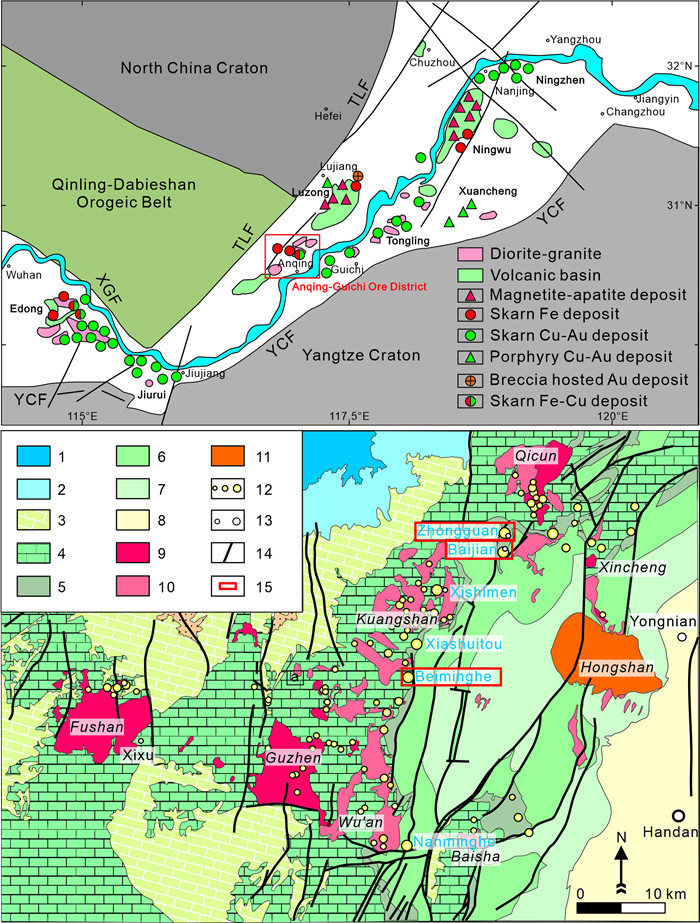
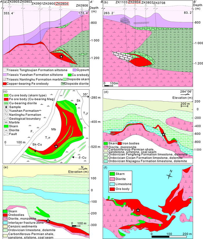
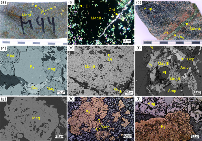
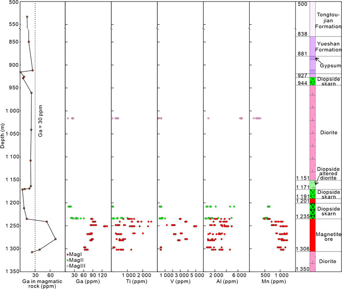
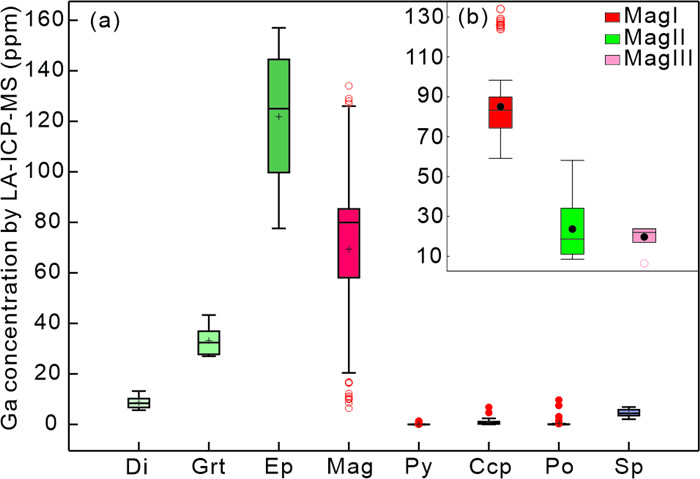
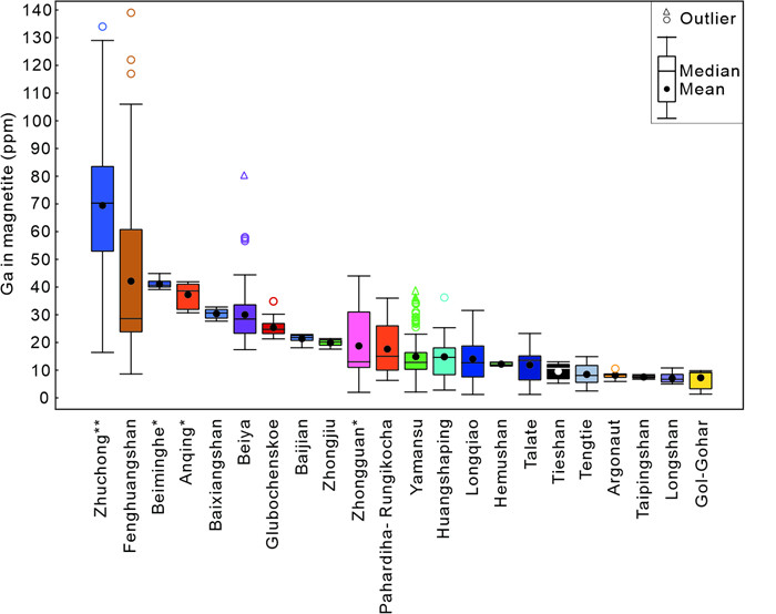
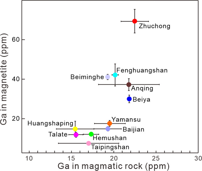
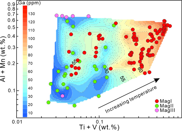
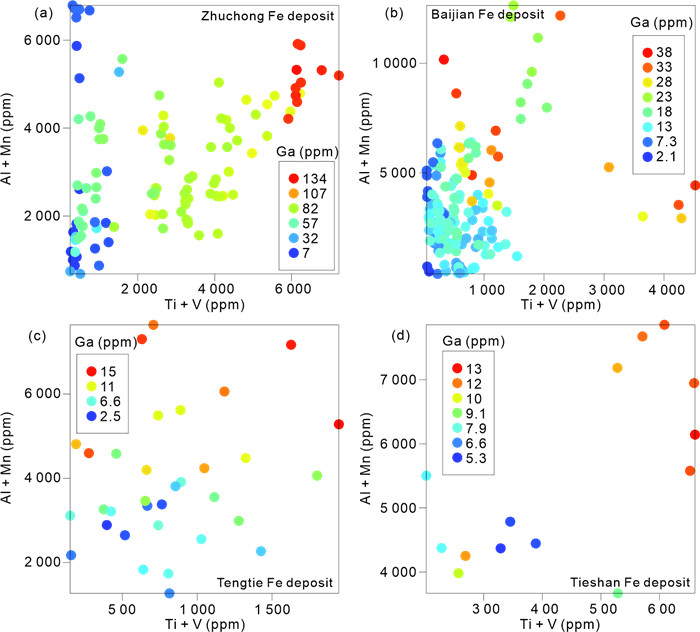
Skarn deposits have provided large quantities of Fe, Cu, W, Sn, and other critical elements such as Ga, Co, In, Te, and Se. Previous studies on critical elements in skarn deposits have focused on the mechanism of Co, Te, and In enrichment, while the occurrence and enrichment mechanism of Ga remain unclear. In this study, we compared Ga contents in magnetite from five skarn iron deposits (including Zhuchong, Anqing, Baijian, Zhongguan, and Beiminghe) in eastern China, with a focus on the Ga enrichment at the Zhuchong deposit. Magnetite from the Zhuchong deposit has the highest Ga contents ranging from 6.4 ppm to 134 ppm (mean = 69.4 ppm), which is much higher than the Anqing (37.3 ppm), Beiminghe (41.1 ppm), and Zhongguan (19.9 ppm). Magnetite at the Zhuchong deposit can be categorized into three types based on its texture and occurrence: dense massive magnetite within magnetite ore layer (MagI: average Ga = 85.1 ppm), disseminated magnetite in skarn layer (MagII: 23.7 ppm), and veinlet magnetite in altered diorite (MagIII: 19.7 ppm). The positive correlation between the Ga contents in whole-rock magmatic samples and the Ga contents in magnetite from skarn deposits suggests that higher Ga contents in the magmatic rocks contribute to the formation of Ga-rich magnetite within these deposits. Due to widely developed diopside and garnet in skarn deposits, the Ga in these hydrothermal minerals is also an important factor for Ga in magnetite. Ga content in MagI decreases with the depth, following the same trend of Ti, Mn, and V, suggesting the control of temperature on the enrichment of Ga in magnetite. This study indicates that Ga in the Zhuchong deposit has the potential to be recycled during the exploitation of magnetite.

Quantitative Constraints on the Exhumation and Preservation of the Giant Jinchuan Cu-Ni Sulfide Deposit
Wang Chen, Tao Ni
2026, 37(4): 1540-1551. doi: 10.1007/s12583-025-0362-7
Abstract:

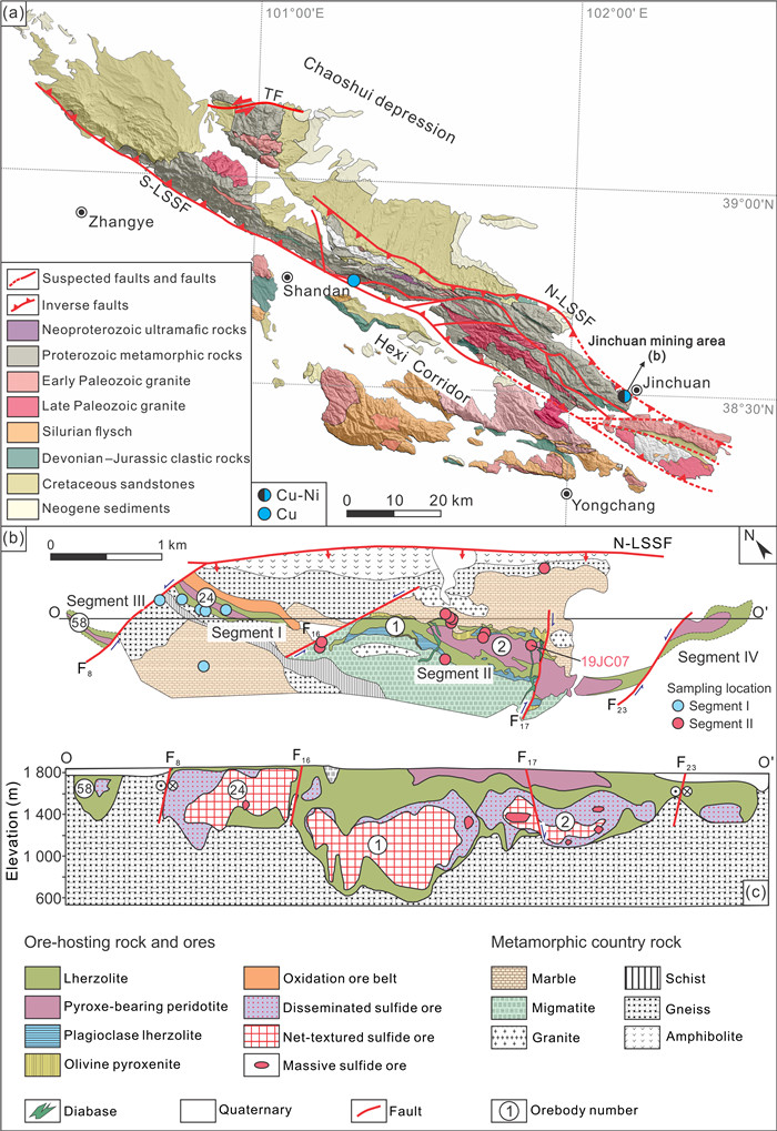
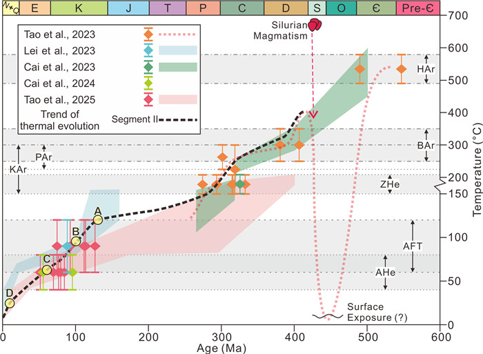
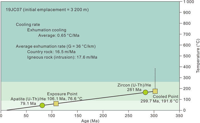
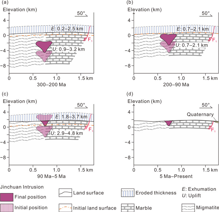
Jinchuan deposit, the world's 3rd largest Cu-Ni sulfide magmatic deposit formed in the Neoproterozoic, has been developed as an open pit mine, indicating the impact of exhumation and erosion on the deposit. To evaluate the preservation of the Jinchuan deposit, this study compiles published thermochronological data (zircon (U-Th)/He, apatite (U-Th)/He, apatite fission track) and Monte Carlo inverse thermal modeling results, with the aim to reconstruct < 300 Ma time-temperature of the Jinchuan deposit when the deposit was exhumed to zircon (U-Th)/He temperature range. Furthermore, we conduct 2D explicit finite difference inverse thermal modeling and the results suggest that near-surface exposure of the Jinchuan deposit most likely occurred during the Mid-Cretaceous (ca. 90 Ma), which is corresponding to the timing when the Jinchuan deposit entered the apatite (U-Th)/He closure temperature range and is much earlier than a previously suspected Miocene exposure. A total cumulative exhumation thickness of 2.7–6.2 and 1.8–3.7 km is calculated for time periods since initial exhumation (ca. 300 Ma) and surface exposure (ca. 90 Ma). It is noted that post-exposure erosion thickness is thicker than the current maximum thickness of the residual ore-bearing intrusion (1.2 km). Prolonged post-mineralization exhumation facilitates the shallow exhumation and ultimately leads to exposure, partly erosion and a degree of preservation with appreciable economic value for the ancient Pre-Cambrian Cu-Ni sulfide Jinchuan deposit.

Metallogenic Mechanism for the Deep Part of the Jiaojia Gold Zone in the Eastern North China Craton (Jiaodong): Constrains from Pyrite Re-Os Geochronology, in-situ Trace Elements and Sulfur Isotope Compositions
Naijie Chi, Zuozhen Han, Xuefeng Yu, Wei Shan, Chuan'e Liu, Xiufeng Wang, Zengsheng Li, Shenghu Li, Chenxi Zhang, Xiangxian Ma
2026, 37(4): 1552-1571. doi: 10.1007/s12583-023-1924-z
Abstract:

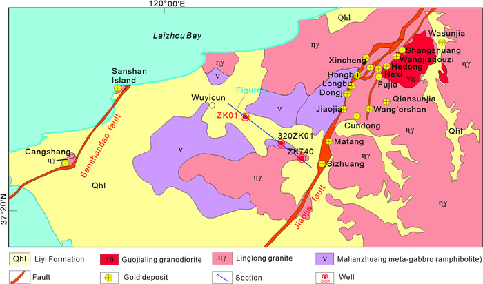
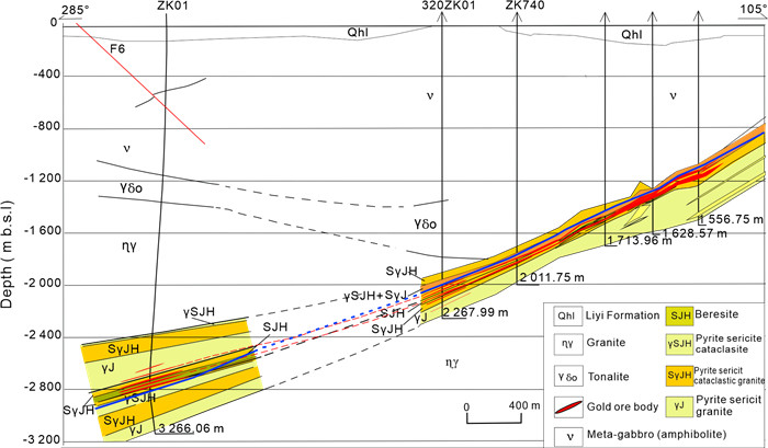
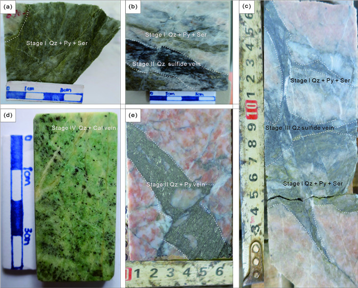
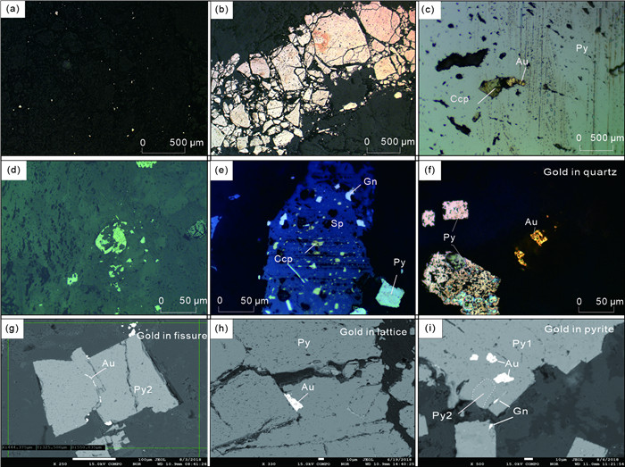
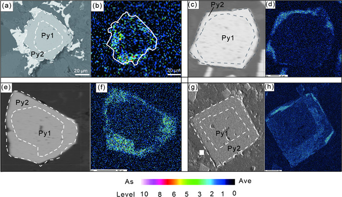
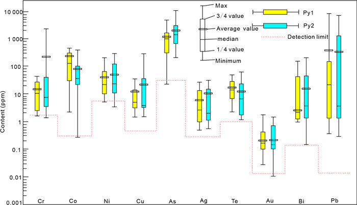
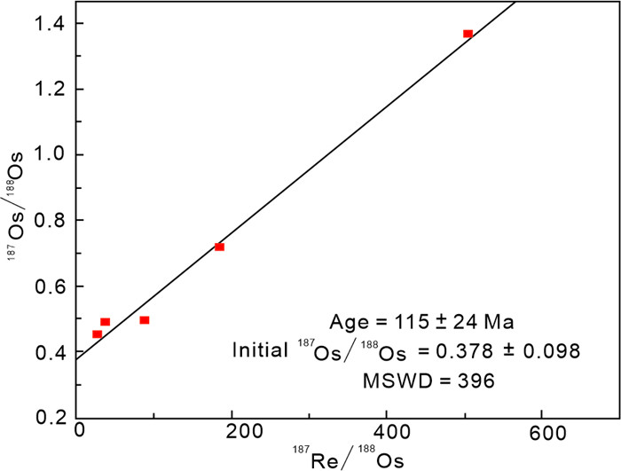
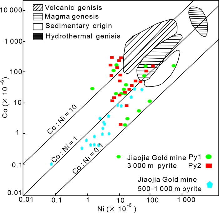
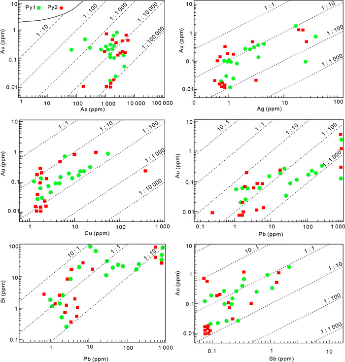
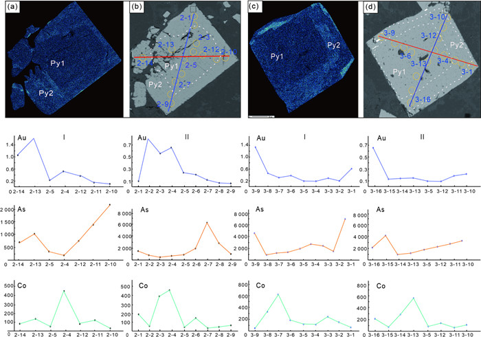
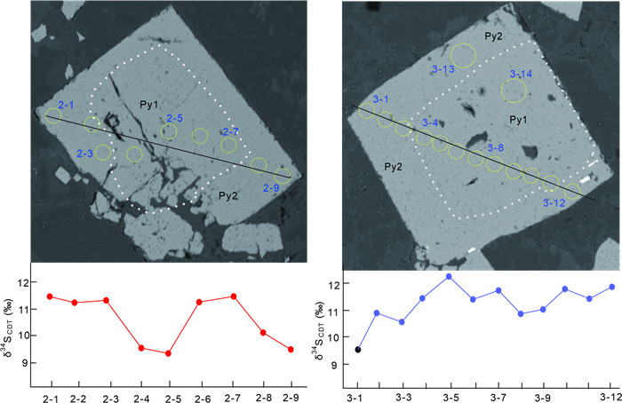
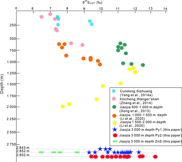
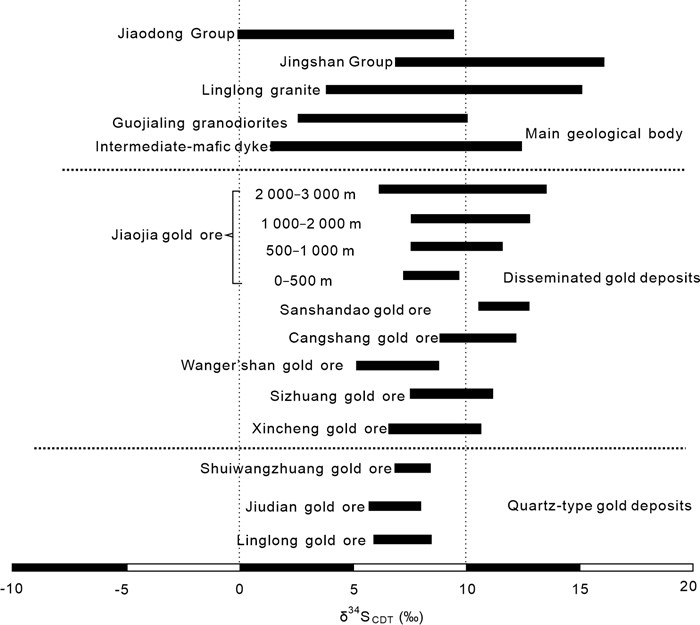
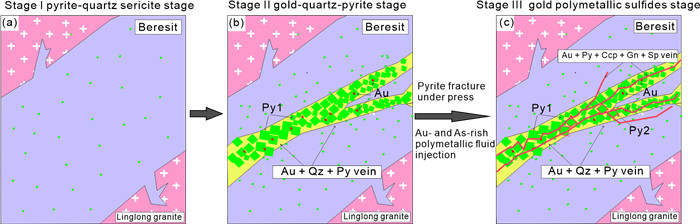
The Jiaojia gold metallogenic zone preserves large and super-large gold deposits in Jiaodong gold province, China. Pyrite is the most common and main gold-bearing mineral in the Jiaojia gold deposits. Studying the pyrite closely retated to gold is of great significance for understanding the metallogenesis, especially the gold precipitation mechanism. In this study, gold-bearing pyrite samples were taken from the gold ore bodies at 2 700–3 000 m in the Jiaojia fault. Systematic microscopic observation, electron microprobe analysis, in-situ LA-ICP-MS trace elements analysis, in-situ sulfur isotope analysis, as well as Re-Os isotope dating were carried out. Two types of pyrites were identified: type 1 pyrite (Py1) and type 2 pyrite (Py2). Py1, hosted in the gold-quartz-pyrite veins, is homogeneous in chemical composition with no obvious zonal growth. They contain uniform concentrations of As- and Au-rich. Py2, an As-bearing pyrite hosted in the quartz-polymetallic sulfides veins, shows distinct As enrichments, As rich rims of pyrite, and growth zoning. In-situ sulfur isotope analyses were carried out on Py1 (δ34S = 9.41‰–12.20‰) and Py2 (δ34S = 9.48‰–13.06‰). The results suggest that the sulfur isotope in the gold ore-body is a complex mixture enriched in δ34S, including sulfur from the Jiaodong Group and the Mesozoic granitoids, with the participation of magmatic sulfur from the mantle and the crust. The Re-Os dating technique was used on the pyrite from gold-bearing pyrite veins to determine the age of gold metallogenesis.

Impact of Fluorine on Crystal-Melt Separation in High-Silica Magma: Insights from Muscovite in the Ramba Leucogranite of Tethyan Himalaya
Liran Chen, Wangchun Xu, Lianxun Wang, Hongfei Zhang
2026, 37(4): 1572-1583. doi: 10.1007/s12583-024-0003-6
Abstract:

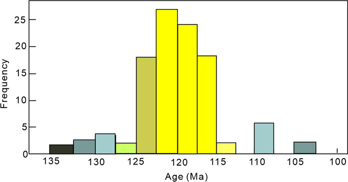
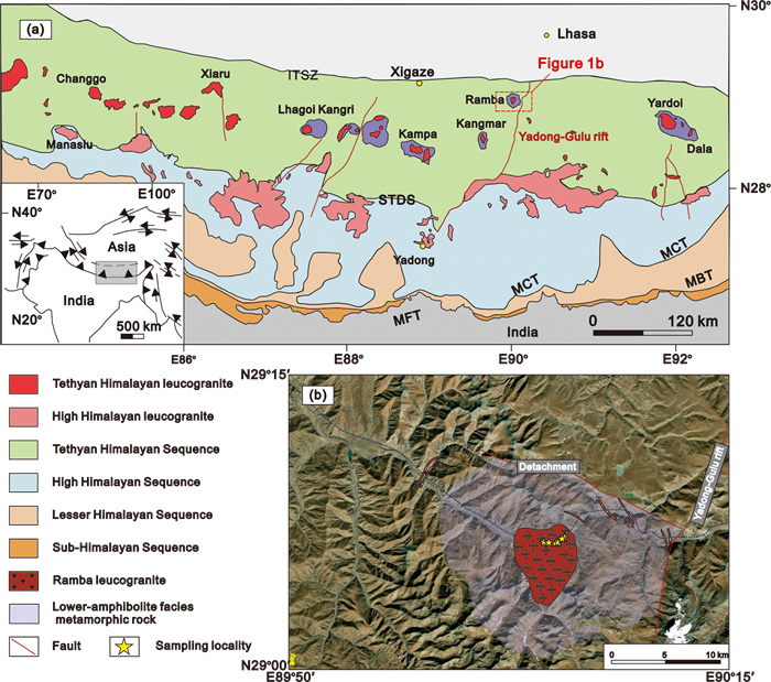
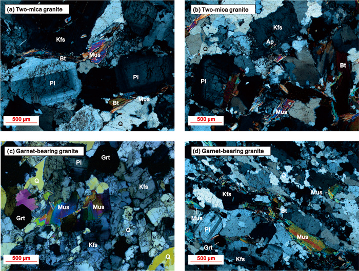
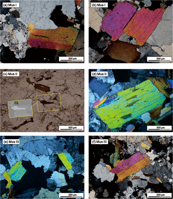
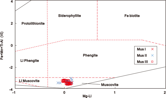
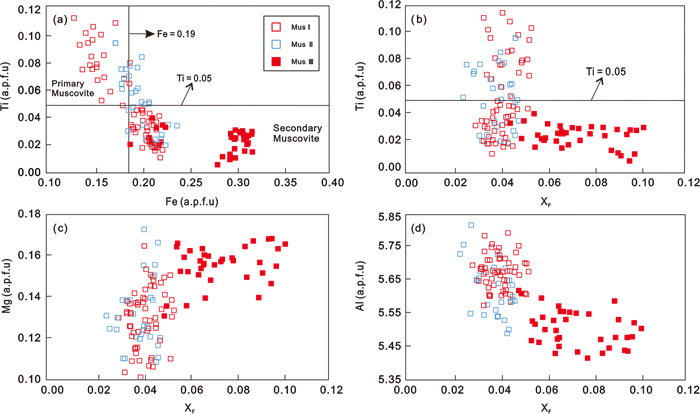
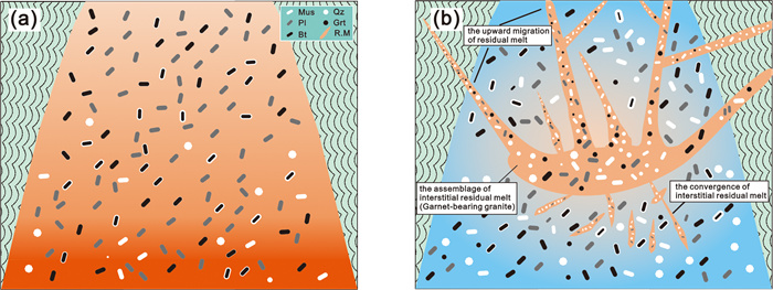
The process of crystal-melt separation in the high-silica magmatic mush is still a subject of debate. To explore the process, we conducted a detailed study of Late Miocene leucogranites (SiO2 > 70 wt.%) in the Ramba dome of the Tethyan Himalaya, focusing on the genesis and fluorine content of muscovite. The Ramba leucogranites consist of two-mica granite with minor garnet-bearing granite. Large and euhedral muscovites are found in both types of granite exhibiting different geochemical features. The muscovites from the two-mica granites exhibit lower F (mean value: ~0.41 wt.%–0.43 wt.%), FeO (mean value: ~1.75 wt.%–1.81 wt.%), but higher TiO2 (mean value: ~0.61 wt.%–0.73 wt.%) contents compared to those from the garnet-bearing granites (mean F value: ~0.72 wt.%; mean FeO value: 2.48 wt.%; mean TiO2 value ~0.23 wt.%). According to geochemical criteria, we categorized the muscovites from the two-mica granite as two groups: (1) crystallized from the early magma, and (2) formed from interstitial residual melt. In comparison, the muscovite from the garnet-bearing granite was likely crystallized from residual melt extracted from the same magmatic reservoir which underwent a higher degree of evolution. Accordingly, the two-mica granite represents the residual crystal mush consisting of early crystals crystallized from magma and trapped interstitial residual melt, while the garnet-bearing granite represents the aggregation of extracted residual melt. We examined the possibility of crystal-melt separation by estimating the variation of fluorine content and viscosity between the early magma and residual melt. Our results indicate a notable disparity in fluorine content between the residual melt (mean value: ~4 364 ppm) and the early magma (mean value: ~2 033 ppm). As a result, the estimated viscosity experiences a reduction from 106.52 Pa·s for the early magma to 105.87 Pa·s for the residual melt. The fluorine enrichment could have played a critical role in decreasing melt viscosity and initiating crystal-melt separation. Our result supports the crystal-melt separation process during the evolution of the Ramba leucogranitic magma. This study underscores the significance of investigating the genesis and fluorine content of muscovite in granite as a crucial constraint for understanding the process of crystal-melt separation in the high-silica magmatic mush.
Chemical Stability and Thermal Equation of State of Si3N4: Implications for Nitrogen Storage in the Deep Earth
Jingyi Zhang, Shengxuan Huang, Shan Qin, Stella Chariton, Vitali B. Prakapenka, Bin Chen
2026, 37(4): 1584-1593. doi: 10.1007/s12583-024-0014-3
Abstract:

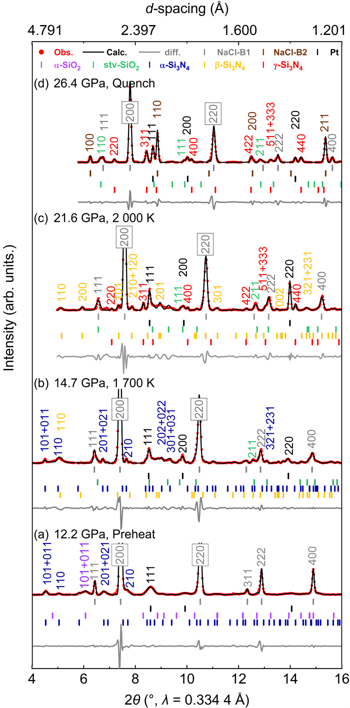
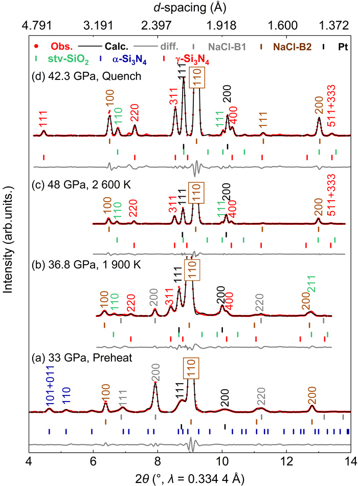
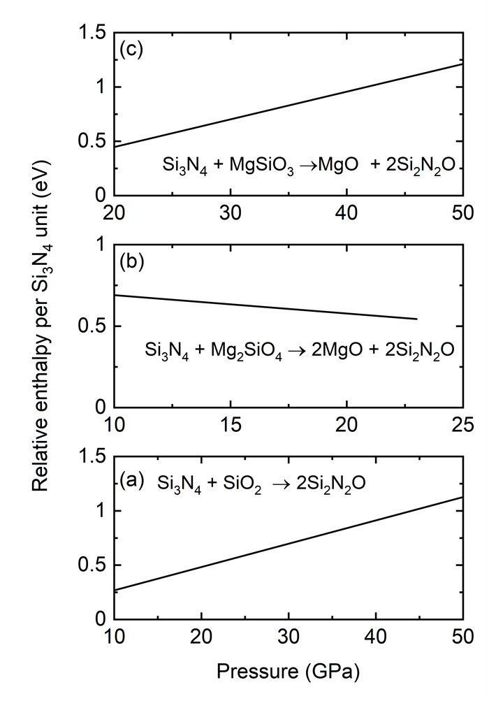
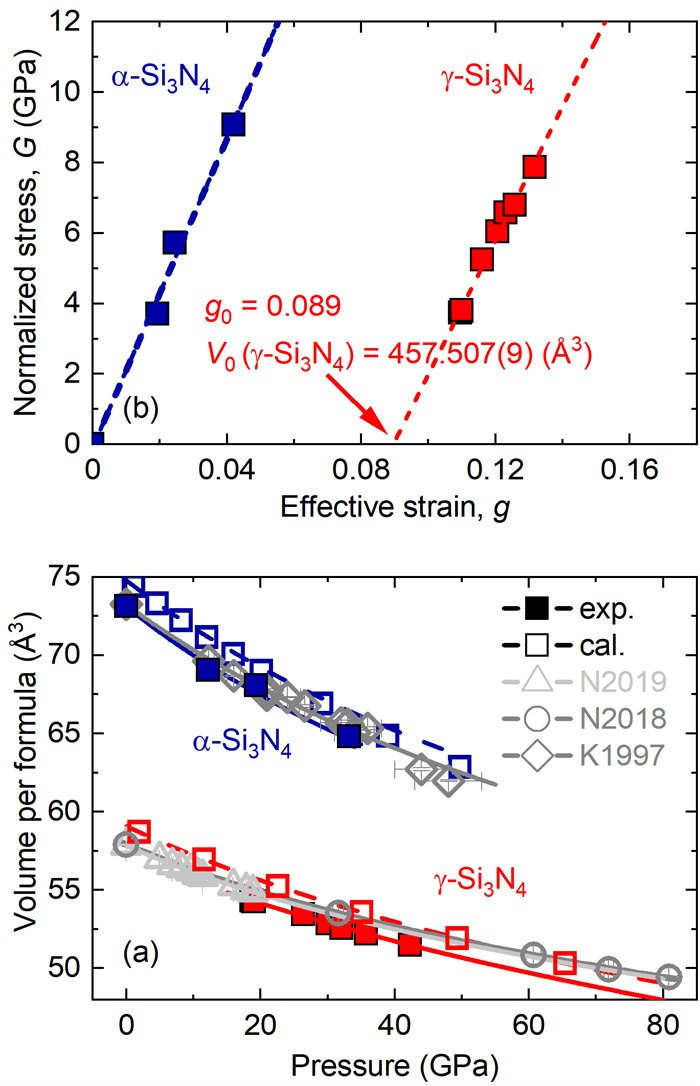
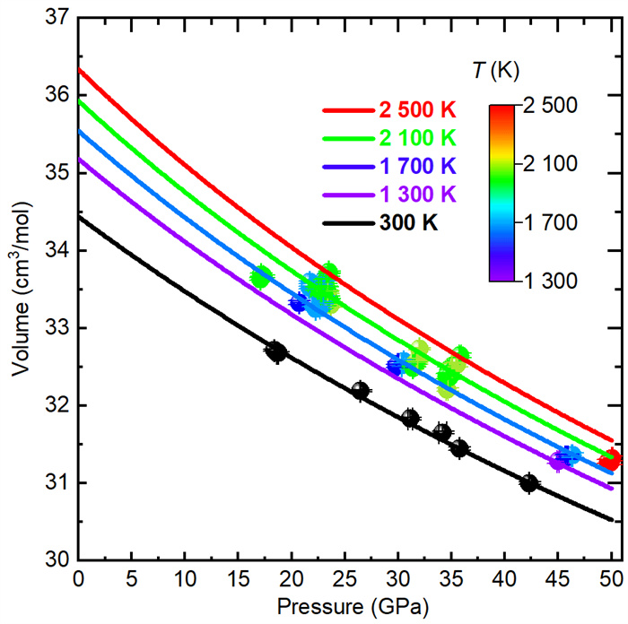
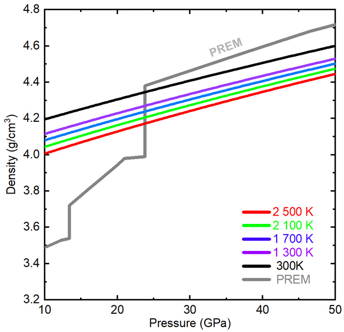
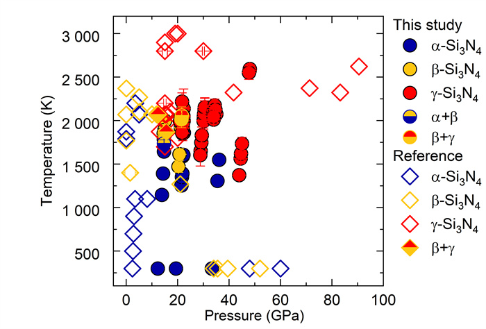
Most nitrogen is predicted to reside in the Earth's interior and could be in the form of nitrides. In this study, the chemical reaction of Si3N4 with SiO2 was explored up to 50 GPa and 2 600 K using laser-heated diamond anvil cells combined with synchrotron radiation X-ray diffraction. The experimental results demonstrate that Si3N4 does not react with SiO2 and cubic γ-Si3N4 remains stable at extreme pressure and temperature. First-principles calculations were performed to investigate the chemical stability of Si3N4 with the SiO2-MgO assemblage, showing that Si3N4 can coexist with Mg2SiO4 and MgSiO3 polymorphs. Based on our thermal equation of state of cubic γ-Si3N4, we suggest that cubic γ-Si3N4 is denser than the upper mantle but less dense than the lower mantle. The formation of Si3N4 in the early Earth may contribute to the nitrogen preservation in the deep mantle soon after crystallization of the mantle and Si3N4 is likely a precursor of nitrogen hosts in the modern deep Earth.
Improving U-Pb Dating Accuracy for High-U Stalagmites in Quaternary Records
Pu Zhang, Shitou Wu, Tingyong Li, Zhe Zhang, Zhaofeng Zhang
2026, 37(4): 1594-1607. doi: 10.1007/s12583-025-0262-x
Abstract:

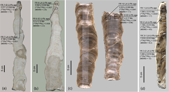
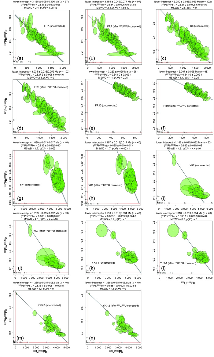
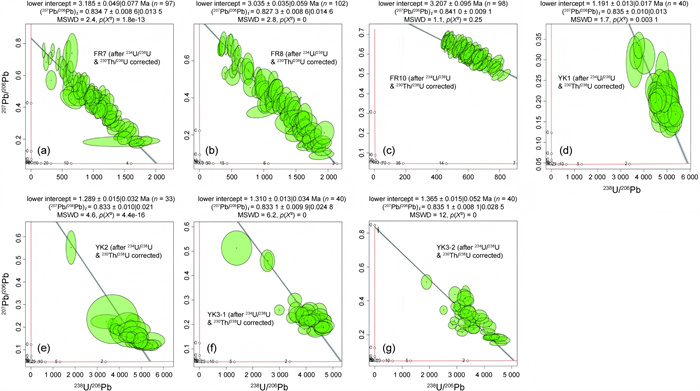
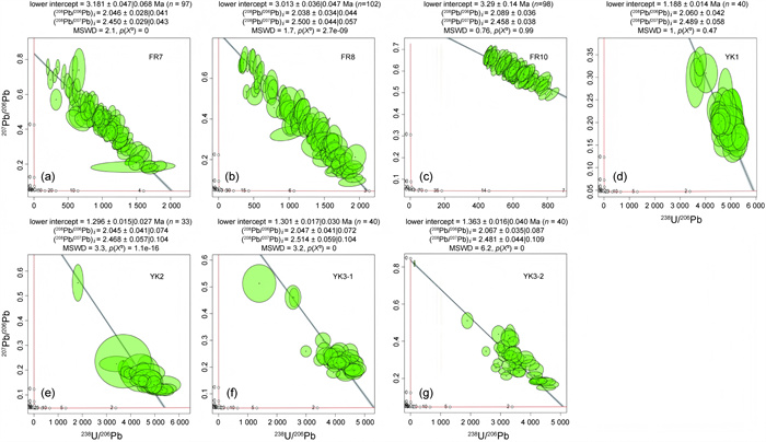
This paper explores the accuracy of U-Pb dating of stalagmites with high uranium contents and high μ values of > 10 000, focusing on Quaternary records. Isotope dilution thermal ionization mass spectrometry (ID-TIMS) and laser ablation inductively coupled plasma mass spectrometry (LA-ICP-MS) U-Pb dating methods are compared, and it is found that LA-ICP-MS U-Pb dating yields a better precision, especially for samples up to 3 Ma. This research highlights the importance of correcting 234U/238U disequilibrium for accurate dating, though 230Th/238U calibration is not necessary for Quaternary samples. Common lead correction has a minimal effect on high-uranium samples regardless of whether 2-D or 3-D linear regression is applied to the U-Pb concordia data. The results of the LA-ICP-MS U-Pb method are consistent with those of the ID-TIMS U-Pb method for samples up to 2 Ma, and the error can reach 1.1%–2.9%. Ultimately, this study provides a framework for improving the accuracy of U-Pb dating of high-resolution stalagmite records, which is crucial for paleoenvironment reconstruction.

Structural Geology and Energy Science
Stochastic Modeling of Folded Structures in Scarce Data Scenarios Using Transiogram with Locally Varying Anisotropy
Yabo Zhao, Weihua Hua, Guoxiong Chen, Dong Liang, Zhipeng Liu, Xiuguo Liu
2026, 37(4): 1608-1619. doi: 10.1007/s12583-022-1646-9
Abstract:

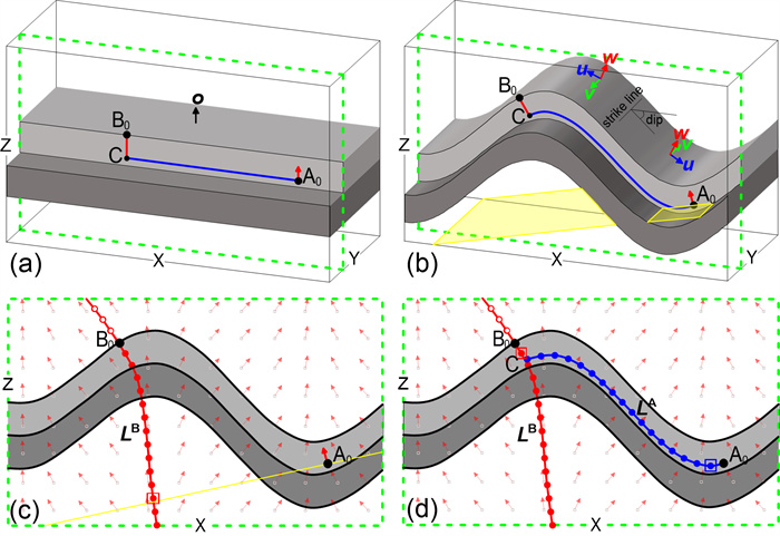
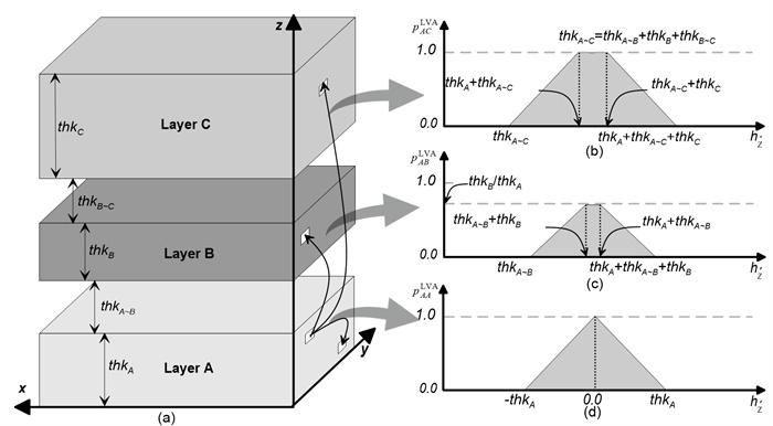
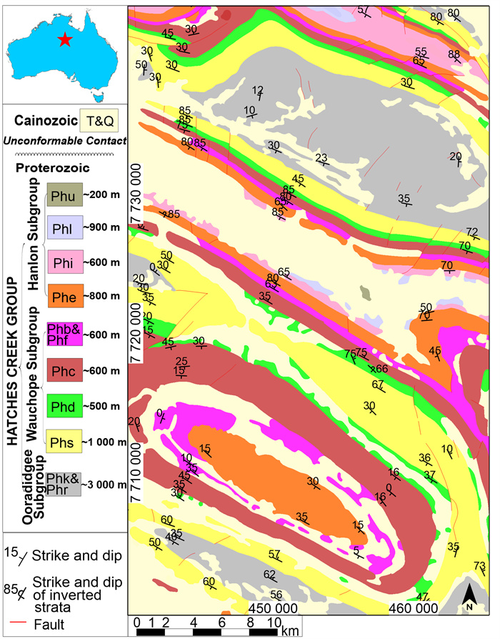
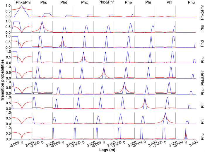
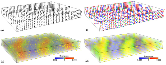
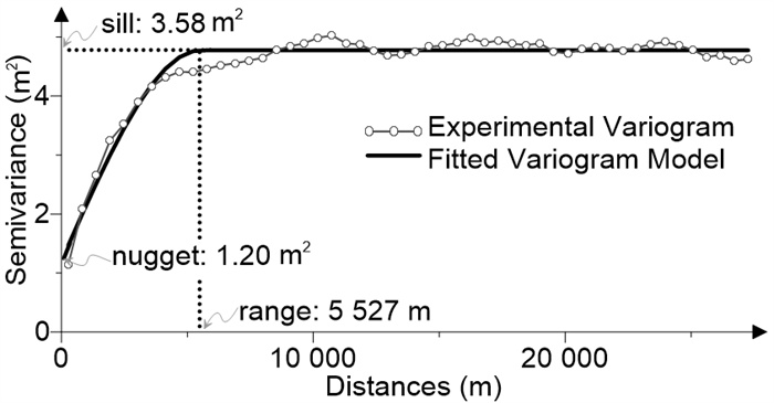
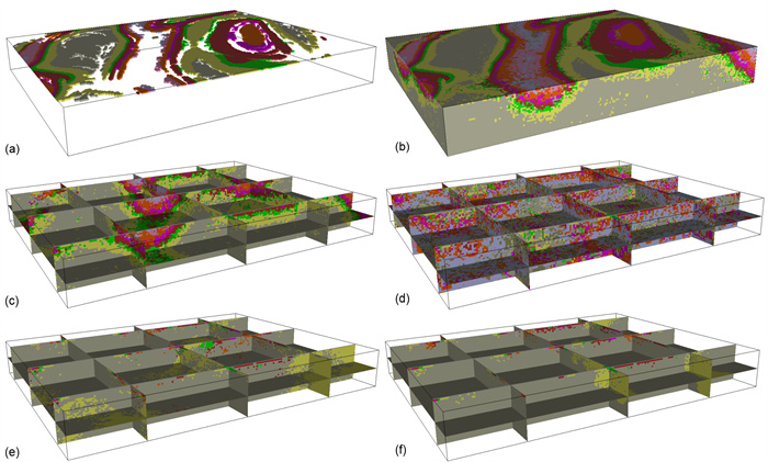
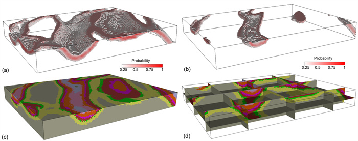
Sampling is usually scarce in geological modeling, and hence, complex and continuous geological phenomena are difficult to simulate when anisotropy changes locally. The current study aimed to present a method for modeling folded structures using transiogram with locally varying anisotropy in scarce data scenarios. Based on the direction fields of locally varying anisotropy, a pathline-based algorithm was proposed to simulate the folds that are flattened and calculate the relative position of any two random points thereafter. Compared to the traditional two-point spatial continuity measures (such as the variogram), the locally varying anisotropy transiogram could not only describe the high order Markovian of the spatial distribution of geological bodies, but also do so with explicable physical implication. The report revealed that the locally varying anisotropy transiogram of horizontal strata can be directly obtained if the stratigraphic sequence and stratum thickness are known. In the case study, only one geological map was used in a real complex-fold area to successfully simulate the 3-D stratigraphic model.

Structural Characteristics and Formation Process of Pseudotachylyte in the Wulian Detachment Fault Zone on the Jiaodong Peninsula, China
Ruijie Wang, Jinlong Ni, Guiyuan Li, Junlai Liu, Lei Ji, Yiren Wang, Runye Lyu
2026, 37(4): 1620-1638. doi: 10.1007/s12583-025-0214-5
Abstract:

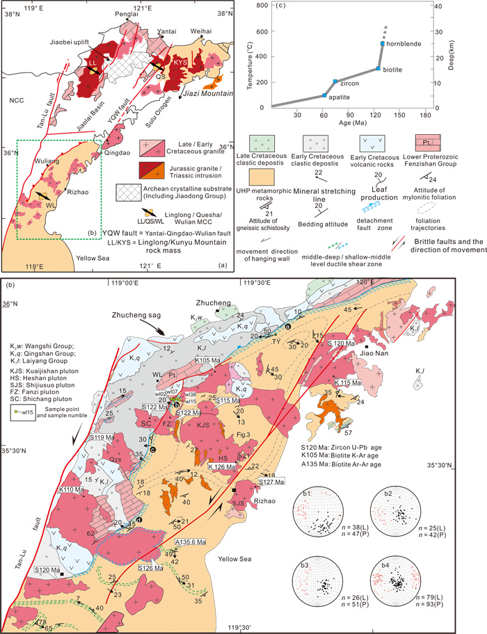
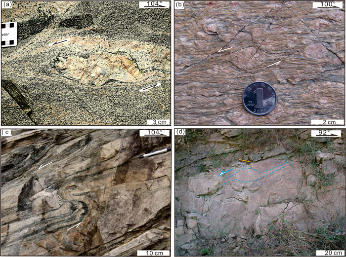
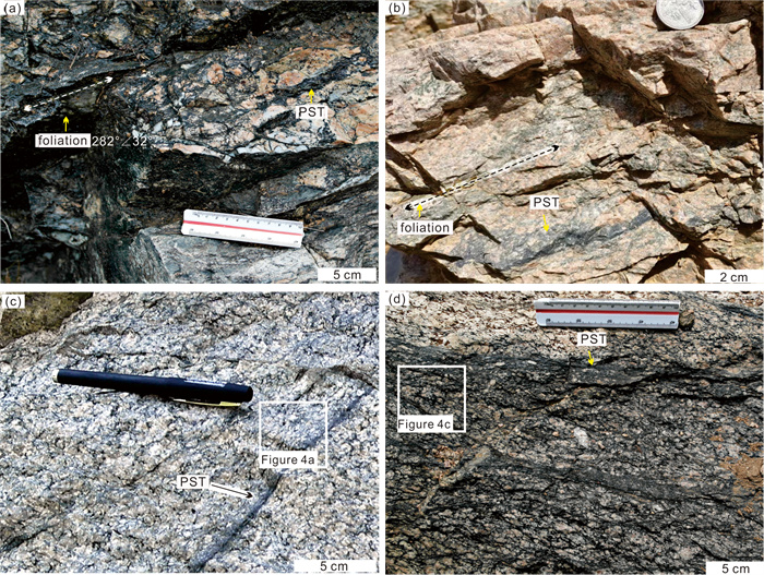
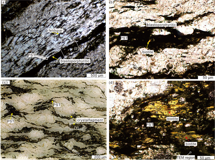
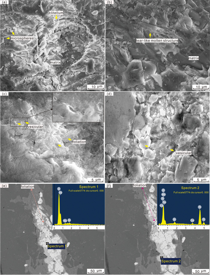
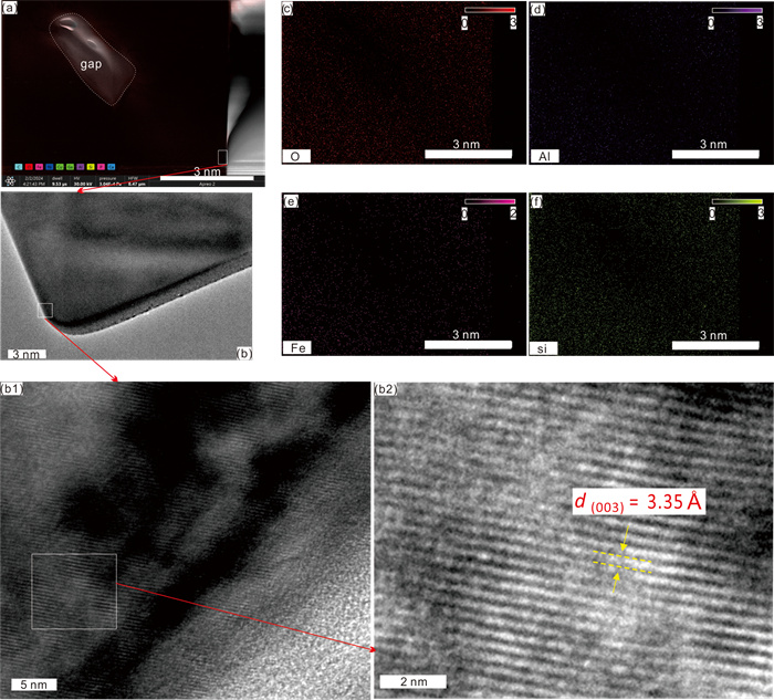
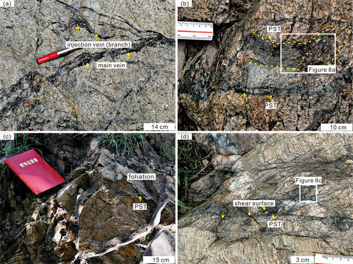
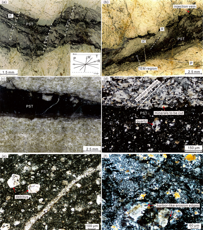
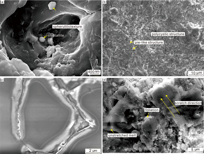
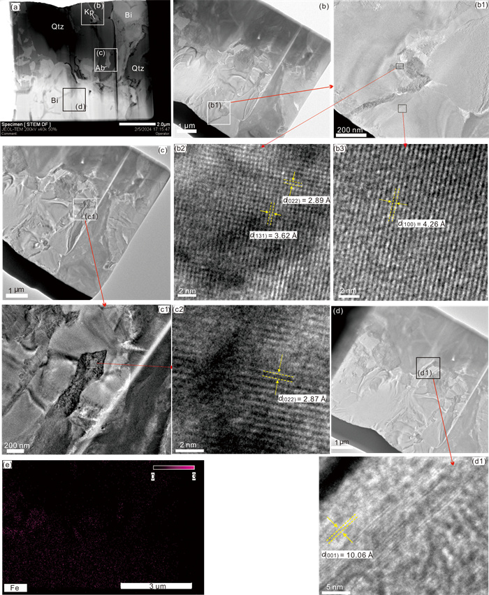
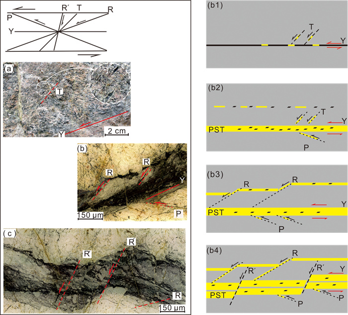
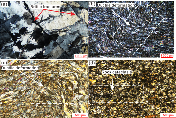
Exploring pseudotachylytes (PSTs) within detachment fault zones provides valuable insight into the kinematic processes of these fault systems. Nevertheless, significant controversy persists regarding the origin and formation mechanisms of PST veins. The PST was initially identified within the Wulian detachment fault zone (DFZ) on the Jiaodong Peninsula by delineating the deformation characteristics of the fault zone's transition from ductile to ductile-brittle behavior. Macroscopic and microstructural features of the PST within the Wulian DFZ were examined using geological field surveys. Using quantitative and high-resolution techniques, such as scanning electron microscopy, TIMA-X mineral composition analysis, and transmission electron microscopy, variations in mineral composition between the veins and detritals of the PST were investigated. Furthermore, this study has investigated the progressive deformation processes and underlying causes contributing to PST formation within the DFZ. This study revealed the presence of both type D and B-type PSTs in the Wulian DFZ formed under ductile or ductile-brittle conditions. These PSTs exhibit fracture and fusion structures resulting from fault frictional fragmentation and frictional melting and undergo progressive deformation. During the initial stages of the D-type PST formation, biotite fragmentation in poorly cohesive foliation was the primary contributor, supplemented by frictional melting. As the deformation progressed, quartz fragmentation and partial melting became dominant, constituting up to 81.9 wt.% of the matrix. The formation of the B-type PST aligns with deformation under brittle or ductile-brittle conditions, with frictional fragmentation and fragmentation flow playing significant roles. Vein formation is initiated by biotite fragmentation or partial melting, followed by quartz, potassium feldspar, albite fragmentation, or partial melting. Mature PST veins exhibited distinct zoning characteristics, with a diffuse quartz distribution comprising up to 59.87 wt.% of the vein composition. Intermittent and abrupt uplift of the detached fault zone, along with the resultant fault friction, contributed to fine graining and melting, serving as pivotal factors in PST formation.

Quantitative Prediction of Multi-Period Tight Sandstone Fractures in Thrust-Fold Belt Based on Minimum Energy Dissipation Theory in Kuqa Depression of Tarim Basin
He Du, Shouyu Xu, Jianwei Feng, Shuizhen Liu, Xiang Gao
2026, 37(4): 1639-1653. doi: 10.1007/s12583-024-0019-y
Abstract:

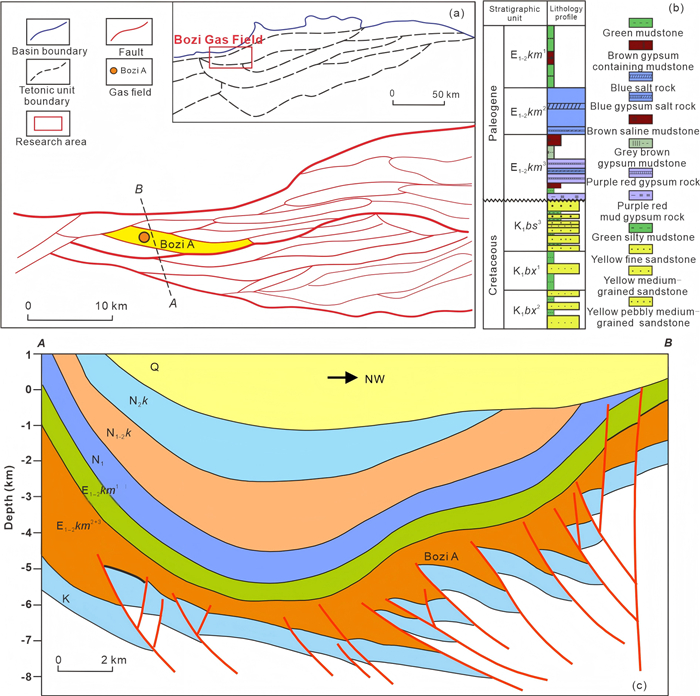
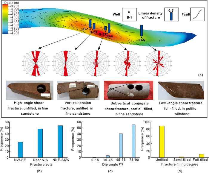
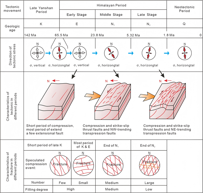
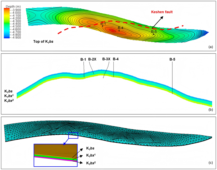
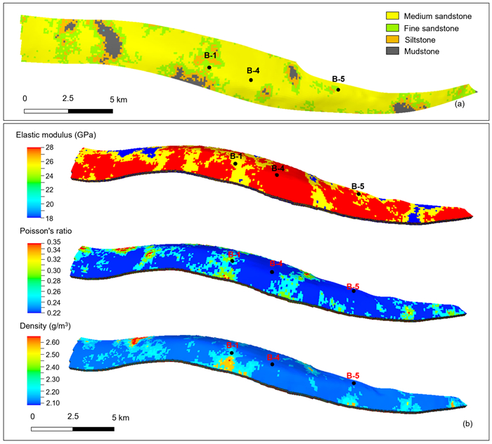
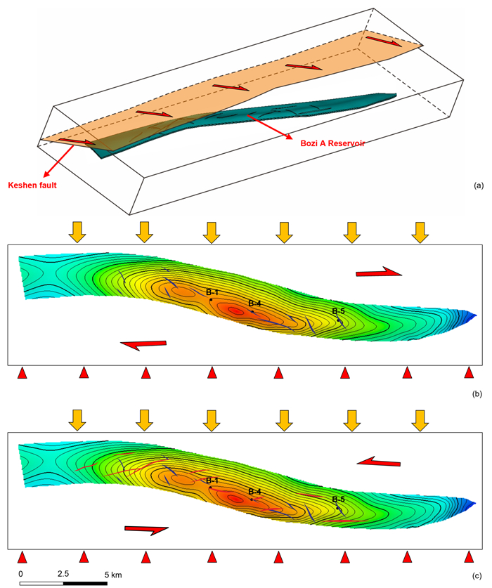
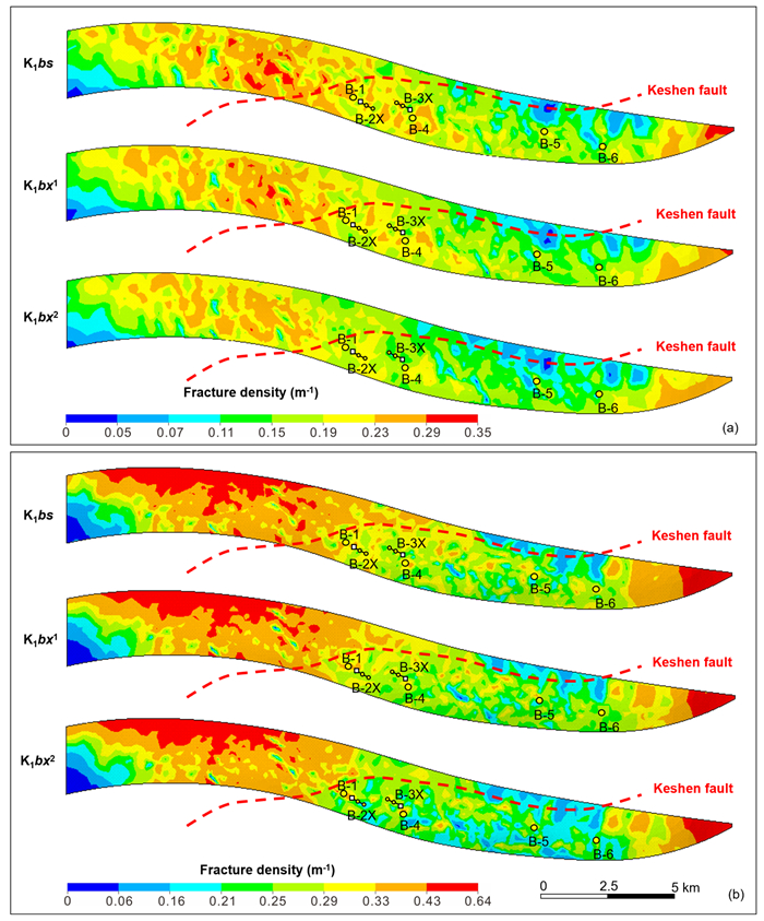
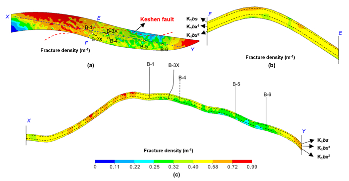
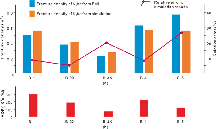
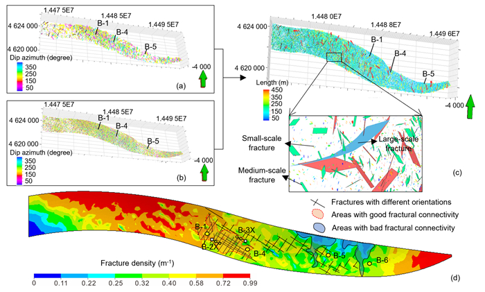
Deep tight sandstone reservoirs in the thrust-fold belt of the Kuqa depression, Tarim Basin, host substantial oil and gas resources. Structural fractures are the dominant reservoir space and seepage pathways in these tight reservoirs, yet their multi-periodic development and strong heterogeneity caused by multi-stage tectonic compression make accurate quantitative prediction extremely difficult. This study aims to establish a quantitative prediction method for multi-period tight sandstone fractures based on the minimum energy dissipation theory, targeting the Bozi Gas Field in the Kuqa depression. We first constructed a fine 3D geological model based on tectonic, drilling and logging data, then simulated the paleotectonic stress fields of key fracture-forming periods via 3D finite element analysis, and finally built a quantitative fracture parameter model of Bozi Gas Field by integrating the minimum energy dissipation theory with key fracture-controlling factors (thrust-fold structure, faults and lithology). The results show that the overlying thrust structure is the dominant control on the paleotectonic stress field distribution under intense tectonic compression, and the simulated fracture linear density shows a strong positive correlation with FMI logging interpretation results. The simulation result fully verifies the high accuracy and reliability of the method. This method provides critical guidance for tight gas exploration and development in the Kuqa depression, and a reference for fracture prediction in similar thrust-fold belts globally.

Slow Fluid Leakage along Faults: A Multidisciplinary Study on the Mud Volcanoes of the Bolle della Malvizza (Southern Apennines, Italy)
Stefano Vitale, Stefano Albanese, Maurizio Ambrosino, Pietro Boni, Domenico Cicchella, Claudio De Paola, Maria Giulia Di Giuseppe, Carmela Fabozzi, Roberto Isaia, Jacopo Natale, Mubashir Mehmood, Fabio Pagliara, Ernesto Paolo Prinzi, Antonio Troiano, Sabatino Ciarcia
2026, 37(4): 1654-1675. doi: 10.1007/s12583-026-0506-4
Abstract:

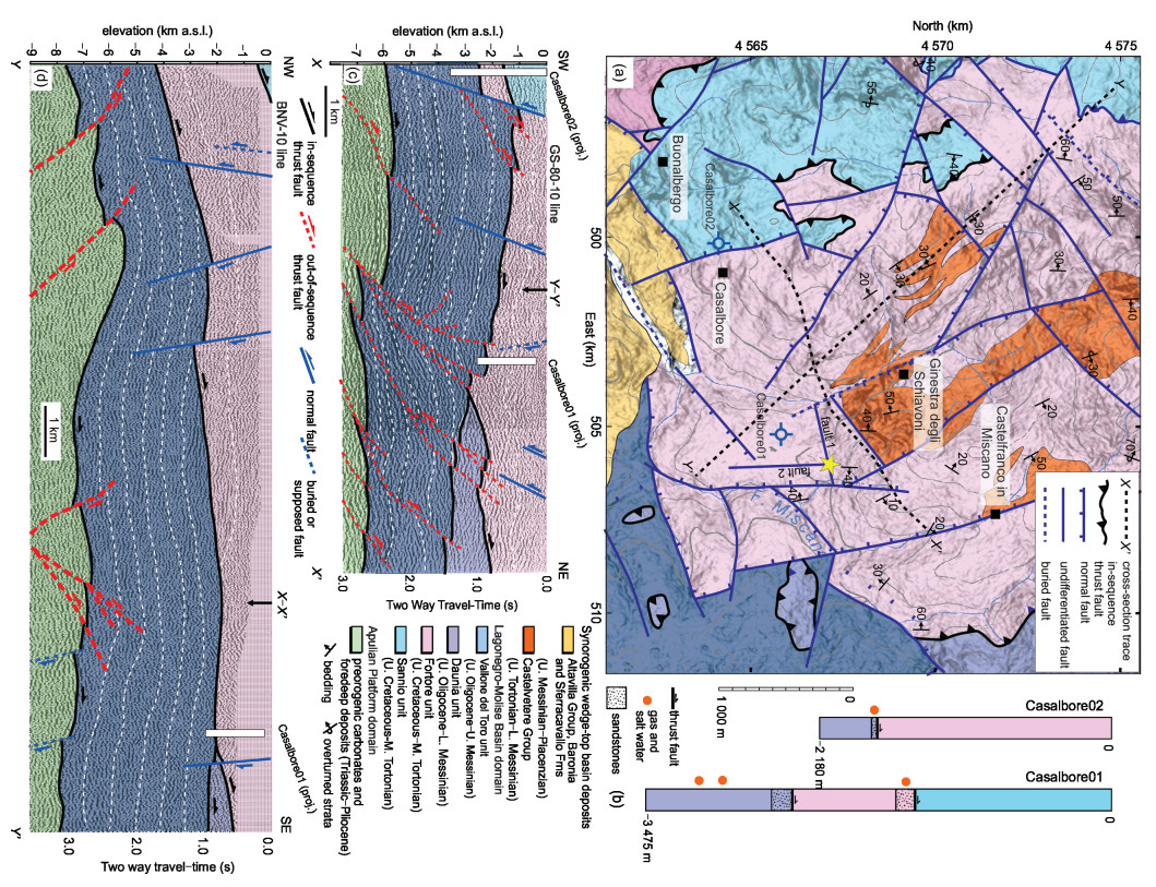
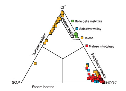
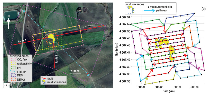
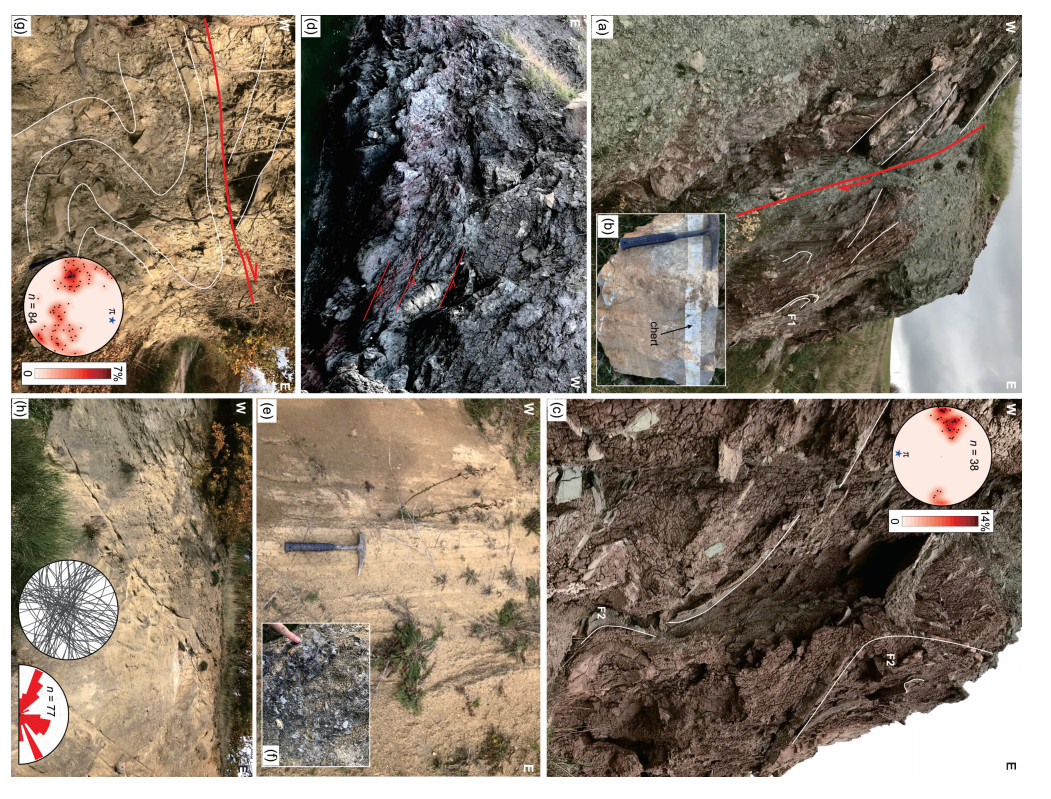
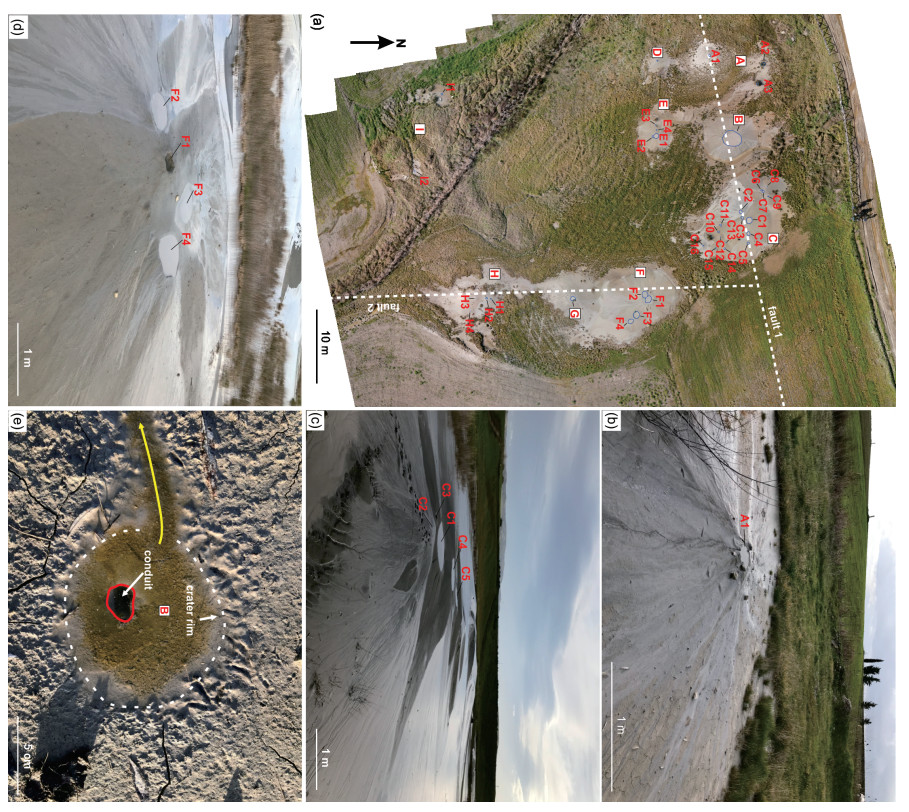
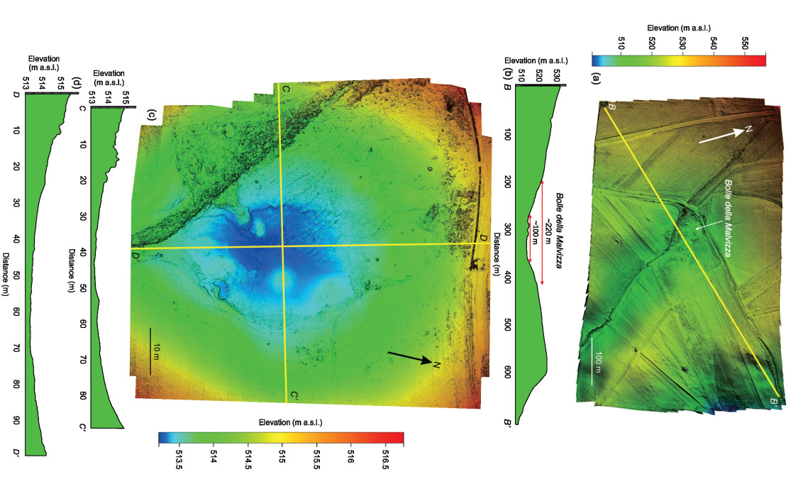
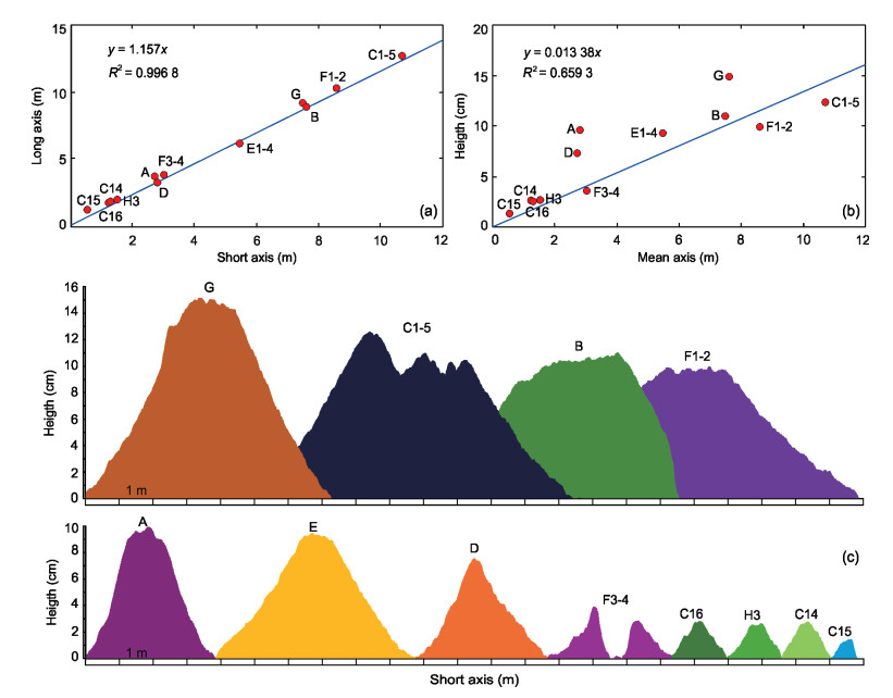
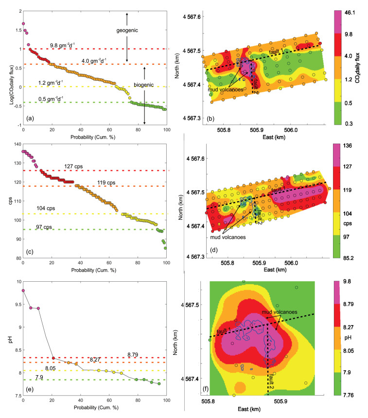
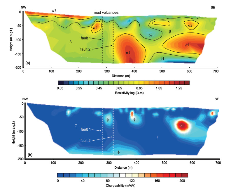
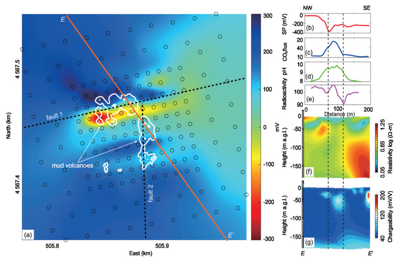
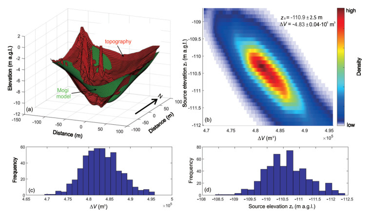
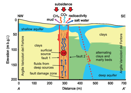
This study presents a multidisciplinary investigation of the Bolle della Malvizza mud volcanoes, located in the southern Apennines fold-and-thrust belt (Italy), aimed at characterizing these structures and constraining processes and sources of mud and gas leakage. Twelve main vents are present, continuously and slowly ejecting mud, saltwater, and gases, including CH4 and CO2. We carried out different investigations, including (ⅰ) stratigraphic and structural surveys, (ⅱ) topographic and morphometric evaluations using a digital elevation model obtained by drone photogrammetry, (ⅲ) geochemical measurements of CO2 flux, radioactivity and soil pH and (ⅳ) geophysical surveys including electrical resistivity tomography, induced polarization and self potential. Nine main groups of mud volcanoes are present in the area, varying in size (from a few centimeters to 13 meters) and height (from ~3 to 15 cm). These mud eruptive vents are aligned along the ENE-WSW and N-S directed normal faults. The geogenic CO2 flux is low when compared to other non-volcanic emissions in the southern Apennines. The electrical resistivity tomography reveals conductive volumes interpreted as clay-rich layers alternating with resistive bodies of clay-marly rocks, and conductive layers corresponding to shallow and deep aquifers. The induced polarization data highlights high-chargeability zones linked to clay-rich bodies and a narrow vertical conduit connecting deeper conductive zones to shallow levels. Self-potential data show a pronounced negative anomaly aligned with the main vents, spatially matching the high-chargeability conduit and a resistivity inflexion in the electrical section. Ground deformation modelling and Monte Carlo simulation suggest a source at ~110 m depth, with a negative volume change of ~5 × 10⁵ m3. We propose a conceptual model in which deep fluids slowly ascend along damage zones of two major faults, interacting with the surficial aquifer and the clayey host rock, and accumulate in a shallow reservoir that gradually releases muddy fluids to the surface, forming mud volcanoes that are continuously eroded during rainfall events.

Differential Enrichment of Deep Shale Gas in Southeastern Sichuan Basin: Dynamic Evolution and Preservation Mechanisms
Ke Zhang, Haikuan Nie, Songhang Zhang, Tianwu Xu, Zhujiang Liu, Chuanxiang Sun, Chengxiang Wan, Wei Dang, Pei Li, Jia Rong, Shuheng Tang
2026, 37(4): 1676-1695. doi: 10.1007/s12583-026-0505-5
Abstract:

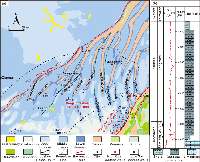
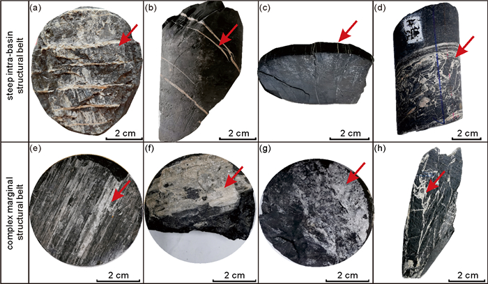
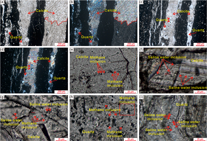
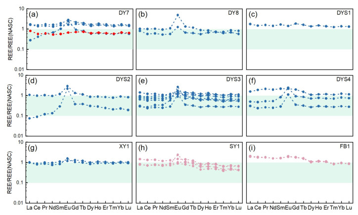
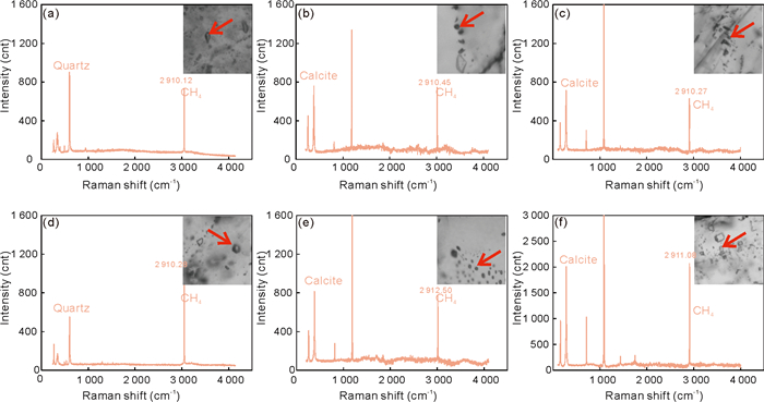
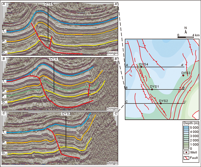
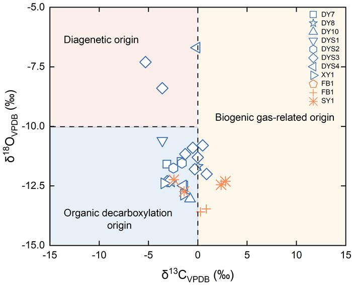
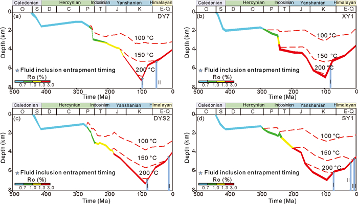
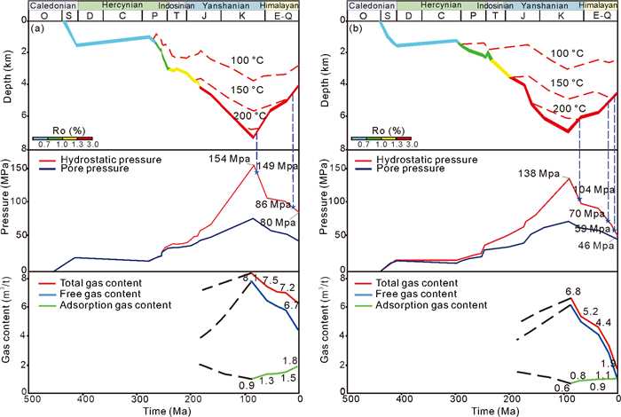
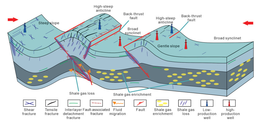
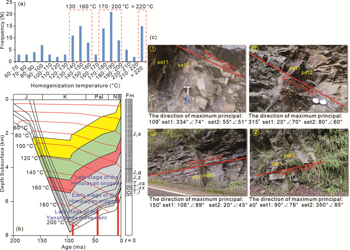
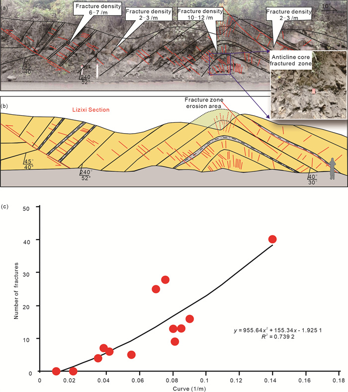
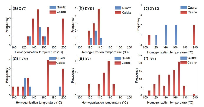
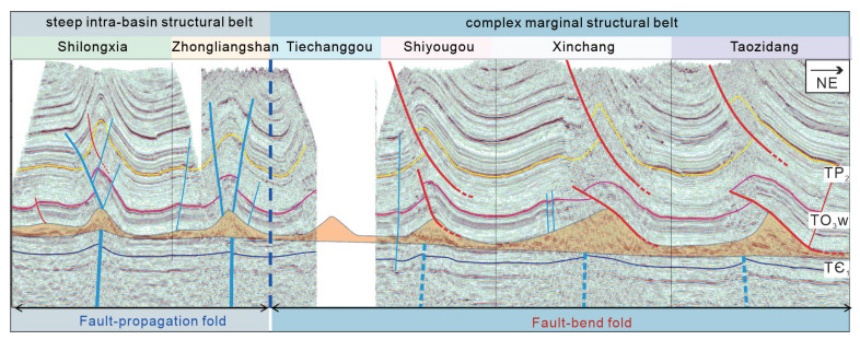
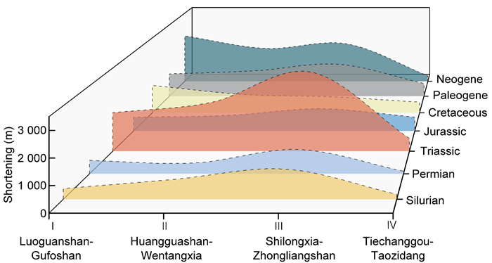
Significant heterogeneity in deep shale gas enrichment is observed within the Wufeng-Longmaxi formations in southeastern Sichuan, yet the dynamic evolution processes and mechanisms driving differential enrichment remain unclear. This study focuses on the complex marginal structural belt (Dongxi, Dingshan, Xinchang) and the steep intra-basin structural belt (Shilongxia, Lizi), and investigates the mechanisms of deep shale gas enrichment based on analyses of vein types, carbon and oxygen isotopes, rare earth elements, and fluid inclusion homogenization temperatures, integrated with basin modeling. The results show that: (1) Vein characteristics reflect differences in gas preservation conditions. Fracture-filling veins are mainly composed of calcite and quartz, formed during the Late Cretaceous to Miocene (10–95 Ma). In the intra-basin high-steep anticlines, veins are associated with hydrothermal and meteoric water origins, and exhibit wide homogenization temperature ranges and three phases of fluid activity, indicating poor gas preservation. In contrast, the marginal zones are dominated by veins derived from in situ formation fluids, show narrower homogenization temperature ranges, and experienced fewer fluid events (1–2 phases), suggesting favorable preservation conditions. (2) Fracture-fluid interactions dominate reservoir evolution. At maximum burial depth, deep shale reservoirs in the Wufeng-Longmaxi formations were strongly overpressured (pressure coefficient > 2.0) and had high gas contents (> 6 m3/t). In the intra-basin high-steep structures, repeated opening and closure of high-angle fractures during the Yanshanian–Himalayan uplift led to rapid gas loss from the Late Cretaceous to Oligocene, resulting in present-day gas content below 2 m3/t, whereas marginal fault-bend anticlines with weak high-angle fracture development retained overpressure (pressure coefficient > 1.8), and current gas contents remain above 6 m3/t. (3) Structural style controls differential enrichment. In areas of structural superposition between the Luzhou paleo-uplift and the southern Sichuan finger-like structures (Lizi, Shilongxia), significant stratigraphic shortening and the development of back-thrust and strike-slip faults led to severe reservoir damage. In contrast, marginal fault-bend anticlines experienced less shortening and weaker deformation; regions without back-thrust faults retained higher gas contents. Favorable enrichment zones are identified in fault-bend anticlines without back-thrusts and in slope or syncline areas far from high-steep or strike-slip fault zones. These findings provide theoretical support for targeted exploration and efficient development of deep shale gas resources in the Sichuan Basin.

Environmental Geology and Hydrogeology
Stability Mechanisms of CO2-H2O-Dawsonite-Bearing Sandstone Reaction System
Fulai Li, Kaining Wang, Xiang Yu, Fangyu Dong, Yong Chen, Zhongfeng Duan
2026, 37(4): 1696-1708. doi: 10.1007/s12583-024-0098-9
Abstract:

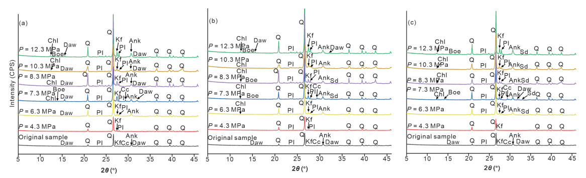
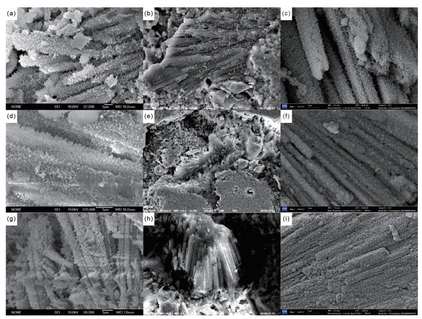
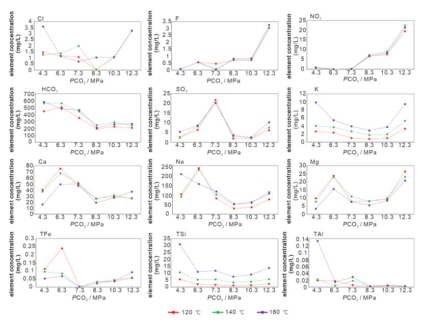
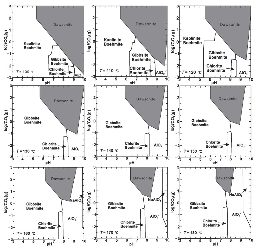
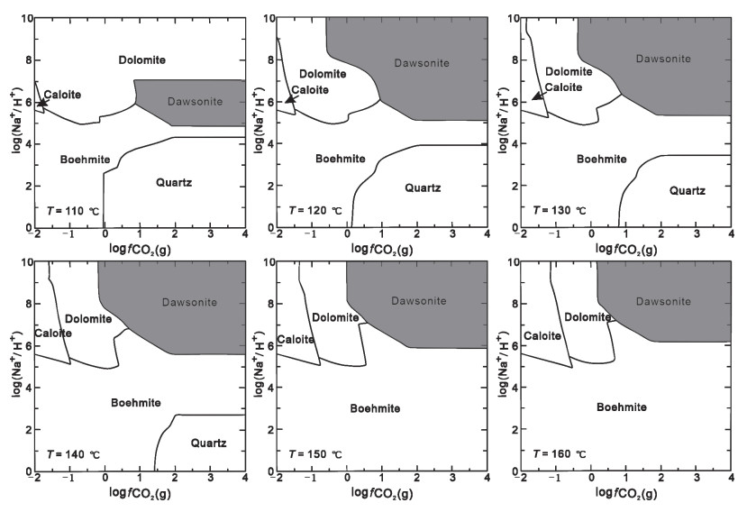
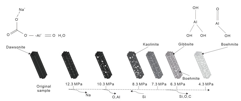
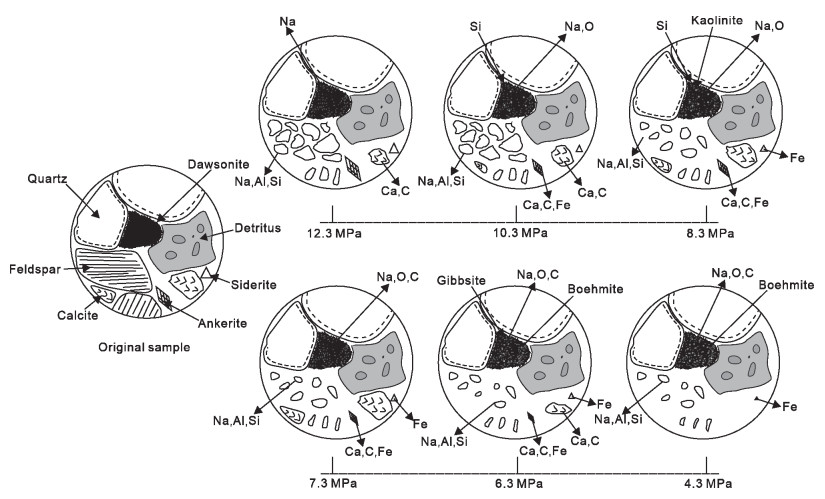
Effective CO2 sequestration is crucial for mitigating climate change, and dawsonite-bearing sandstone reservoirs are considered potential geological storage sites for CO2. In this process, the interactions among CO2, H2O, and rock directly influence the precipitation and dissolution of carbon-bearing minerals within the dawsonite-bearing sandstone, thereby affecting the stability of carbon sequestration. This study focuses on natural dawsonite-bearing sandstone from the Dongying sag. We conduct physical experiments in a high-temperature, high-pressure reactor to investigate the CO2-H2O-dawsonite-bearing sandstone interaction under different temperatures and CO2 pressures. X-ray diffraction, scanning electron microscopy, energy spectrum analysis, and water chemical analysis were employed to systematically investigate the dissolution and precipitation characteristics of the sandstone samples. Additionally, thermodynamic simulations were performed using the PHREEQC numerical simulation software, facilitating an understanding of the stable states of the reaction system under different conditions. The results indicate that the dissolution of dawsonite tablets leads to the formation of gibbsite and boehmite, which can transform into kaolinite under certain conditions. Temperature and CO2 pressure exert significant effects on these processes. Notably, the CO2-H2O-dawsonite-bearing sandstone reaction system remains stable under high CO2 pressure and exhibits strong carbon fixation ability. This research provides valuable insights for assessing the feasibility and safety of CO2 geological sequestration and storage.

Salinity Change Overrides Nitrogen Increase in Affecting Microbial Abundance, Diversity, Community Composition and Organic Carbon Mineralization in Saline Lakes
Jian Yang, Bingfu Yao, Min Cai, Mingxian Han, Zenghui Wu, Pingping Zhang, Haiyi Xiao, Jibin Han, Xiying Zhang, Hongchen Jiang
2026, 37(4): 1709-1721. doi: 10.1007/s12583-024-0139-4
Abstract:

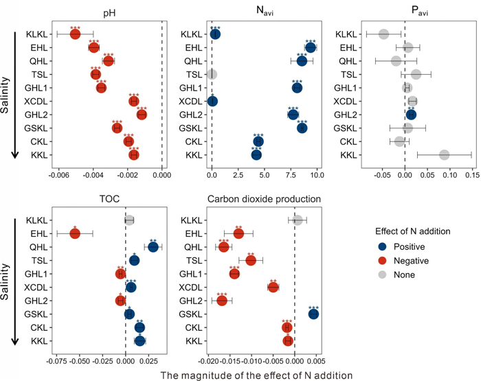
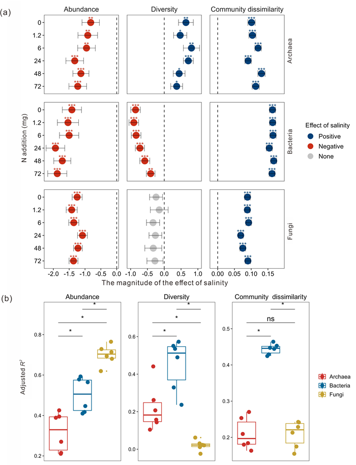
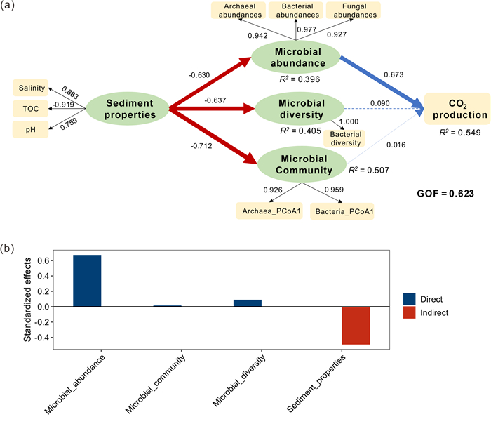
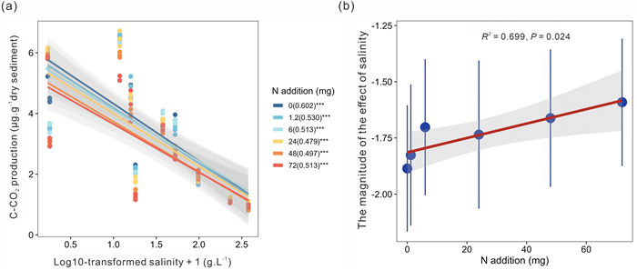
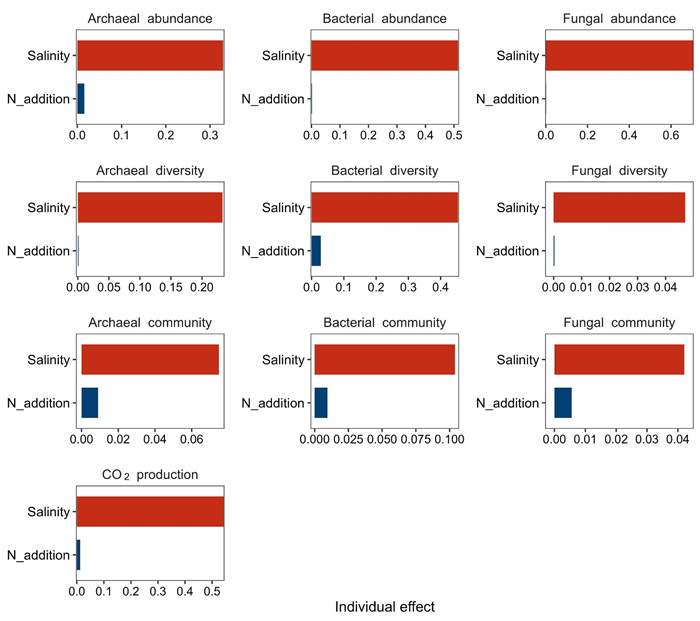
Saline lakes are simultaneously affected by salinity change due to climate change and increased nitrogen (N) input from human activities and atmosphere deposition. However, it is poorly known about how the salinity change and increased N input synchronously influence microbial community and its associated organic carbon mineralization in saline lakes. Here, lake sediments with different salinity (0.7–376.3 g·L-1) were employed to establish microcosm experiments, supplemented with different concentrations of NH4NO3, followed by incubation for 6 months and subsequent analyses of geochemistry and microbial community composition of the incubated sediments. The results showed that salinity change relative to nitrogen increase had a greater impact on microbial abundance, diversity, community structure and organic carbon mineralization in the studied lake sediments. Salinity increase significantly (P < 0.05) reduced CO2 production rates and bacterial diversity in lake sediments with different amounts of N additions, and the magnitude of the effect of salinity decreased with increasing N. Taken together, our results provide a more comprehensive understanding of the synchronous effects of salinity changes and increased N input on microbial abundance, diversity, community structure, and organic carbon mineralization in lakes with a wide salinity range.

Brachiopods from the Silurian "Lower Red Beds" of Wuhan (E. Hubei, South China): Paleoecological and Paleogeographical Implications
Jiayi Yin, Yilong Liu, Liebin Huang, Yiming Gong, Ruiwen Zong
2026, 37(4): 1722-1734. doi: 10.1007/s12583-024-0015-2
Abstract:

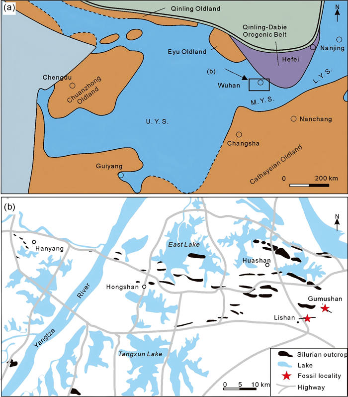
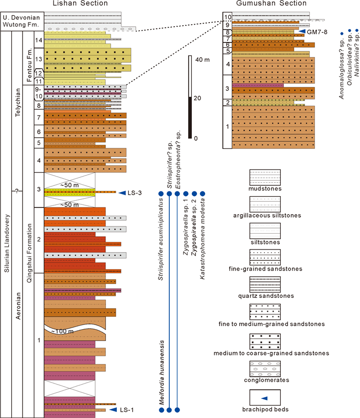
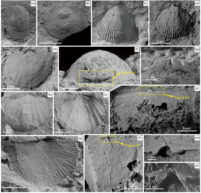
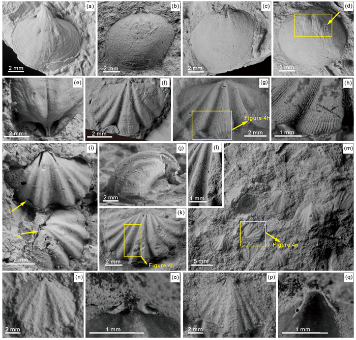
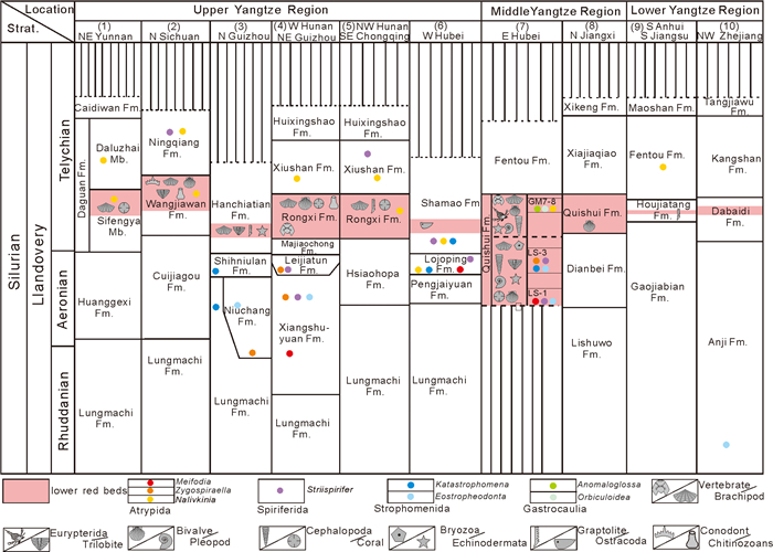
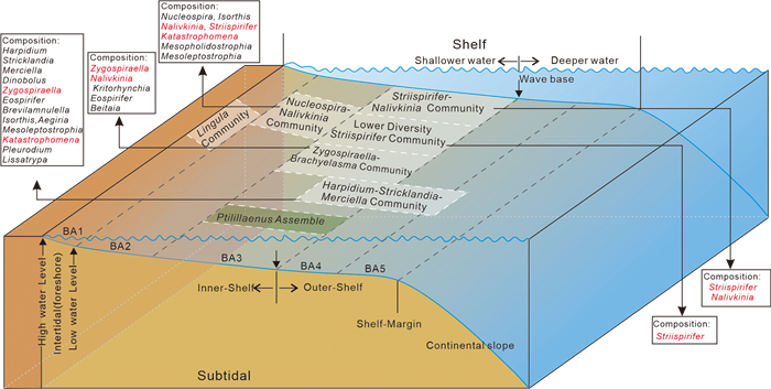
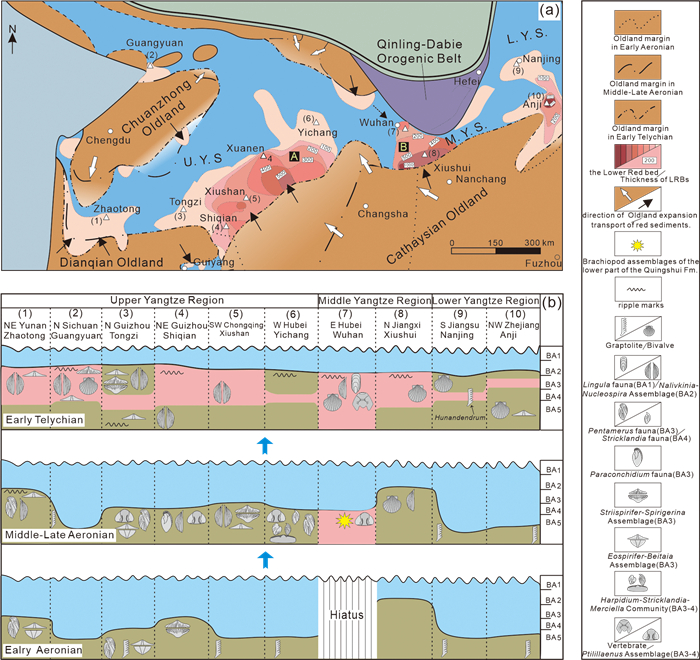
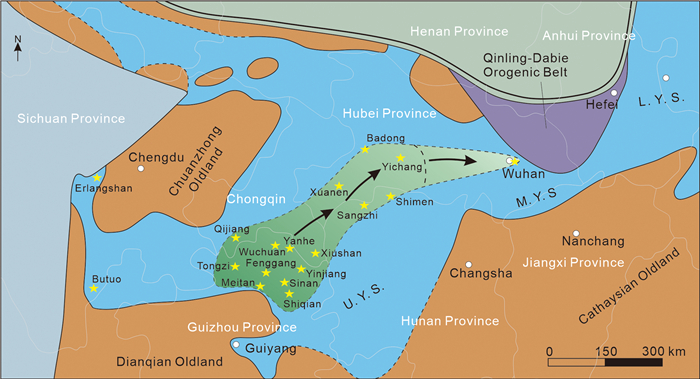
The age and sedimentary environment of the Silurian "lower red beds" (LRBs), which occur widely in South China, have long been controversial because of the scarcity of index fossils. Recently, these beds have been dated by trilobites as Middle–Late Aeronian to Early Telychian in age. Here, we report abundant brachiopods from the LRBs in Wuhan, Middle Yangtze Region, including atrypides (Meifodia hunanensis, Zygospiraella sp. 1, Zygospiraella sp. 2 and Nalivkinia? sp.), spiriferides (Striispirifer acuminiplicatus, Striispirifer? sp.), strophomenides (Eostropheodonta? sp. and Katastrophomena modesta), and linguliformeans (Anomaloglossa? sp. and Orbiculoidea? sp.). Most of these are common in the Leijiatun, Xiangshuyuan, Shihniulan, Niuchang, Lojoping, and Shamao formations in the Upper Yangtze Region. The discovery of brachiopods from the LRBs in Wuhan not only enrich the biodiversity of the LRBs in the Yangtze Region, where Meifodia, Zygospiraella, Katastrophomena and Eostropheodonta are first found in the LRBs, but also expand the paleogeographical distribution of brachiopods to Middle–Lower Yangtze Region that first radiated after the End-Ordovician Extinction. In addition, this brachiopod fauna also provides important implications for the sedimentary environment of LRBs during the Llandovery, which is usually developed in the nearshore shallow-water (BA1-2), althought this paper extends to the deeper parts of the shallow-marine (BA3-4).

Calving Mechanisms of Lake-Terminating Glaciers in the Southeastern Tibetan Plateau
Menger Peng, Wenfeng Chen, Wei Yang, Jonathan L. Carrivick, Yushan Zhou, Xiaoran Han, Guoqing Zhang
2026, 37(4): 1735-1753. doi: 10.1007/s12583-025-0376-1
Abstract:

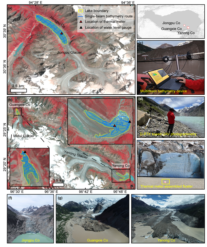
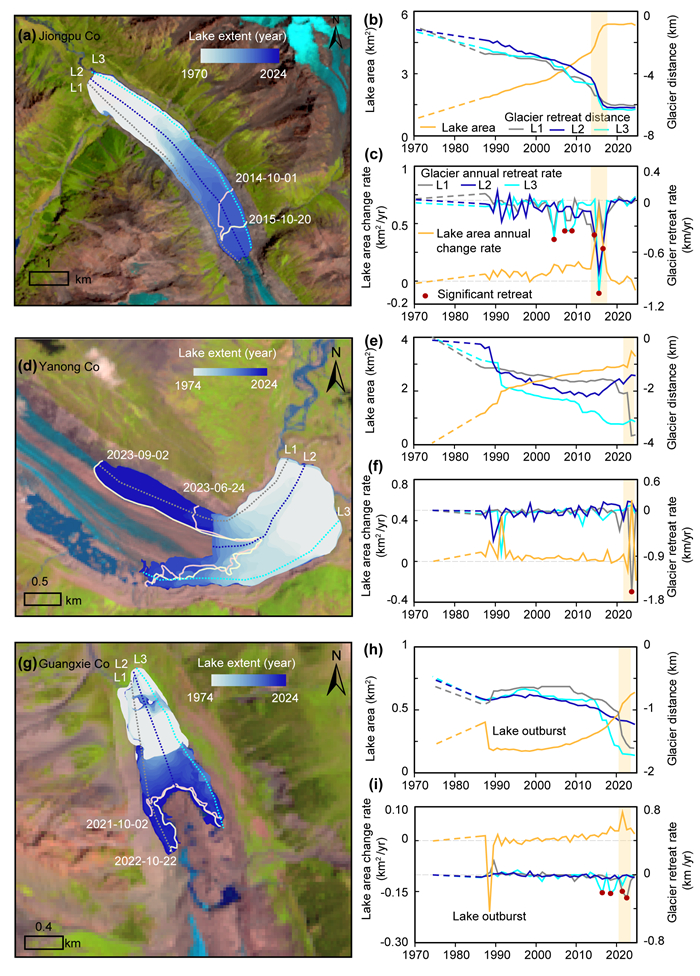
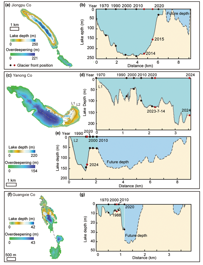
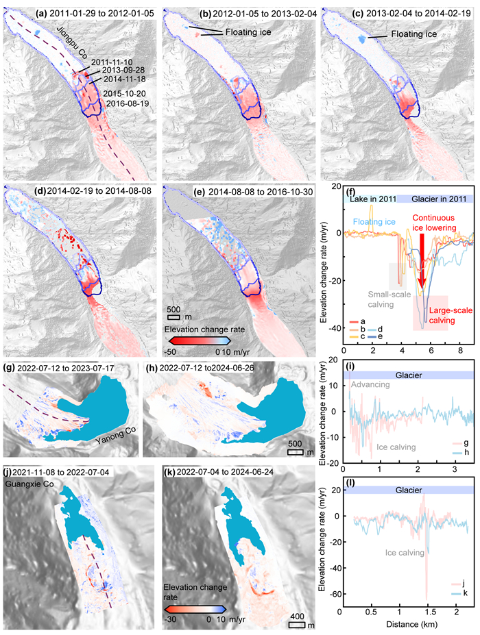
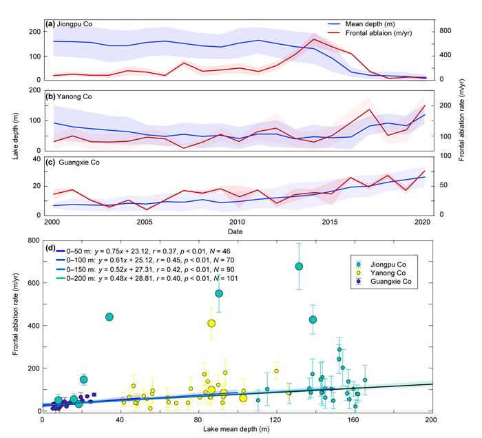
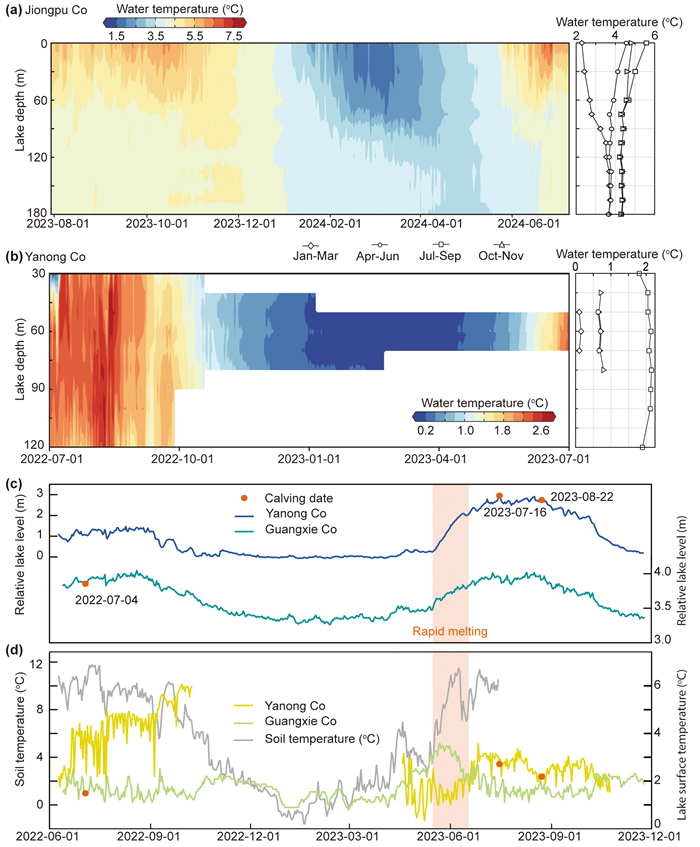
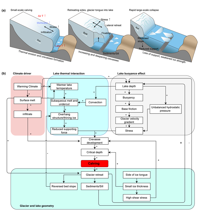
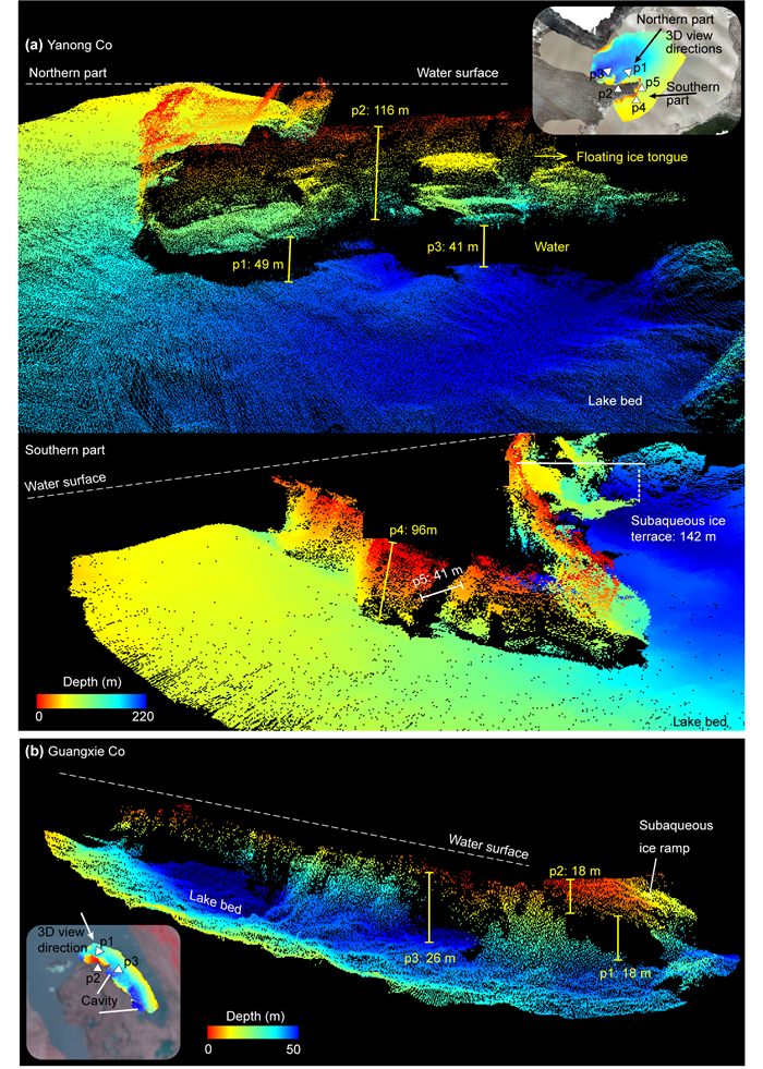
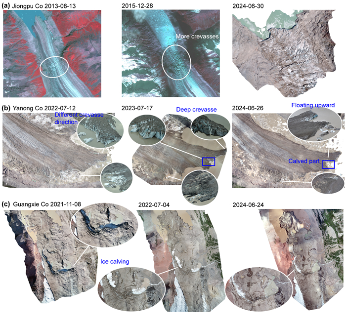
Understanding the interactions between glaciers and lakes is crucial for predicting water availability and mitigating associated hazards. However, the mechanisms driving the dynamics of high-altitude glacier-lake systems remain underexplored. This study investigates the calving processes of lake-terminating glaciers in the southeastern Tibetan Plateau, using a combination of remote sensing data and field observations. We examined calving events at Jiongpu Co, Yanong Co, and Guangxie Co from 2000 to 2023, including detailed measurements of lake temperature, subglacial morphology, and lake bathymetry. Our results indicate that calving plays a primary role in accelerating lake expansion and glacier retreat. The timing and extent of calving are influenced by factors such as lake depth, water temperature, and glacier-lake geometry. In shallow lakes like Guangxie Co, where the glacier is grounded, calving is closely linked to water depth. However, in deeper lakes like Yanong Co, where the glacier's terminus is floating, calving frequency and magnitude are primarily controlled by buoyancy-driven stress, water temperature, and geometric factors. Glacier-lake geometry also plays a critical role in calving dynamics. In deeper lake basins with reverse bed slopes, such as at Jiongpu Co, calving is more pronounced. In contrast, at Guangxie Co, where the bed is shallow and sediment-supported, calving is suppressed. Overall, the interaction of environmental factors shaping calving dynamics and glacier-lake evolution is complex and variable across time and space. We recommend incorporating glacier-lake geometry and calving mechanisms into predictive models to improve hazard assessments and support more effective water resource management for downstream communities.

Multiscale Pore-Network Investigation of Granular Soils: Pore Architecture and Associated Hydraulic Properties
Li Dong, Yunwu Xiong, Quanjiu Wang
2026, 37(4): 1754-1767. doi: 10.1007/s12583-026-0031-5
Abstract:

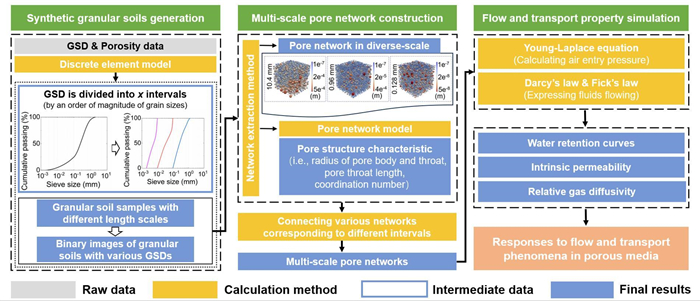
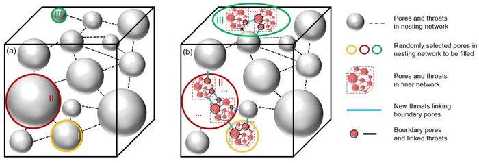
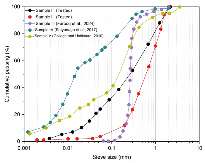
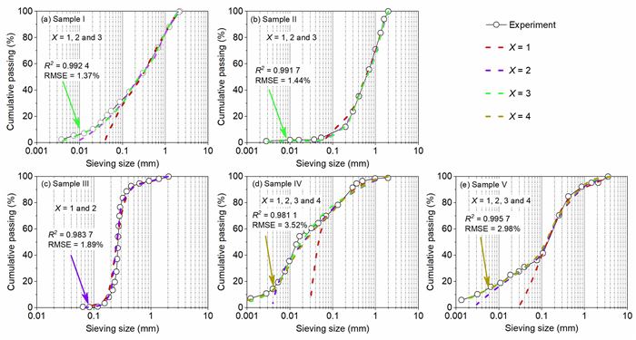
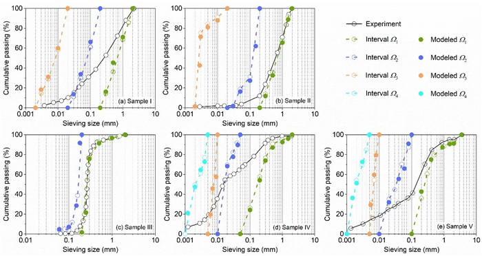
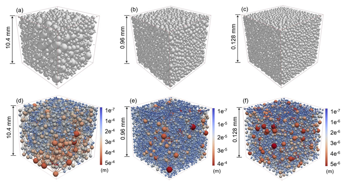
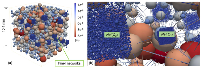
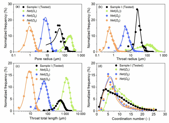
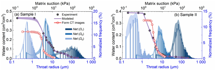
The flow and transport phenomena in granular soils are predominantly governed by the intricate internal structure of the pore space, which is fundamentally determined by grain size distribution and particle spatial arrangement. The characterization of grain-scale packing structures and reliable prediction of flow properties in granular soils, exhibiting broad particle size distributions continue to pose substantial theoretical and computational challenges. In this study, numerical procedures for granular soil generation, multiscale pore-network construction and flow property simulation were systematically applied to granular soils with grain size distribution covering multiple orders of magnitude. Various granular soils are well generated through dividing grain size distribution into multiple intervals with a size ratio not greater than 10 at different length scales. The corresponding topologically equivalent networks of pores and throats are extracted and combined to construct a single multiscale pore-network, which includes pore elements ranging over four orders of magnitude in size, and makes up for the lack of small pore description through X-ray computed tomography method. The flow characteristics of different granular soils are further simulated through the multiscale pore-network modeling, where water retention curves are in good agreement with experimental data, and the intrinsic permeability as well as gas diffusivity are also accurately predicted. The findings of this study provide valuable insights into how grain size distribution influences pore structure and macroscopic flow properties. The developed multiscale pore-network model herein establishes a comprehensive framework that enables investigation of more complex mechanisms, including physical-chemical-biological interactions and other flow phenomena at the pore scale.

Source Identification and Accumulation Prediction of Cu in Soils from Northwest China over the Past 30 Years
Xumei Mao, Yuwei Shao
2026, 37(4): 1768-1776. doi: 10.1007/s12583-024-0022-3
Abstract:

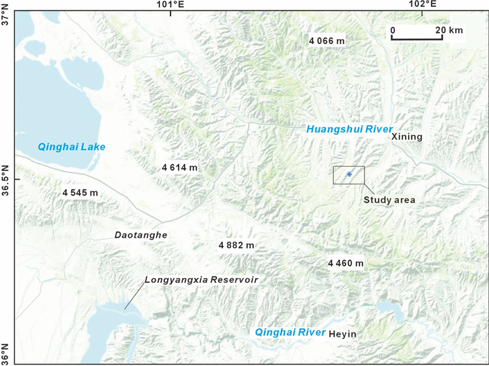
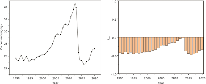
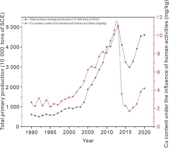
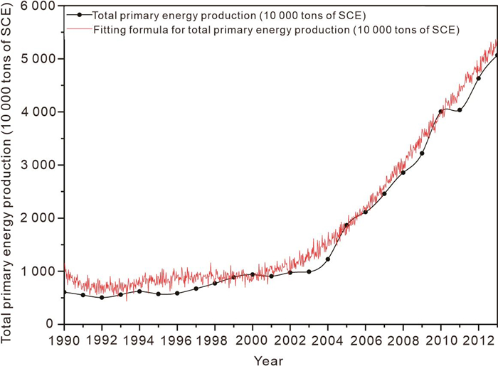
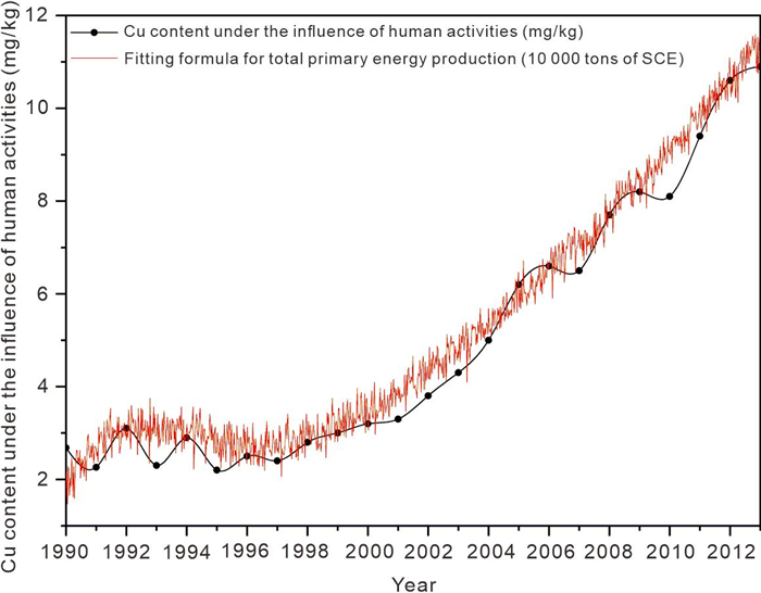
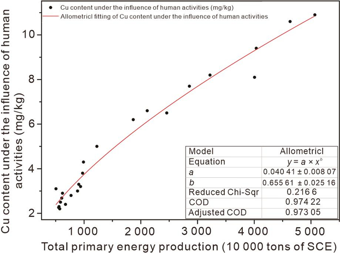
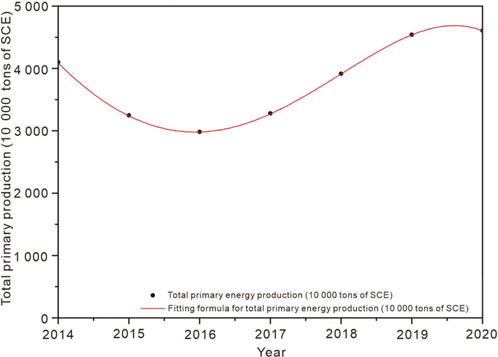
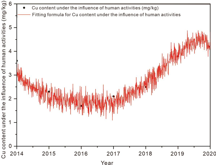
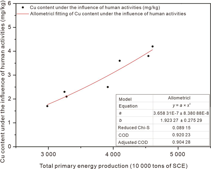
The source and enrichment process of Cu in soil are important for soil environmental pollution monitoring, evaluation, and prediction. The Cu content change curve can reflect the change trend and can be used for early warning and prediction. However, the historical change of Cu content in soil is rarely described by a functional curve due to the lack of long-term observational data. In addition to the soil geochemical background providing soil Cu and the weak accumulation of Cu in soil caused by weathering deposition, industrialization and urbanization in human activities are considered to be the main contribution to accelerating the accumulation of Cu in soil in recent years. According to the historical data of Cu content in soil, the historical change curve of copper content in soil in Northwest China was established based on equation fitting. The results indicate that the Cu content affected by human activities is closely related to the total primary energy production (10 000 tons of SCE). The study area in Northwest China satisfies the Allometric1 model. The average annual weathering deposition in the study area from 1990 to 2020 is about 0.004 87 mg/kg Cu. Based on the total primary energy production (10 000 tons of SCE), the future Cu content in soil in the study area can be predicted by Allometric1 model. This model can provide reference for Cu accumulation control and pollution policy in soil.

Deep Learning and Electromagnetic Wave Reflection-Based Automatic Detection of Sand Dune Movement and Assessment of Its Environmental Impact on Renewable Energy Plants
Huayu Lu, Marzieh Mokarram
2026, 37(4): 1777-1788. doi: 10.1007/s12583-025-0296-0
Abstract:

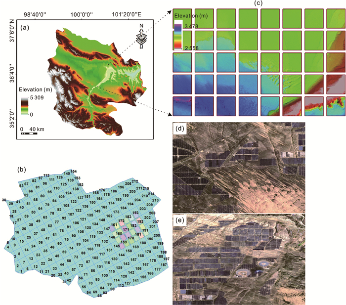
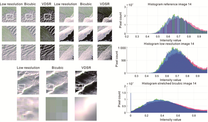
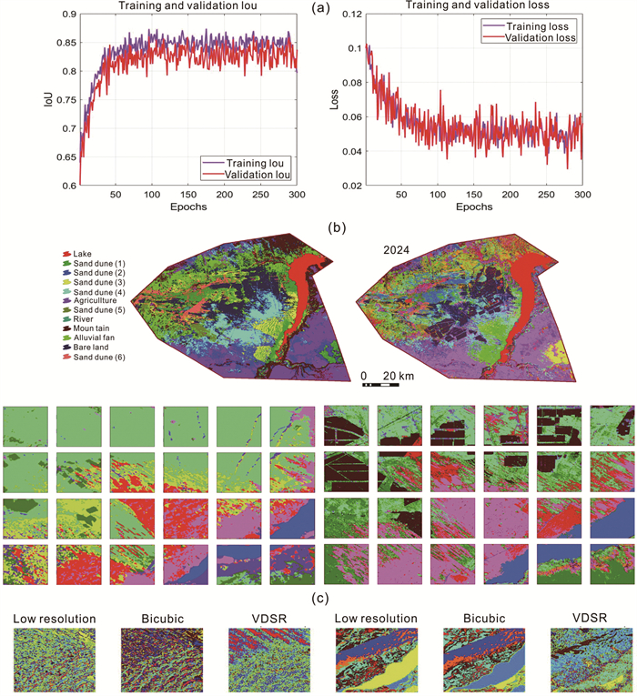
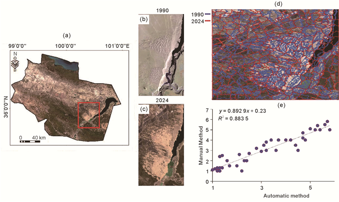
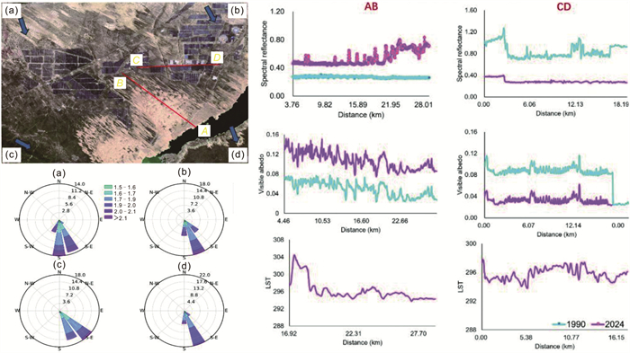
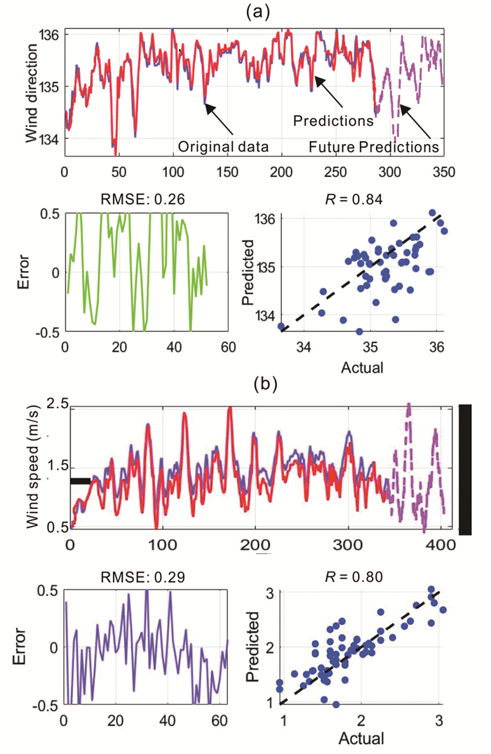
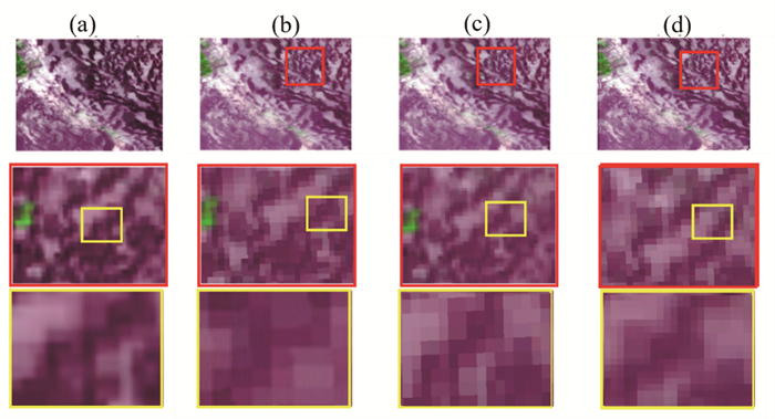
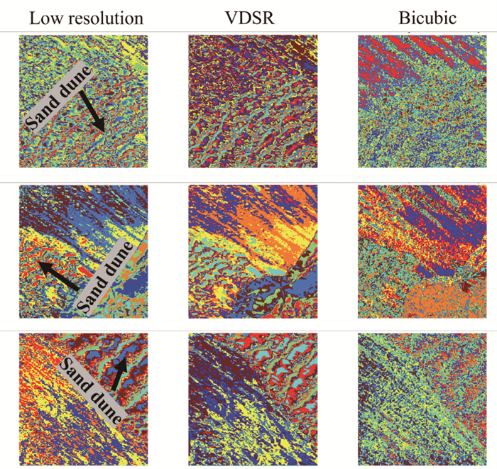
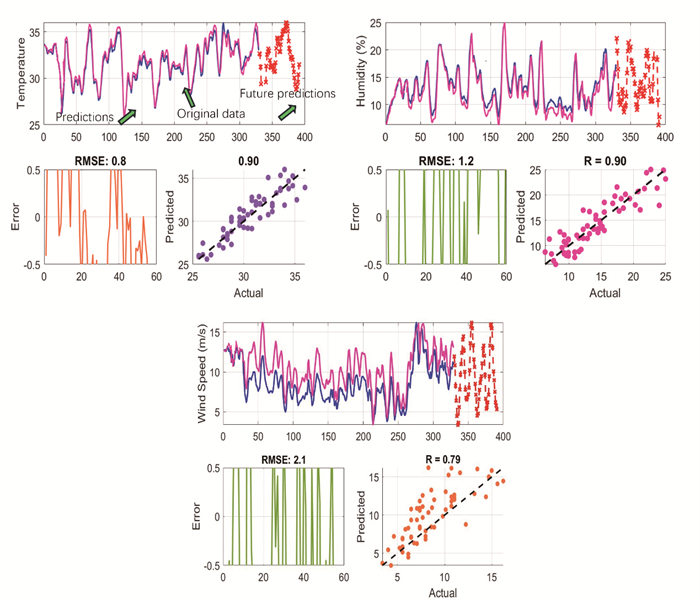
Sand dune movement threatens surrounding landscapes and infrastructures, especially like renewable energy plants. This study aims to predict sand dune movement and assess its risks to solar power plants in the southern Gobi Desert, Qinghai Province, China. This study integrates advanced methodologies, including the very deep super-resolution (VDSR) neural network for enhancing satellite image resolution, the multi-resolution segmentation (MRS) method for optimal dune type segmentation, the U-Net neural network for classifying and delineating desert landforms, and the long short-term memory (LSTM) method for forecasting climate parameters to assess dune movement and risks to solar power plants. The results demonstrate that the neural network significantly improves image resolution and enables clearer visualization of landscape features. When combined with MRS and U-Net, this approach accurately identifies and delineates sand dunes and solar panels, which achieve precise separation of these features in the imagery. Furthermore, the LSTM method predicts a shift in wind direction toward the south and southeast—specifically between 134 and 136 degrees—in the coming years, with wind speeds ranging from 1 to 3 m/s, which poses the greatest risk to solar panels in the northern parts of the region compared to other observation points.

Machine Learning-Based Integration of Climate and Desert Landform for Analyzing Sand Dune Processes
Huayu Lu, Marzieh Mokarram
2026, 37(4): 1789-1801. doi: 10.1007/s12583-025-0299-x
Abstract:

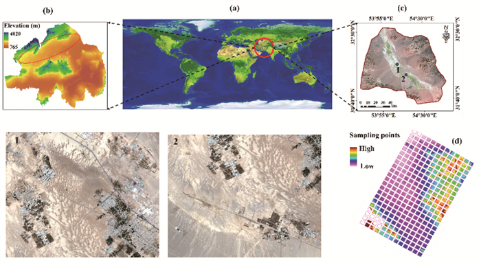
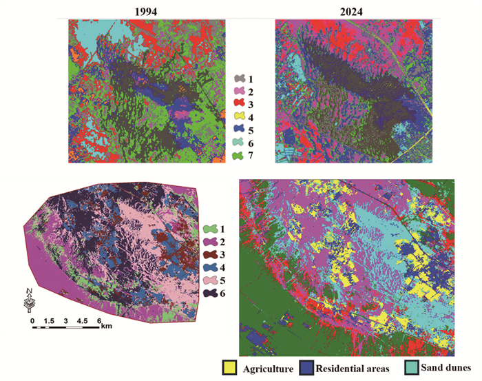
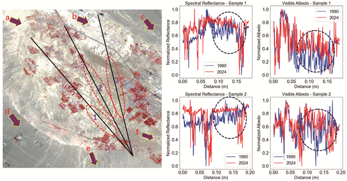
This study aims to identify sand dunes and predict their movement rates using deep neural network-based automatic mapping in the Bafgh Desert, Iran. Additionally, spectrum behavior analysis, including albedo wave and infrared investigations, is conducted to assess dune movement from 1994 to 2024. A machine learning-based neural network is also employed to predict weather parameters and their impact on dune movement. The results indicate that the very deep super resolution (VDSR) deep neural network algorithm significantly enhances satellite image resolution and improves the extraction of morphometric features of sand dunes in desert regions. The U-Net model, with 92% accuracy, effectively classifies sand dunes, which reveals their progression toward residential and agricultural lands and poses significant risks to these areas in the study region. Additionally, spectral reflectance analysis reveals that increases in albedo reflection and infrared wave values indicate the expansion of sand dunes in the study area. Finally, the results of the long short-term memory (LSTM) neural network, with an accuracy of R = 0.90, predict that in the coming years, lower humidity, higher temperatures, and increased dryness will speed up dune movement, especially towards the east and south, creating risk for residential and agricultural areas in the study regions.

Exploring the Spatial Distribution and Drivers of Low Flows in the Basins of the United States
Xinglong Gong, Aiqi Xu, Shuping Du, Yuan Xu
2026, 37(4): 1802-1814. doi: 10.1007/s12583-023-1919-9
Abstract:

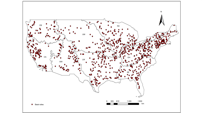
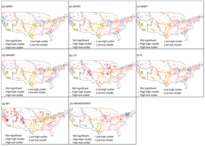
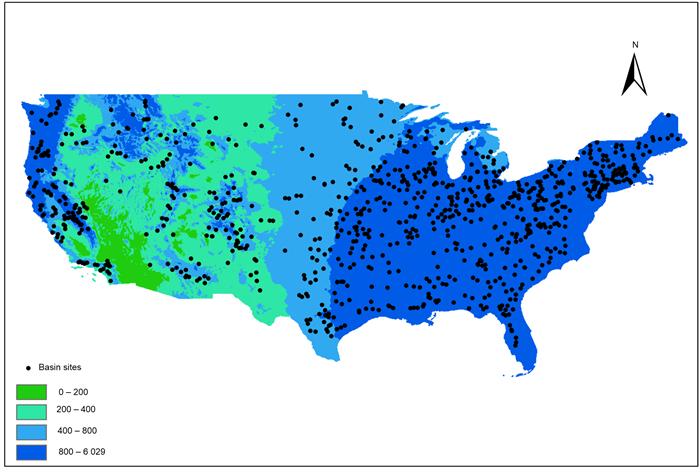
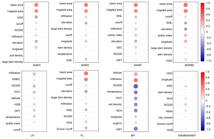
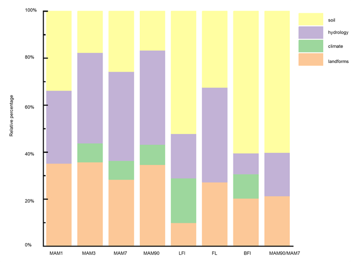
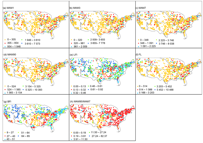
In recent years, with the change of temperature and the intensification of human activities, the quantitative and spatial patterns of low flows in basins have changed significantly, and the problem of low flows selection has emerged. To address this situation, this study selected 910 basins within the United States that reflect a wide range of climatic characteristics and human activities to assess the spatial patterns of regional low flows. The drivers of environmental change were identified from 40 basin attribute characteristics using various methods such as random forest. The spatial smoothness of low flows was also analyzed using the Moran's Index. We found that the spatial low flow magnitude in the United States is characterized by a gradual decrease and then increase from east to west, similar to the precipitation distribution. Basin area and irrigated area were the main drivers of low flows, and the effects were positive. And it was found that low flow indicators with lower spatial smoothness were more difficult to associate with basin characteristics and to predict and select drivers using random forest models. Our study provides a new perspective to explore the impact of factors such as environmental change on low flow variability.

Effects of Typical Karst Tourist Town on the Lijiang River Water: From Heavy Metals to N-Nitrosamines
Yuanyu Shan, Yuru Su, Xinli Xing, Bingquan Zhu, Honghu Zeng, Yuan Zhang, Junyu Li, Xiaoyu Yan, Wenwen Chen, Benjian Li
2026, 37(4): 1815-1828. doi: 10.1007/s12583-024-0004-5
Abstract:

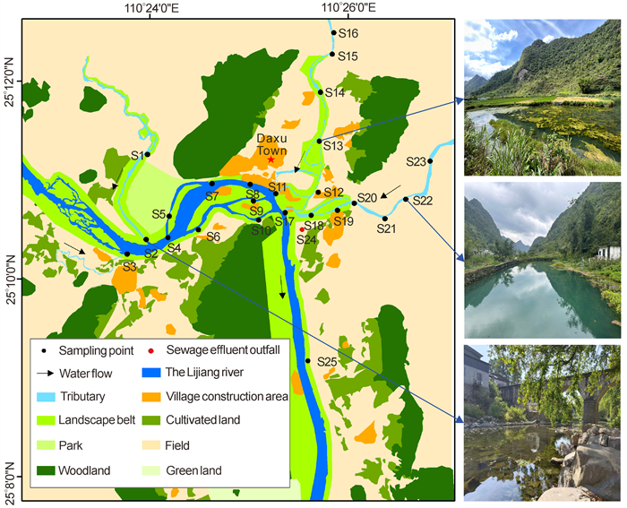
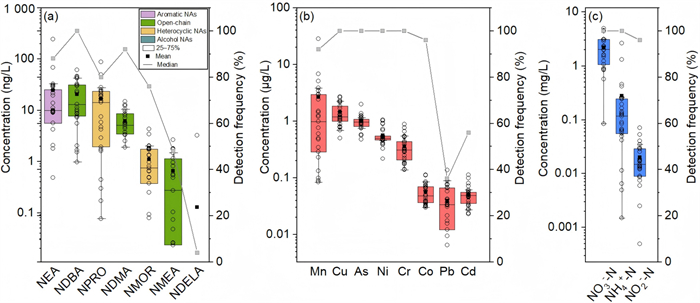
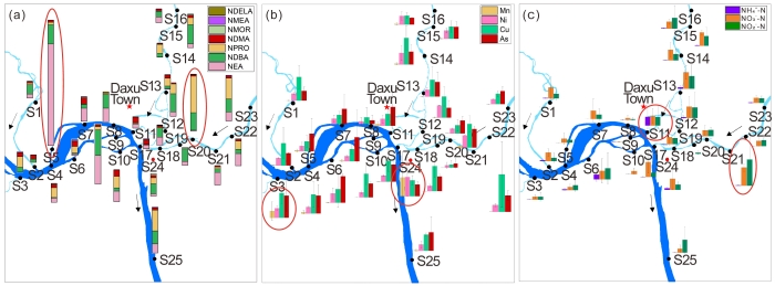
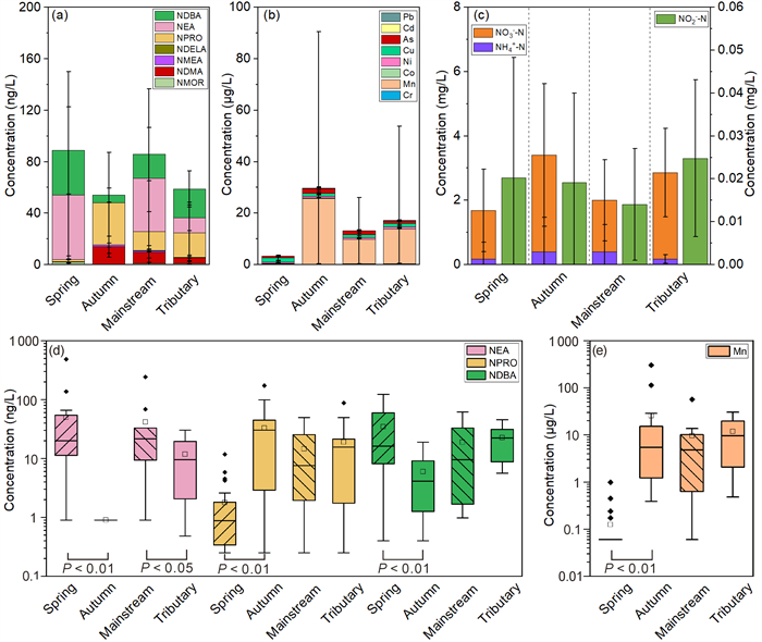
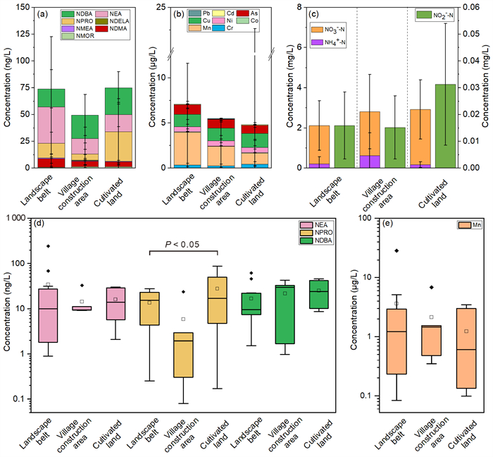
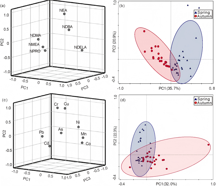
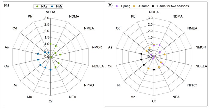
N-nitrosamines are nitrogenous organic pollutants with high carcinogenicity to humans. Heavy metal pollution in aquatic systems is currently a major environmental problem. Tourism in typical karst areas may influence the environment through wastewater discharge. However, it remains unclear whether these activities would cause water pollution. To evaluate the impact of tourism activities in typical tourist towns, this study investigated the occurrence and sources of 18 N-nitrosamines, eight heavy metals (HMs), and dissolved inorganic nitrogen (DIN) in the Lijiang River and its tributaries. Seven N-nitrosamines were detected, among which N-nitroso-N-ethylaniline (NEA, average of 24.8 ng/L) and N-nitroso-l-proline (NPRO, 20.4 ng/L) were the dominant compounds, while especially low concentrations of HMs (Mn, Cu, As, Ni, Cr, Co, Pb, and Cd) and DIN (NH4+-N, NO2--N, and NO3--N) were observed. The most important influencing factors were seasonal factors, followed by land use type and mainstem and tributary factors. Principal component analysis revealed that in the city with developed tourism and relatively less heavy industry, aquaculture and agricultural wastewater were identified as the primary sources of N-nitrosamines. Meanwhile, domestic sewage and agricultural wastewater were found to be the main sources of HMs and DIN, respectively. The ecological risk assessments for all pollutants are relatively low (< 1). Therefore, N-nitrosamines, HMs, and DIN pollution caused by tourist activities pose a negligible risk to the Lijiang River.

Geohazards and Engineering Geology
Experimental Investigation of Geothermal Ice-Melting Efficiency on Pavement at Highway Tunnel Entrances in Cold Regions
Yuanfen Ye, Huiming Tang, Zhi Chen, Junrong Zhang, Chunchen Cao
2026, 37(4): 1829-1840. doi: 10.1007/s12583-025-0247-9
Abstract:

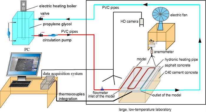
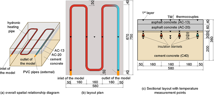
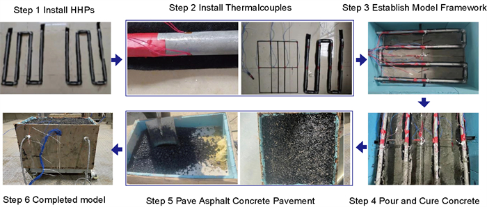
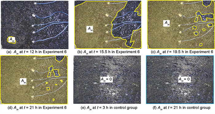
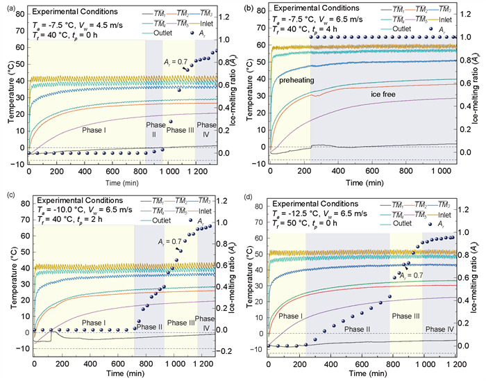
Rapid and efficient de-icing methods are essential to ensure vehicle safety at highway tunnel entrances in cold regions. While geothermal ice-melting technology offers environmental and sustainability advantages, its application in tunnel entrance scenarios remains limited. To address this gap, a four-factor, three-level orthogonal ice-melting experiment was designed to systematically evaluate the ice-melting efficiency of a geothermal hydronic heating system under simulated cold-region tunnel conditions. Key variables, including ambient temperature (-7.5– -12.5 ℃), fluid temperature (40–60 ℃), wind speed (4.5–6.5 m/s), and preheating duration (0–4 h), were tested in a controlled large-scale laboratory. Ice-melting efficiency was quantified by the time required to achieve a melting ratio of 0.7 for a 10 mm thick ice layer. Results identified ambient temperature (Ta) and fluid temperature (Tf) as dominant factors, with Tf = 50 ℃ serving as a critical operational threshold. Lower Ta prolonged the efficient ice-melting period due to increased convective heat loss, while higher wind speeds (6.5 m/s) enhanced sublimation-driven melting. The process was categorized into four distinct phases: initial, rapid, accelerated, and stabilization. Notably, pavement temperature stabilization preceded ice-melting rate equilibrium, and complete melting occurred even when surface temperatures remained sub-zero. These findings provide practical recommendations for optimizing geothermal system parameters in cold regions.

A Novel Tunnel Seismic Prediction Method Based on Threshold Trigger
Peng Guan, Zhenqiang Shen, Cuifa Shao, Yuyong Jiao, Guohua Zhang, Bin Li, Jie Zhou
2026, 37(4): 1841-1851. doi: 10.1007/s12583-024-1982-z
Abstract:

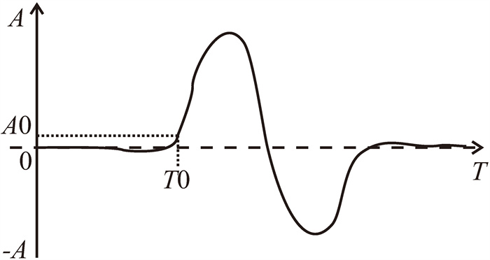
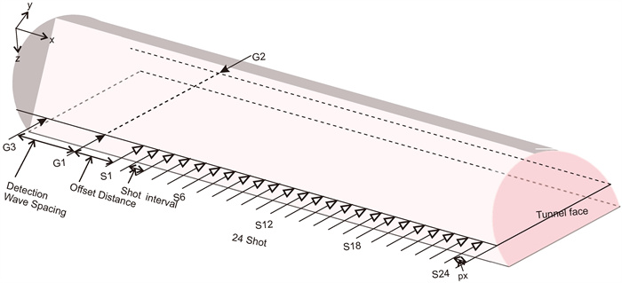
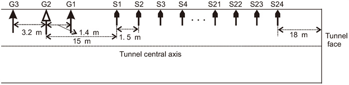
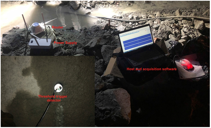
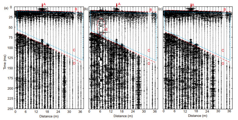
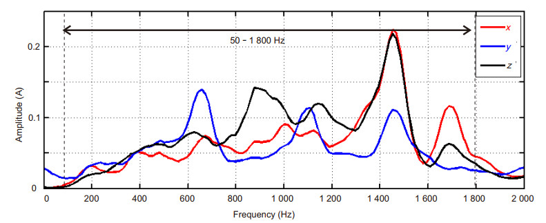
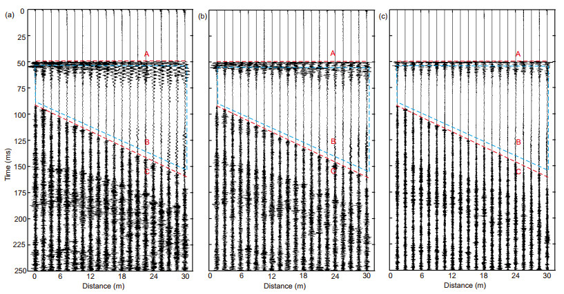
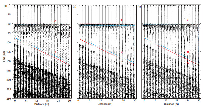
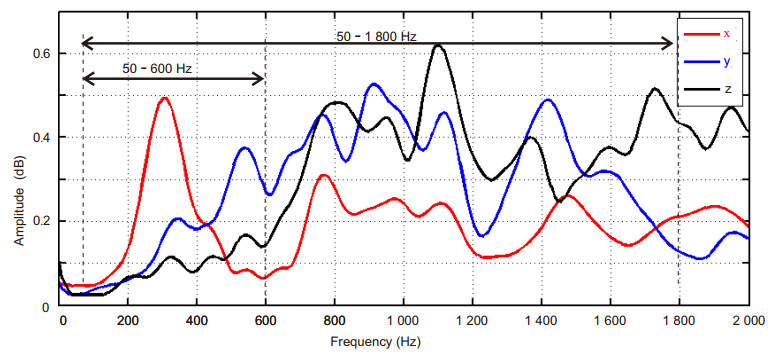
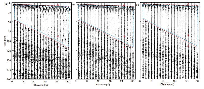
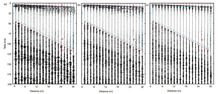
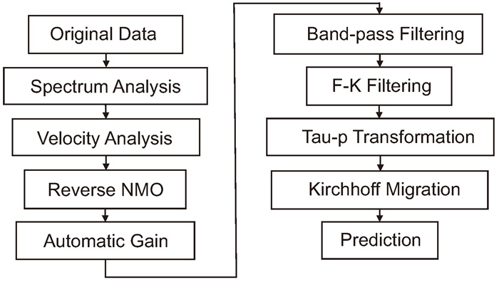
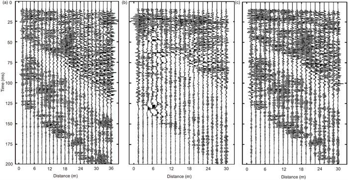
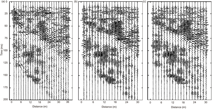
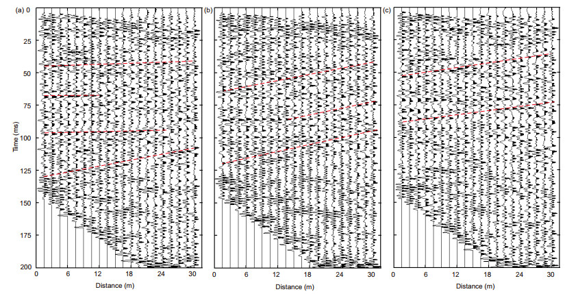
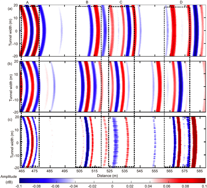
The tunnel seismic prediction method can provide information on the geological anomalous body in front of the tunnel face in a long distance (120 m), which has become a necessary work in tunnel construction. The traditional tunnel seismic prediction methods suffer from two main issues: low data acquisition efficiency and the occurrence of signal delay traces during data gathering. These issues, in turn, impact the accuracy of calculating the velocity of the surrounding rock. To address these shortcomings, this paper proposes a new method called the threshold-triggered tunnel seismic prediction method. The effectiveness of the proposed method is validated through the analysis of measured tunnel seismic data. Firstly, when compared with the traditional short-circuit trigger method, the threshold trigger method demonstrates a significant improvement in data acquisition efficiency. Secondly, the threshold triggering mode effectively eliminates the problem of signal delay and jump that is present in the short-circuit trigger mode, thus ensuring the accuracy of the surrounding rock velocity calculation. These advantages clearly demonstrate the potential engineering application value of the threshold-triggered method.

Seismicity Analysis of the Beijing Area from an Enhanced Long-Term Earthquake Catalog
Huiying Ge, Hongyi Li, Tongli Wang, Shengzhong Zhang, Bowen Cui
2026, 37(4): 1852-1862. doi: 10.1007/s12583-024-0093-1
Abstract:

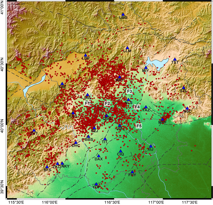
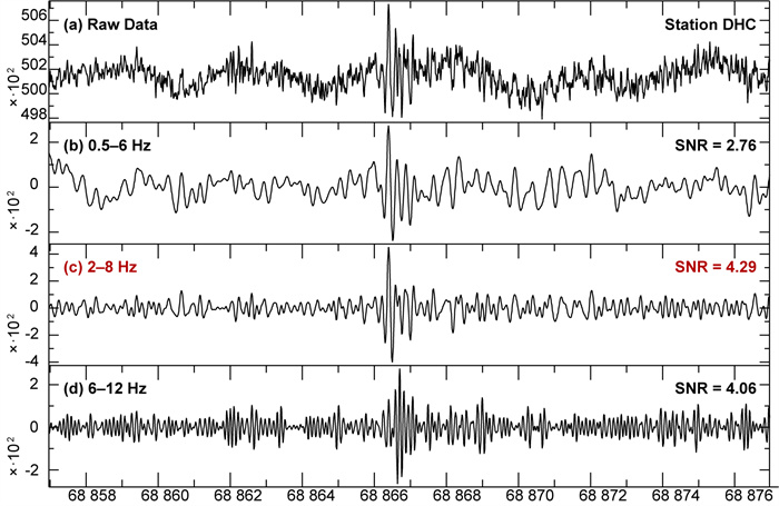
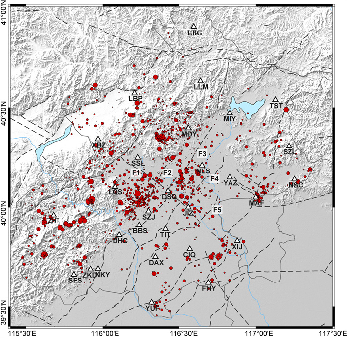
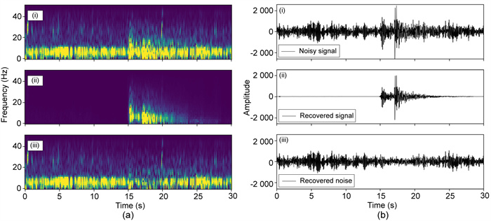
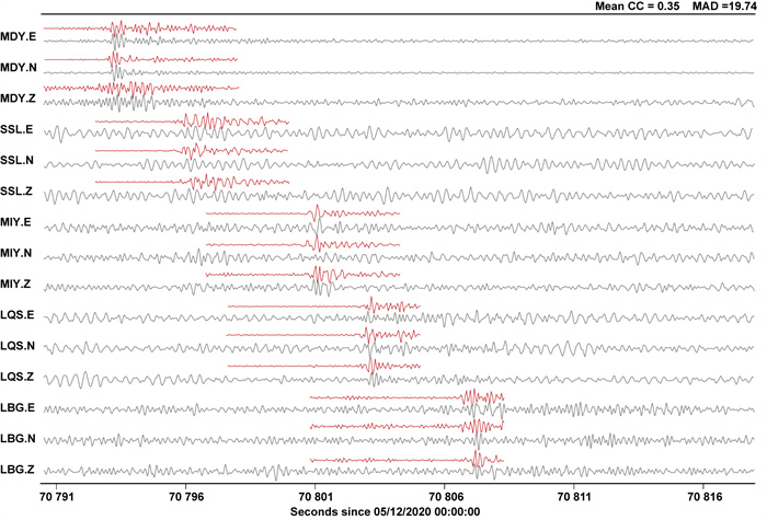
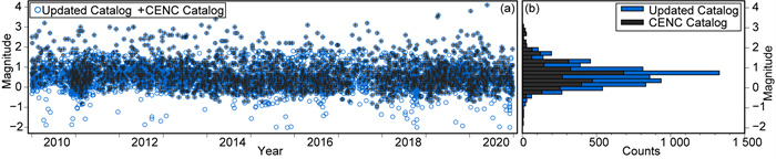
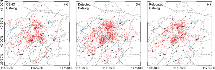
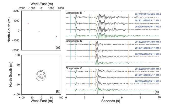
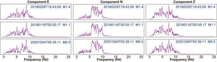
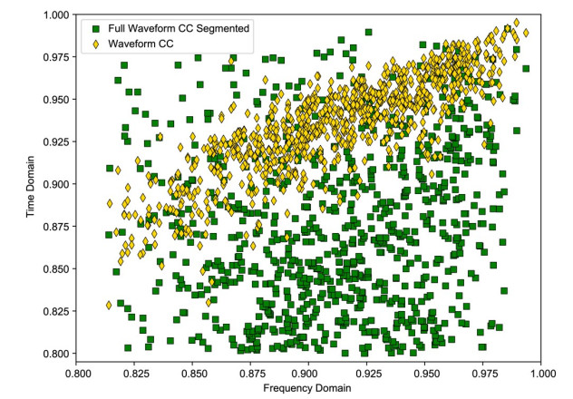
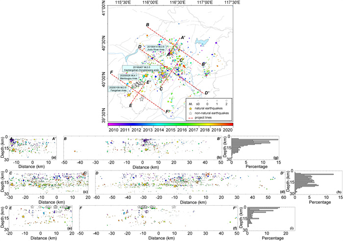
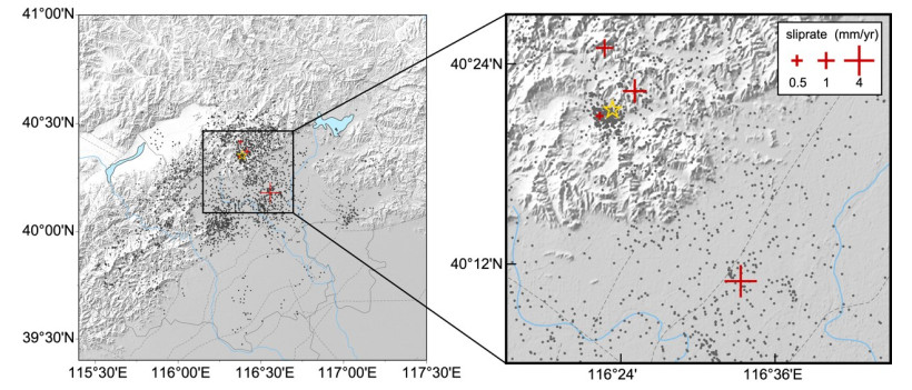
Beijing, a major central city, is located at the junction of Northeast Asia and North China, bordered by the Taihang Mountains to the west and the Yanshan Mountain Range to the north. In this study, continuous waveform data from 29 seismic stations operated by the China Earthquake Networks Center (CENC) covering the period from 2010 to 2020 are collected to construct an enhanced catalog for the Beijing area through the integration of both template matching and machine learning methodologies. We first selected 1 884 earthquakes with high signal-to-noise ratios (SNRs) as template events from 3 405 earthquakes, utilizing the graphics processing unit-based match and locate (GPU-M&L) for earthquake detection and location, and a total of 10 392 events were detected. Then, DeepDenoiser, a deep learning-based technique for noise reduction, was applied to extract seismic signals from continuous raw data, and we identified 7 516 seismic events, approximately 2.2 times the number listed in the CENC earthquake catalog. We then employed PhaseNet, a deep neural network-based method, to pick seismic arrival-time, and HypoDD for relocation. Repeating earthquakes were identified by a segmented cross-correlation method through both time and frequency domains. Our study obtains an enhanced catalog for the Beijing area, adding approximately 5 000 earthquakes primarily in the 0–1 magnitude range. The distribution of earthquakes in the Beijing region is mainly concentrated in three main clusters, revealing a potential concealed fault in the Jiudu River area and new evidence of a southern extension of the Xiaotangshan-Dongbeiwang fault zone. Our results provide a reliable and comprehensive data foundation for assessing earthquake risks and enhancing disaster prevention and mitigation strategies in the Beijing region.

Decoding the Initiation of an Earthquake-Induced Mega-Landslide: Role of Rock Bridge Failures in the Daguangbao Landslide
Shenghua Cui, Yufei Liang, Xiangjun Pei, Roberto Tomás, Tao Jiang, Mengjie Yang, Chun Zhu, Huilin Le, Ling Zhu
2026, 37(4): 1863-1884. doi: 10.1007/s12583-026-0508-2
Abstract:

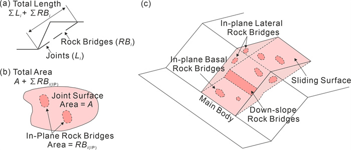
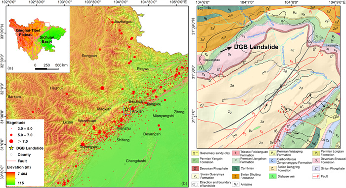
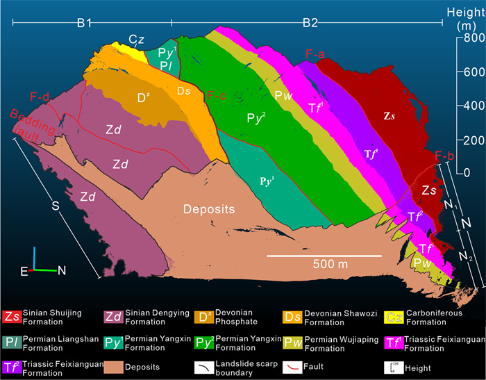
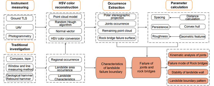
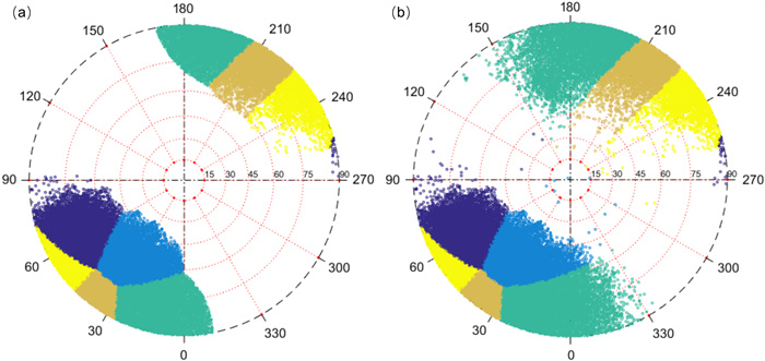
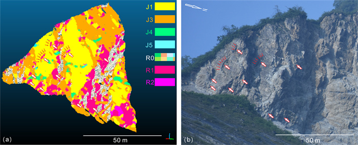
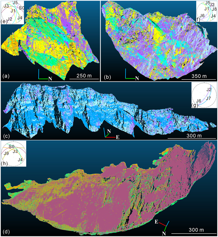
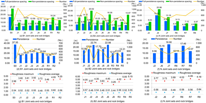
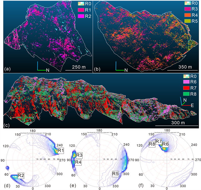
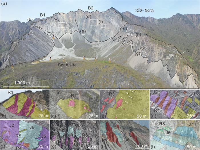
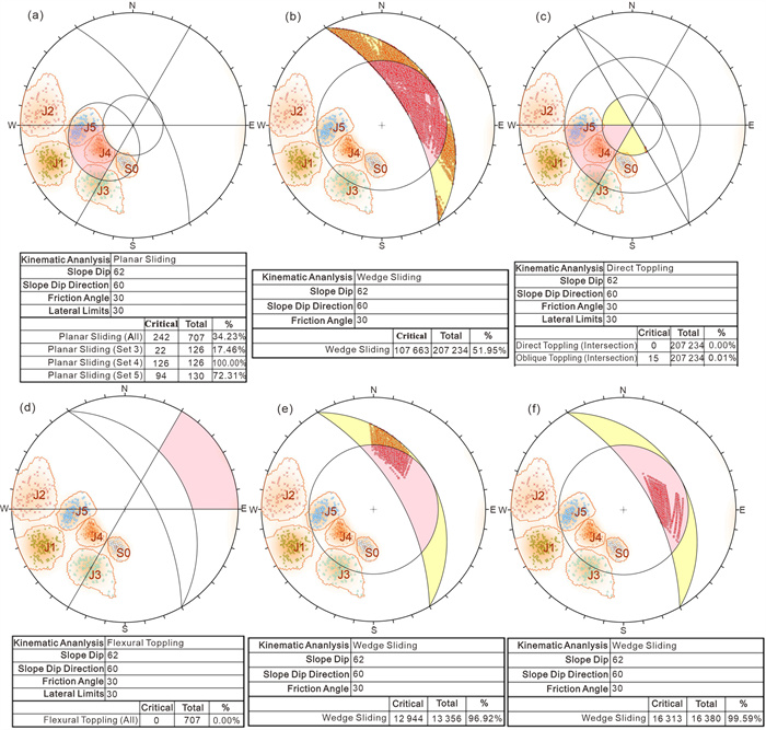
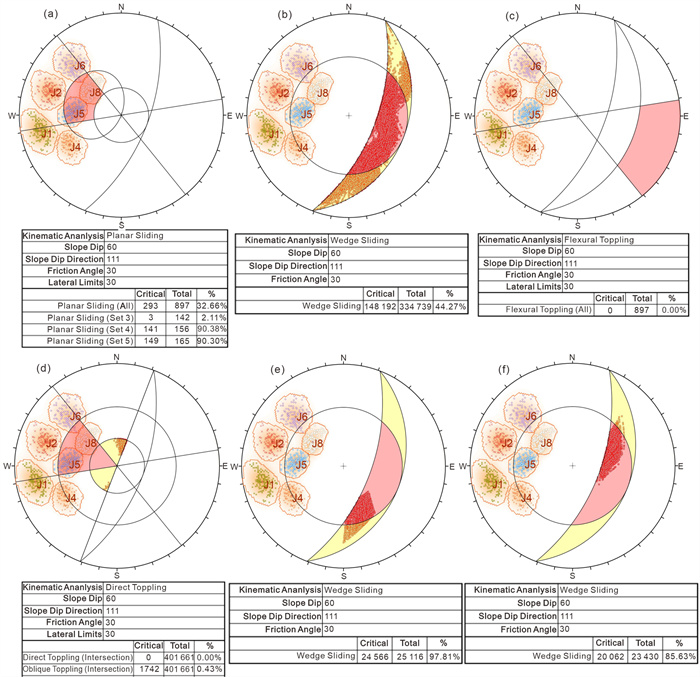
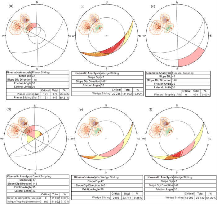
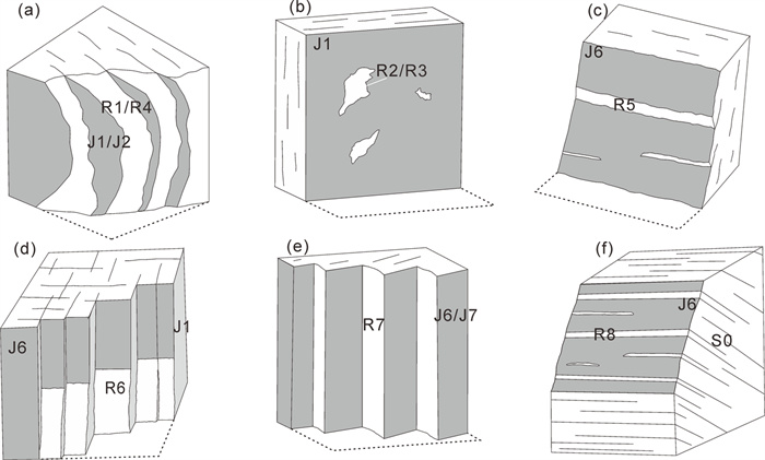
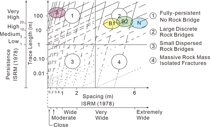
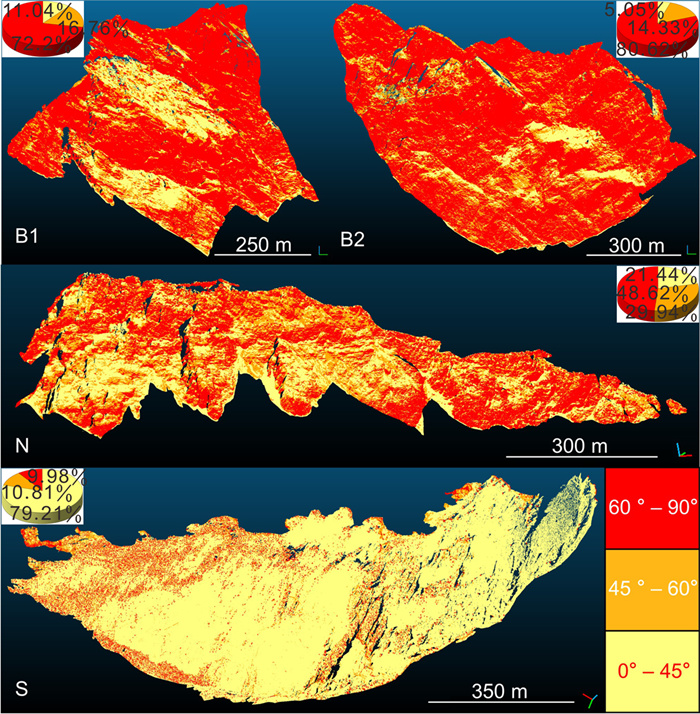
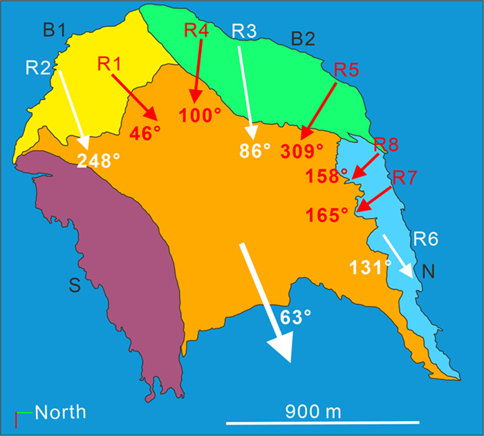
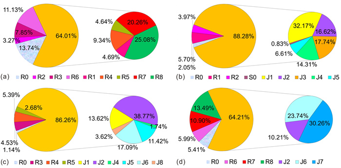
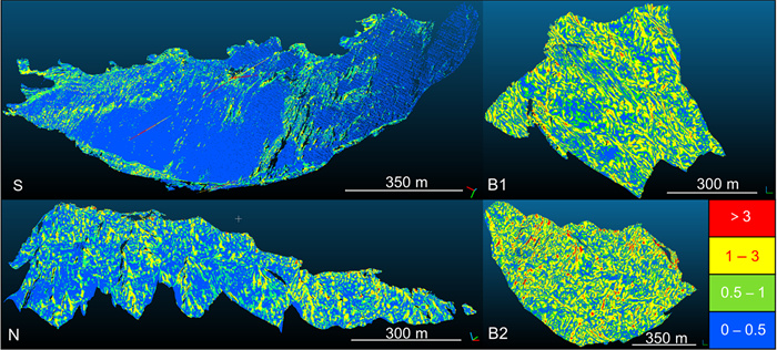
The Daguangbao (DGB) mega-landslide is the largest-scale landslide triggered by the 2008 Wenchuan Earthquake. The slope failure involved approximately 1.2 × 10⁹ m3, exposing a head scarp with a projected area of 1.85 km2 and a maximum height of 800 m. However, the initiation mechanisms remain inadequately understood due to a lack of detailed structural data on the failure boundaries. This study employs 3D laser scanning to analyze rock bridge distribution and fracture patterns on the earthquake landslide scarp. Results indicate that rock bridge failures constitute 22.49% of the total rupture area. The main scarp is characterized by tensile failure involving in-plane basal and downslope rock bridges linked with steep discontinuities, while the northern boundary exhibits combined tensile and shear failure through the linkage of in-plane lateral rock bridges with discontinuities of varying dips. The distribution and morphology of rock bridges indicate that the northern boundary experienced tensile failure under SN-oriented horizontal seismic loading, while the main scarp underwent tensile cracking parallel to the sliding direction due to EW-directed seismic forces. These processes led to the destabilization of a wedge-shaped block bounded by the southern and northern margins together with the main scarp, which subsequently slid along the basal bedding plane. Prior to the landslide's detachment from the source area, seismic activity had already caused 64.01% of the total rock bridge failures. During downslope movement, landslide traction further caused tensile failure of the remaining rock bridges on the main scarp and shear failure of those along the northern boundary. This study demonstrates that rock bridge analysis provides crucial insights into boundary fracture development during the rapid initiation of large earthquake-induced landslides.

New Understanding of the Progressive Failure Process of the 2018 Baige Landslide, Tibet, China: A Role of Intermittent Rainfall
Ling Zhu, Shenghua Cui, Zicheng Lu, Xiangjun Pei, Han Cao, Shuang He, Hui Wang, Hailong Yang
2026, 37(4): 1885-1902. doi: 10.1007/s12583-026-0507-3
Abstract:

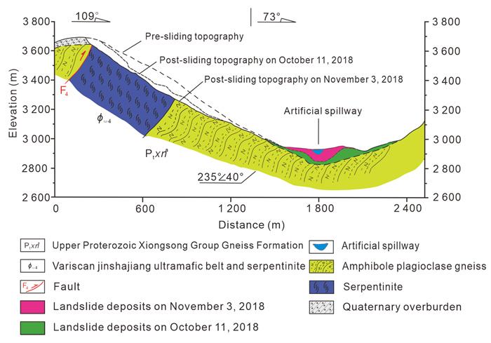
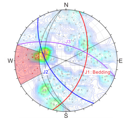
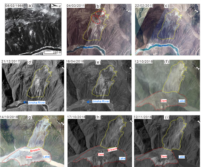
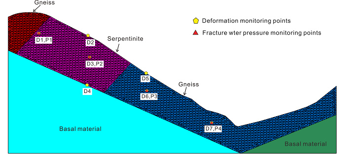
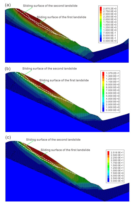
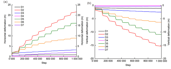
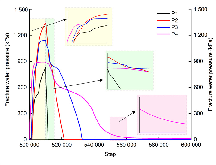
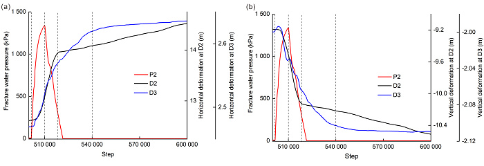
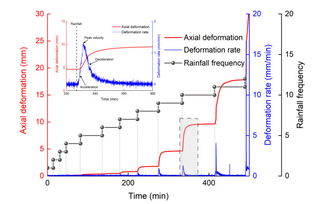
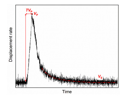
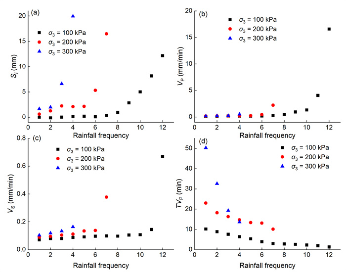
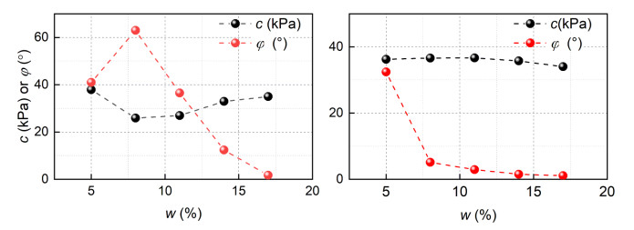
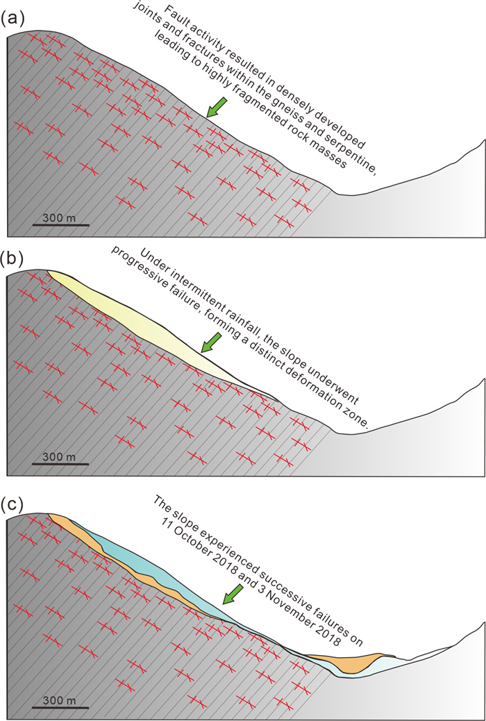
On October 11 and November 3 2018, two successive large-scale landslides occurred at Baige Village, eastern Tibet, China, damming the Jinsha River and causing severe downstream hazards. Despite their catastrophic impact, the progressive failure process of the Baige Landslide has remained poorly understood. In this study, we integrate field investigations, rainfall-step creep experiments, and numerical simulations to clarify the role of intermittent rainfall in slope weakening and failure. Structural mapping shows that faults traversing the northern, rear, and southern margins of the slope promoted dense jointing and fracturing in gneiss and serpentine, providing the fundamental geological basis for long-term instability. Laboratory results demonstrate that intermittent rainfall drives a stepwise deformation process, alternating between episodic acceleration during rainfall and creep stabilization afterward. Rainfall influences slope behavior through both short-term triggering—via increased water content and fracture water pressure—and long-term degradation, expressed as water-rock interactions that progressively reduce frictional resistance and strength. Numerical modeling further reveals that the progressive failure of the Baige Landslide was controlled by the interplay of structural predisposition, intermittent rainfall triggering, and long-term weakening, ultimately leading to large-scale collapse. These findings highlight the critical importance of incorporating historical damage and rainfall-induced degradation into slope stability assessments, particularly in tectonically active and rainfall-prone regions.

Identification and Motion Trajectory Analysis of High-Position Dangerous Rock Mass in the Lanhuazhai Collapse Triggered by the 2022 Luding Ms 6.8 Earthquake
Jingyu Kang, Xiaodong Fu, Kai Wu, Qian Sheng, Xing Wang, Miao Liang, Shuai Huang
2026, 37(4): 1903-1920. doi: 10.1007/s12583-024-0018-z
Abstract:

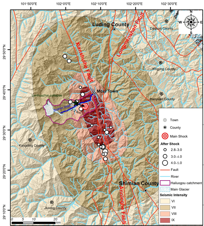
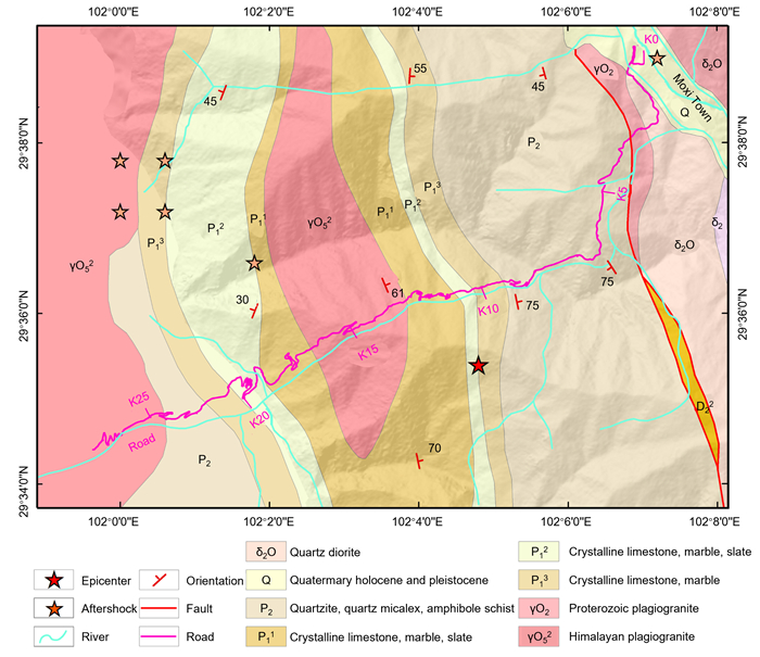
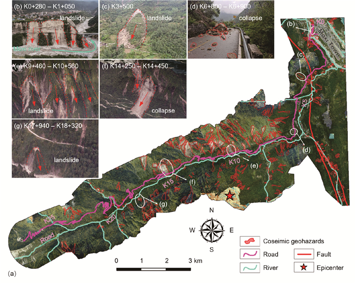
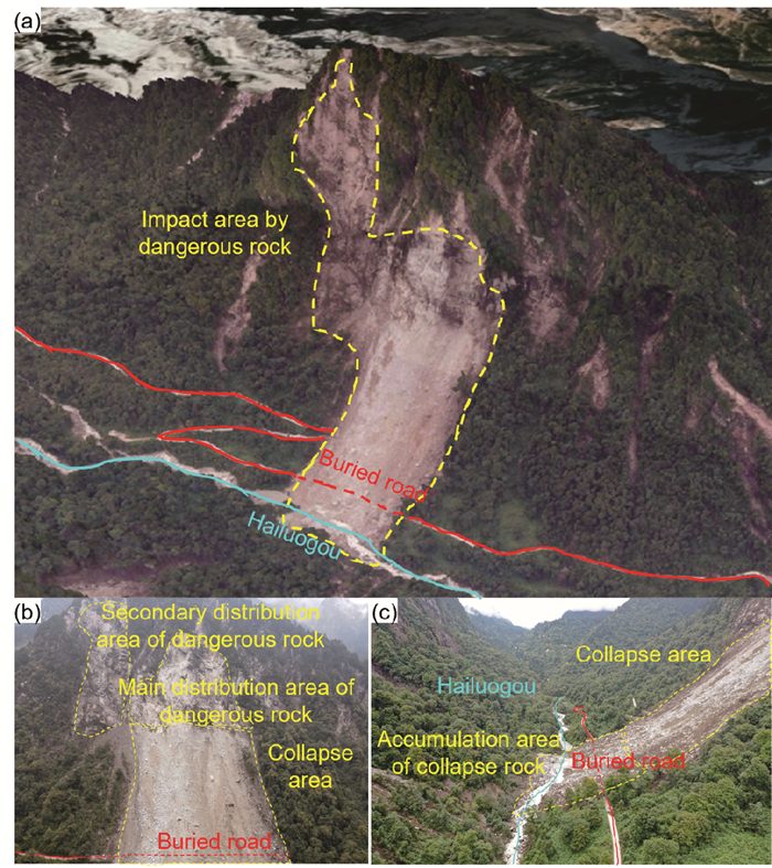
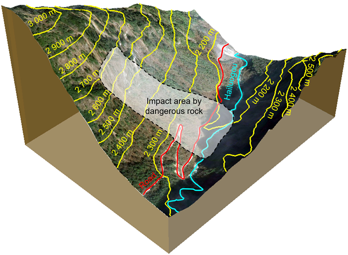
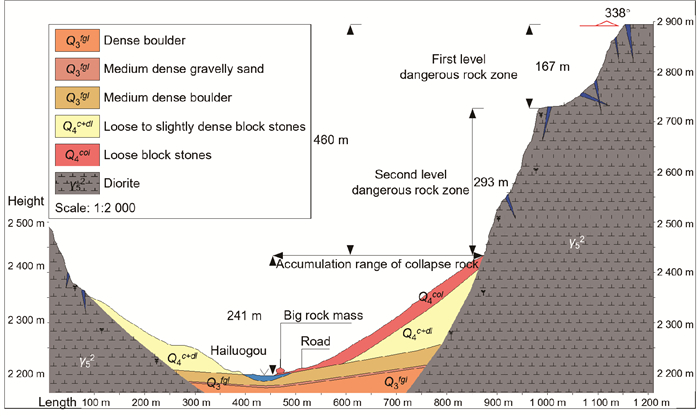
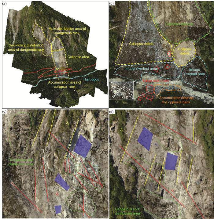
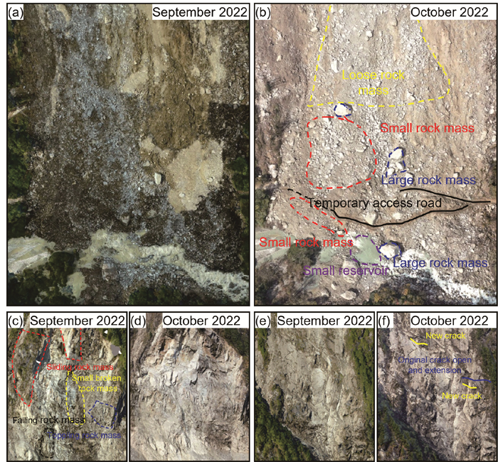
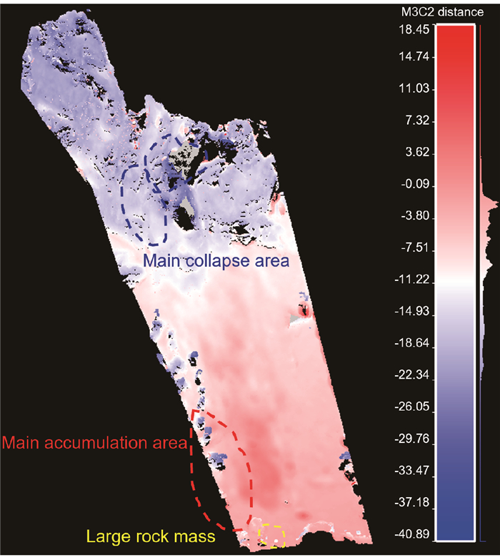
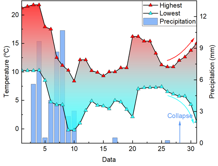
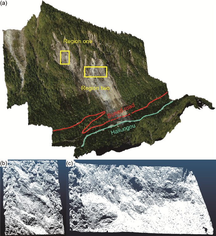
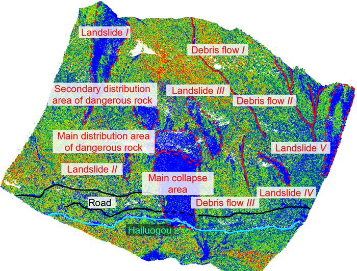
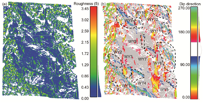
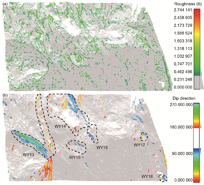
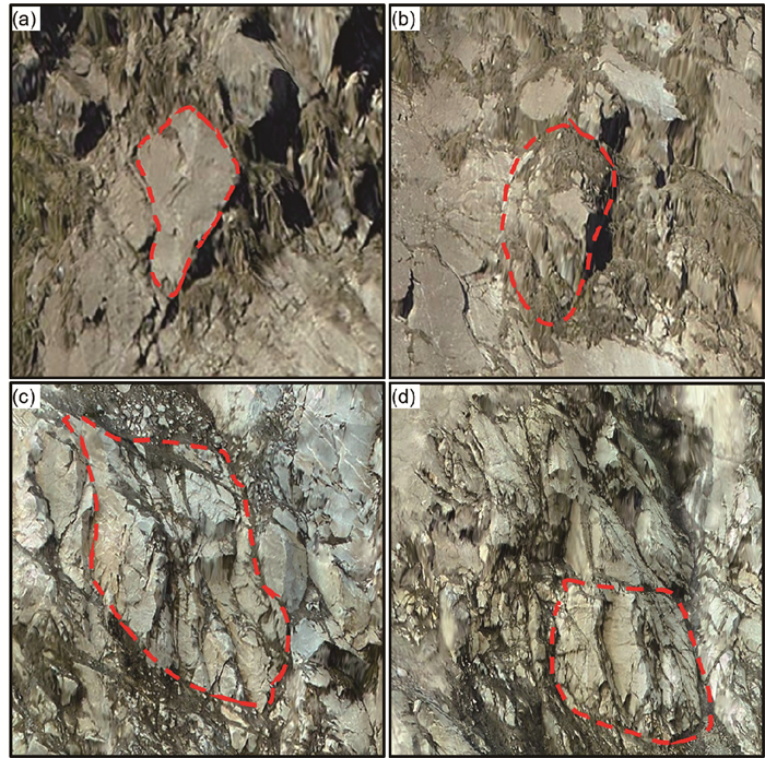
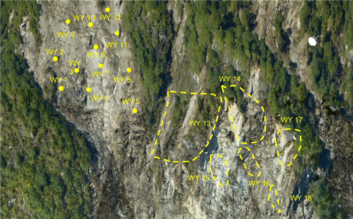
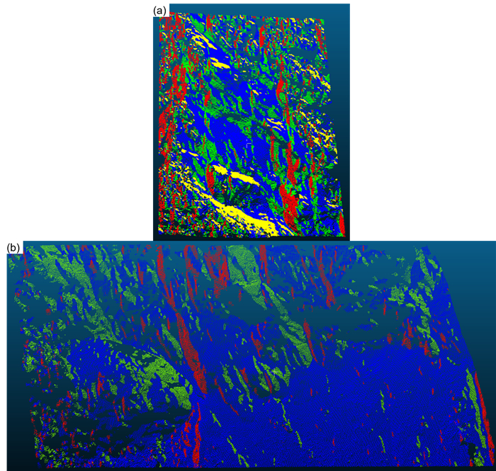
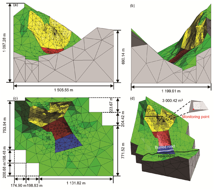
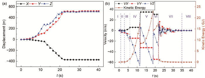
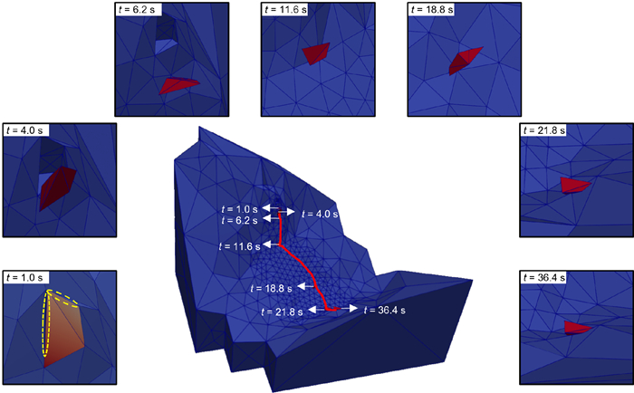
The epicenter of the 2022 Luding Ms 6.8 earthquake was located in Hailuogou scenic area, and a large number of co-seismic geo-hazards occurred along the scenic road. To assess the geo-hazards in Hailuogou scenic area, an extensive field survey was conducted. Firstly, based on the satellite images after earthquake, a large-scale inspection was conducted along the road by manual visual interpretation. A total of 503 co-seismic geo-hazards with a total area of 3.75 × 10⁶ m2 were identified, and almost half of their scale ranged from 1 000 to 5 000 m2. Subsequently, the Lanhuazhai collapse located on K14 section was chosen as a representative site for in-depth study. 3D point clouds and high-resolution photos were obtained by UAV, and the distribution characteristics of dangerous rock mass, joint set, and accumulated rock were preliminarily investigated. A comparative study was carried out when subsequent collapse occurred on October 28, and the causes were discussed. Based on the 3D point clouds, the source and impact area of geo-hazards were automatically identified, which contained six landslides and three debris flows apart from the collapse. Two high-position regions with exposed bedrock were selected for accurate identification of dangerous rock mass and joint, and the results were consistent with those observed in site. Finally, the 3D DDA model was established and used to simulate the runaway process of a typical dangerous rock mass. The motion trajectory was analyzed according to the variation of kinetic energy and the disposal scheme was provided, which can be served as guidance for rescue and reconstruction.
Large-Scale Discrete Element Modelling of in-situ Direct Shear and Plate Load Tests on Granular Soils
Zhichun Lu, Shan Dong, Guodong Liu, Marcos Arroyo, Xingwei Ren
2026, 37(4): 1921-1935. doi: 10.1007/s12583-024-0017-0
Abstract:

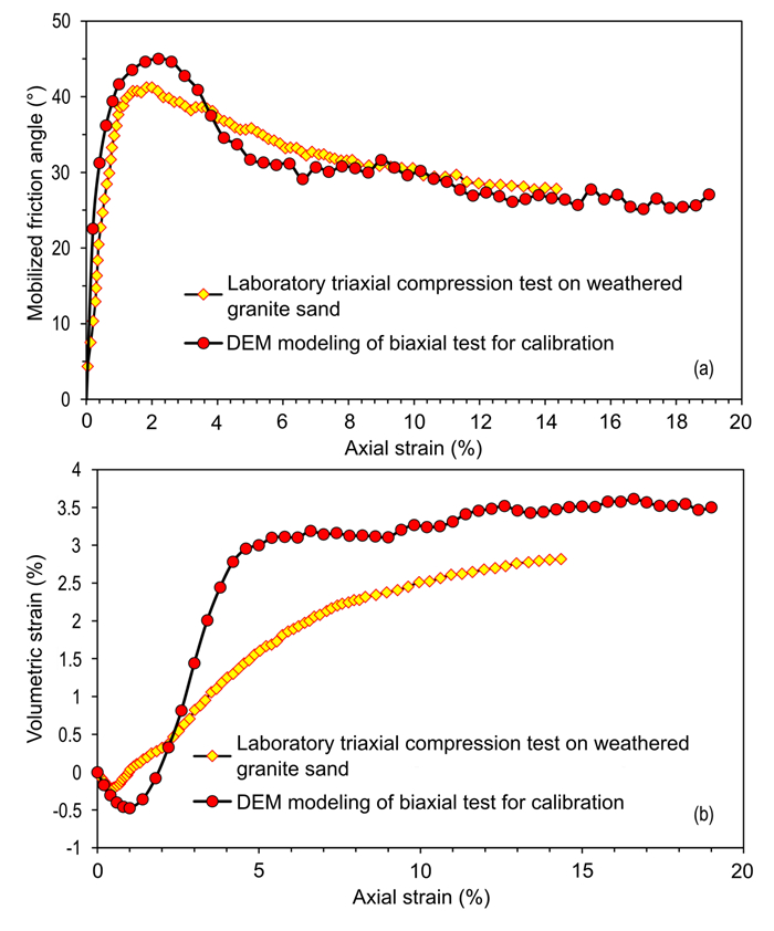
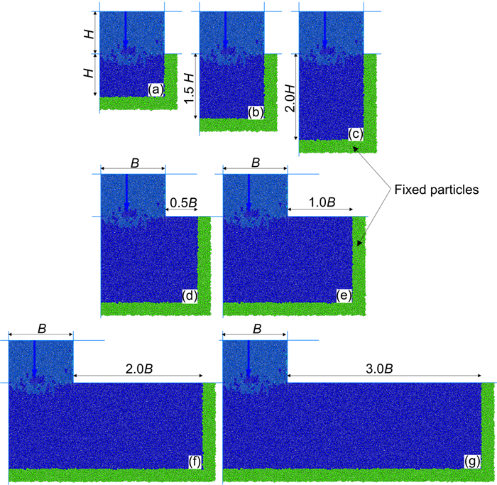
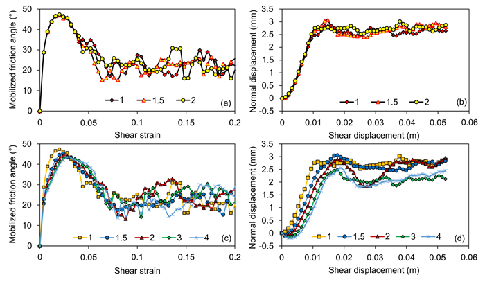
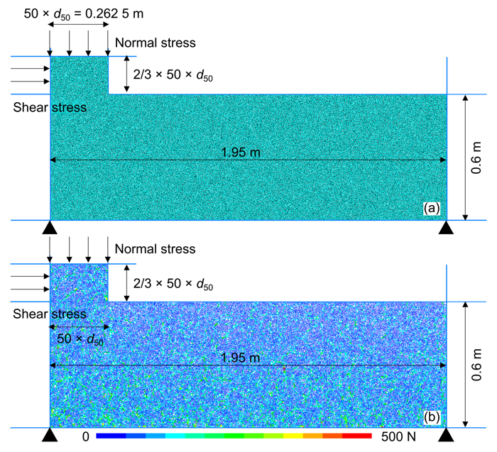
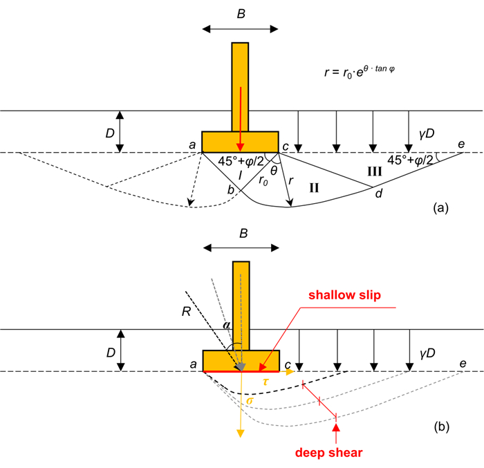
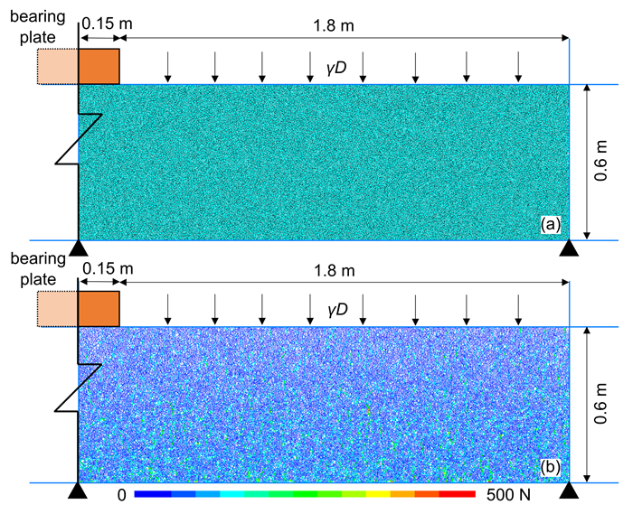
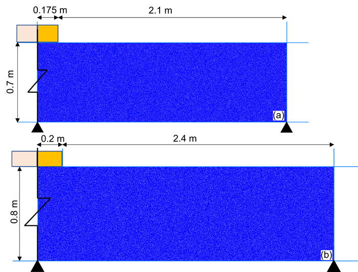
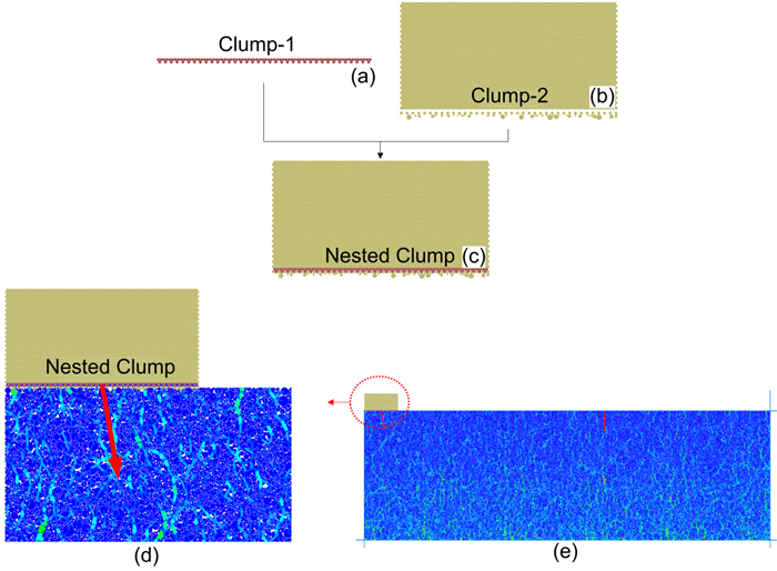
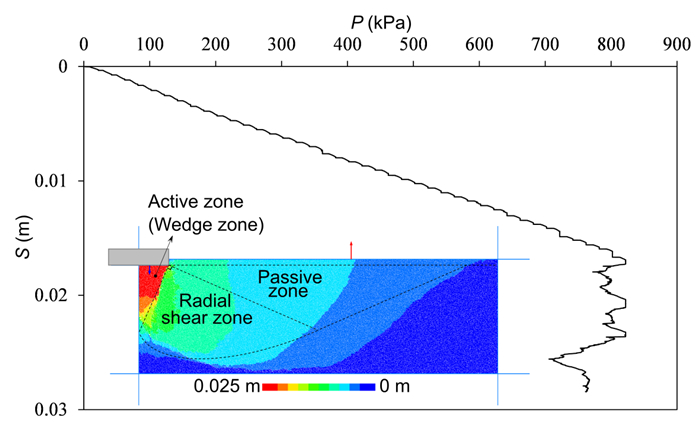
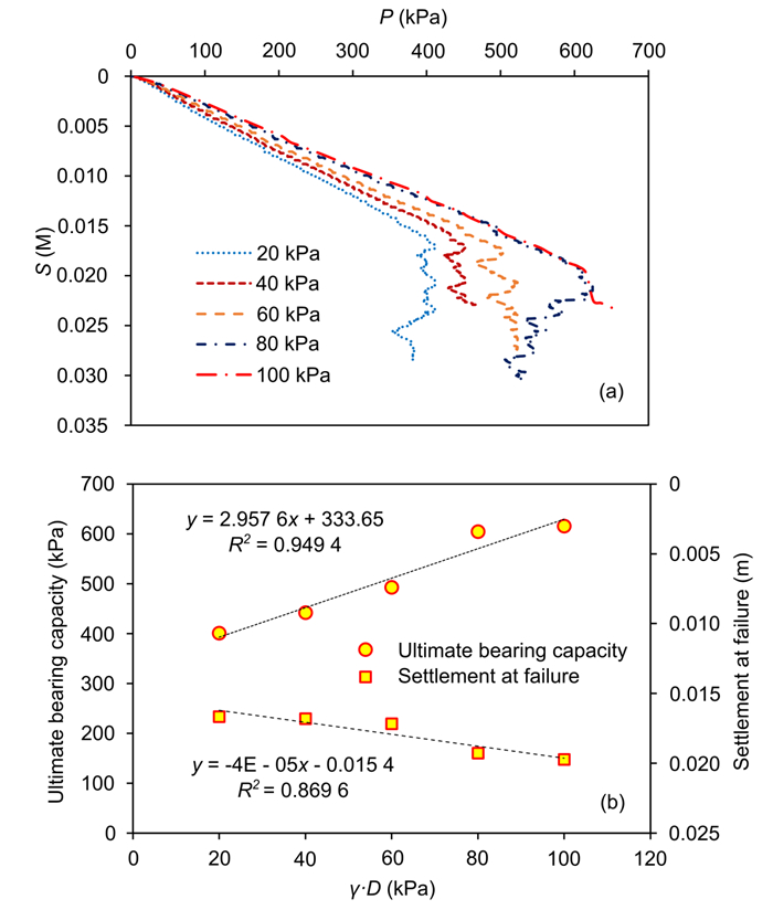
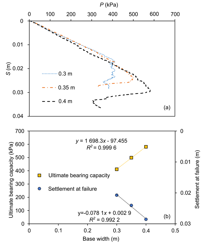
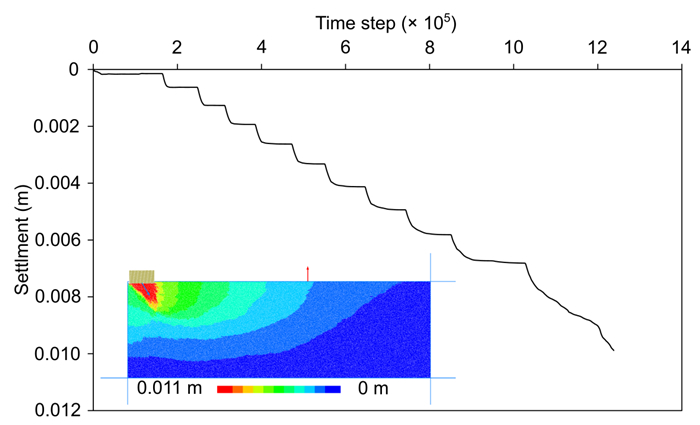
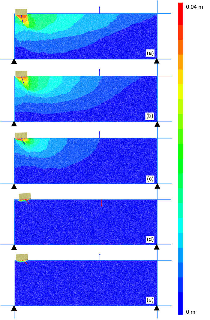
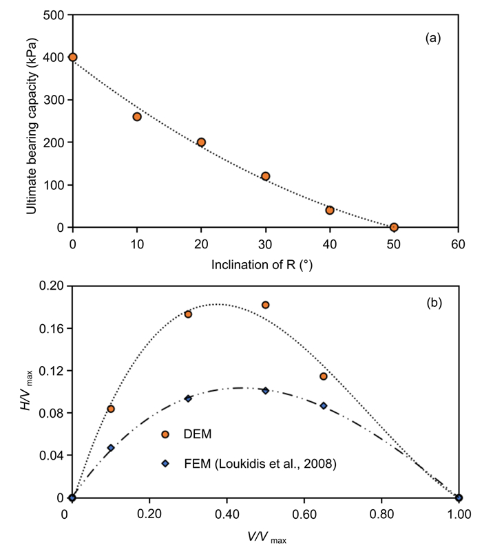
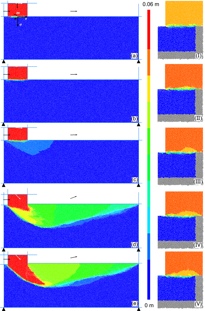
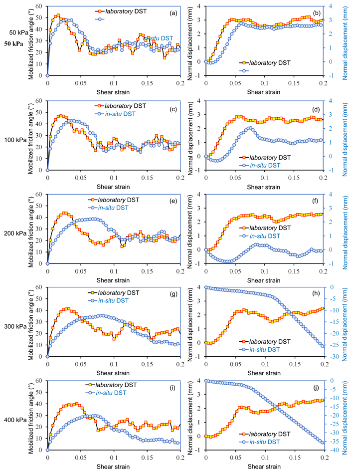
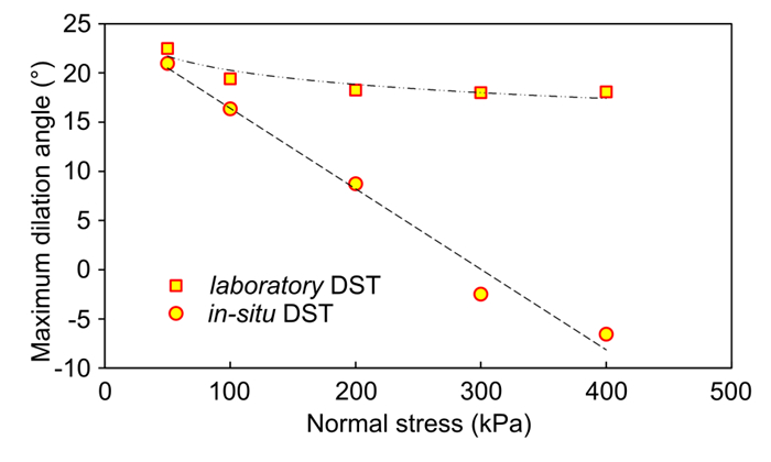
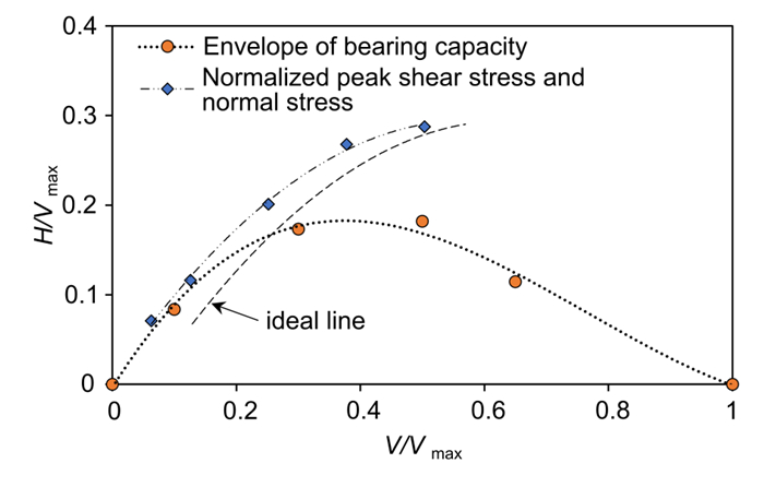
This study unveils a novel and potentially economical particulate discrete element modeling (DEM) technique for large-scale simulation of in-situ direct shear tests (DST) and plate load tests, aimed at accurately determining the shear strength and bearing capacity of granular soil foundations, and exploring the key factors influencing these properties. To overcome the limitations associated with the oversimplification of particle shapes, this work introduces an innovative contact model based on the Hertz contact mechanism that incorporates rolling resistance, enhancing the model's ability to simulate realistic particle interactions. Guided by Prandtl's foundation bearing-capacity theory, the dimensions of the foundation model for the DST and plate load tests were meticulously calculated to reflect realistic conditions. DEM simulations showed the peak friction angle from in-situ DST to be consistently lower than laboratory DST, due to a smaller dilatation angle, while proposed loading methods for plate load tests established linear relationships between the foundation's ultimate bearing capacity and its dimensions, also defining the capacity envelope. Crucially, this study highlights a crucial finding: in-situ direct shear tests (DST) conducted under high normal stress may lead to foundation failure, indicating that excessive normal stress should be avoided to ensure the accuracy of in-situ shear test data and its subsequent applicability in engineering design.
Estimation of Cation Exchangeable Capacity and External Specific Surface Area of Homoionic Montmorillonite from Water Adsorption Isotherms
Penglin Zheng, Qingbing Liu, Jinge Wang, Changdong Li
2026, 37(4): 1936-1948. doi: 10.1007/s12583-024-0010-7
Abstract:

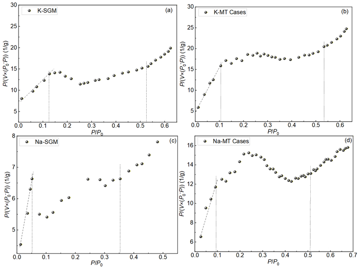
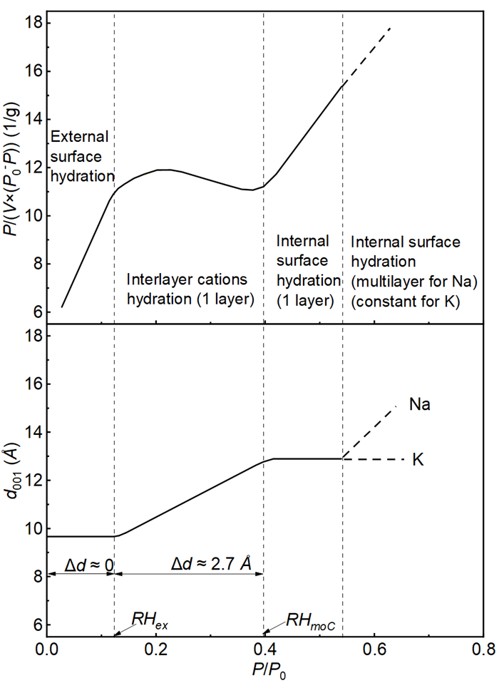
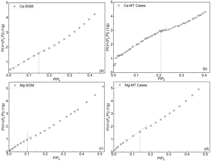
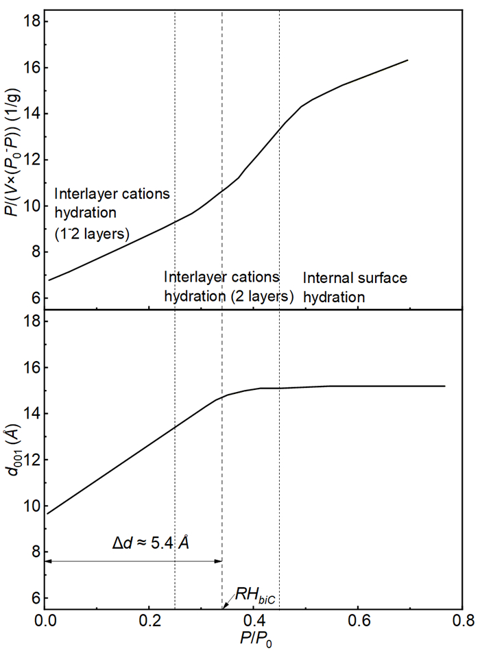
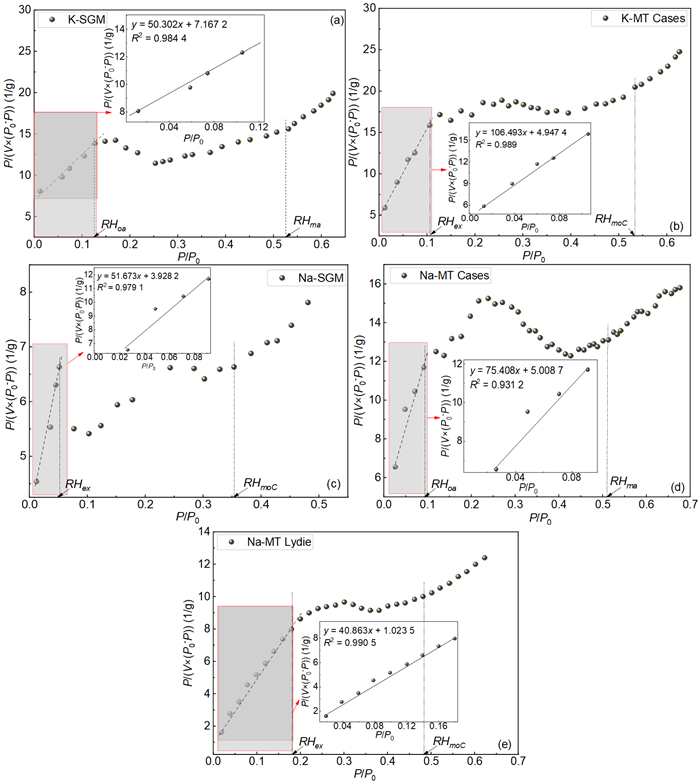
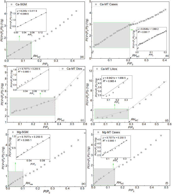
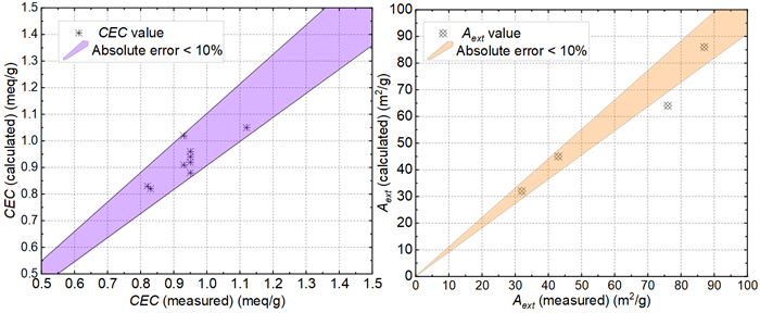
This paper presents a method, based on Brunauer Emmett Teller (BET) theory, to estimate cation exchangeable capacity (CEC) and external specific surface area (SSAext) of homoionic montmorillonites using water adsorption isotherm. To this end, the dominant mechanism of water vapor adsorption by montmorillonite in different relative humidity (RH) range was firstly examined by analyzing the variation of basal spacing (d001) with RH, and the sequence of two hydration mechanisms, i.e., cation hydration and surface hydration, were identified in terms of their relative contribution to interlayer expanding. On this basis, the BET model was applied to analyze water vapor adsorption isotherm and the variations of shapes of BET-plots for different homoionic montmorillonites was interpreted from the view of the dependency of hydration sequence on cation type. By linking BET curve with d001 variation curve, an approach based on BET-plot to distinguish the boundary RH value between cation hydration and outer/interlayer surface hydration was proposed. With this approach, the definition of monolayer water content was reconsidered and a method to predict the CEC and SSAext was developed. The validity of the proposed method was examined by comparing the predictions with experimental results. It is shown that, depending on interlayer cation type, the adsorption of water could initially occur either on cation or on external surfaces. This behavior, on one hand, allows for extending BET model to CEC prediction, and on the other hand, implies that the conventional way of calculating SSAext from straight-line BET plot, without considering the effect of cation types, may be inappropriate for montmorillonite-rich soil.

Marine Geology
Cenozoic Sedimentation and Response to Greenhouse-Icehouse Transition in the Eastern Amundsen Basin, Arctic Ocean
Fei Wang, Weiwei Ding, Pingchuan Tan
2026, 37(4): 1949-1964. doi: 10.1007/s12583-026-0076-5
Abstract:

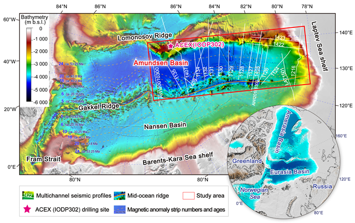
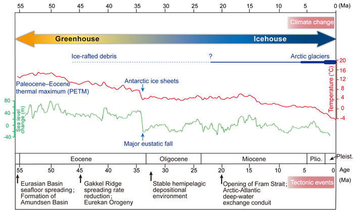
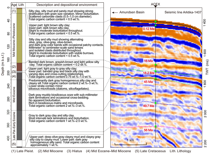
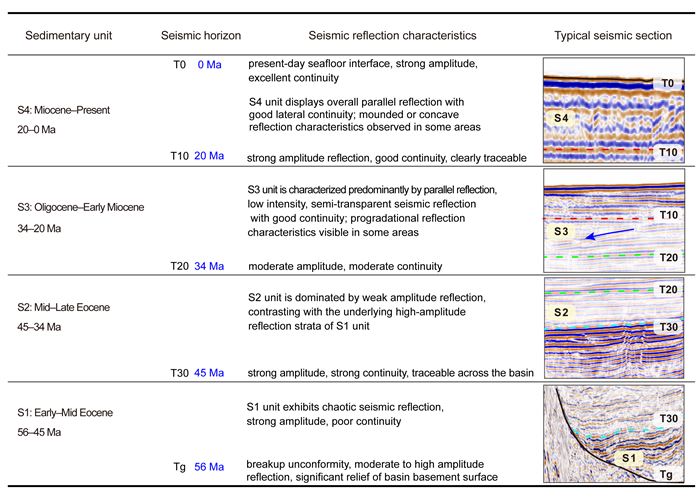
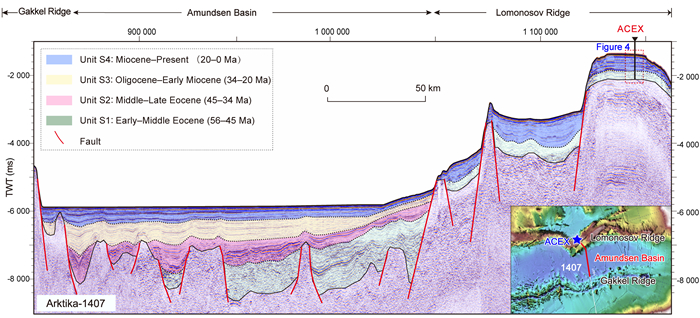
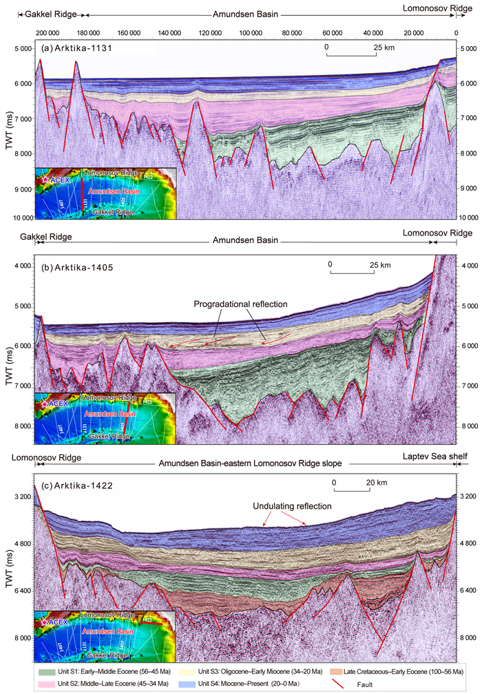
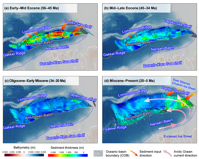
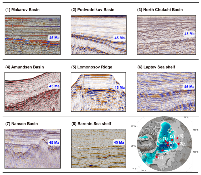
The Amundsen Basin preserves a relatively complete Cenozoic sedimentary record, providing insights into the Arctic paleoenvironmental changes during the greenhouse-to-icehouse climate transition. This study establishes a Cenozoic stratigraphic framework for the eastern Amundsen Basin based on 19 multichannel seismic profiles integrated with IODP Expedition 302 (ACEX) drilling data. Through quantitative analysis of sediment budget variations and depocenter migration patterns, we reconstruct the Cenozoic sedimentary evolution. Key findings include: (1) Cenozoic sediment budget exhibits an "initial high, intermediate decline, and late recovery" trend: peaking at 18.21 × 10³ km3/Myr during the warm-humid Early–Middle Eocene (56–45 Ma), declining by ~35% to 11.92 × 10³ km3/Myr during Middle–Late Eocene cooling (45–34 Ma), reaching a minimum of 8.73 × 10³ km3/Myr under pelagic-dominated Oligocene–Early Miocene conditions (34–20 Ma), and recovering to 9.91 × 10³ km3/Myr since the Miocene (20–0 Ma), driven by glacial erosion, fluvial maturation, and ocean circulation reorganization. (2) Depocenter migration reflects provenance shifts: localized depocenters (~3 000 m) developed along the Laptev shelf margin during the Early–Middle Eocene, shifted toward the Lomonosov Ridge after the Middle Eocene with basin-wide thickness homogenization (200–500 m) during Oligocene–Early Miocene, and returned to Laptev margin dominance since the Miocene. (3) The Middle Eocene (~45 Ma) marks a critical turning point in Arctic sedimentary environment, evidenced by both the abrupt ~35% decline in sediment budget and significant differences in seismic reflection characteristics above and below this interface, with synchronous responses observed across multiple Arctic regions. Combined with ACEX ice-rafted debris records, these findings demonstrate that the Middle Eocene climate transition exerted regional control on Arctic sedimentation.

Upper Mantle Structure beneath the Mid-Ocean Ridges in Indian Ocean: Insights from the Seismic Tomography Models
Yana Yu, Xing Yu, Hu He, Zhaocai Wu, Zakaria A. Khamis, El-Gharabawy Suzan, Hang Hu, Huichen Li
2026, 37(4): 1965-1975. doi: 10.1007/s12583-025-0300-8
Abstract:

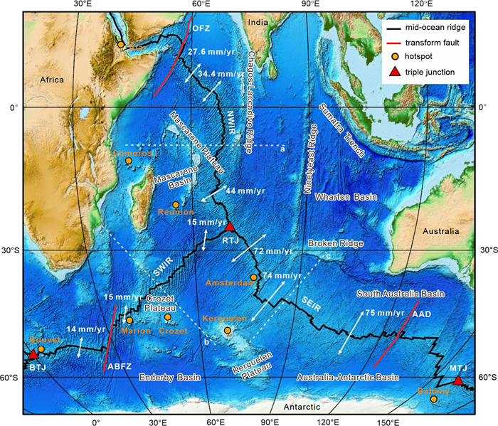
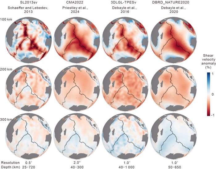
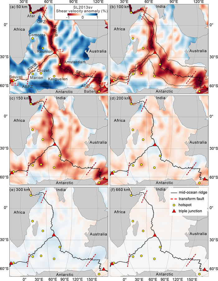
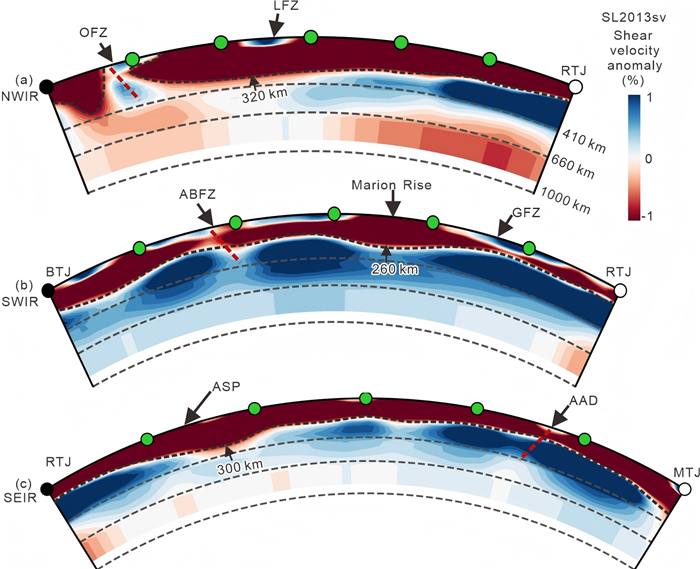
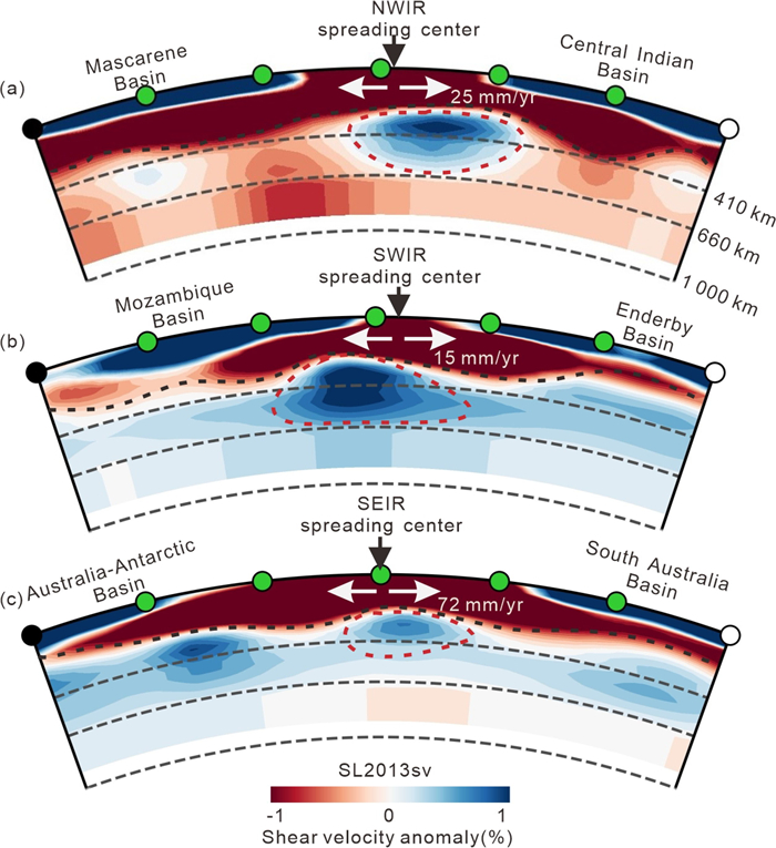
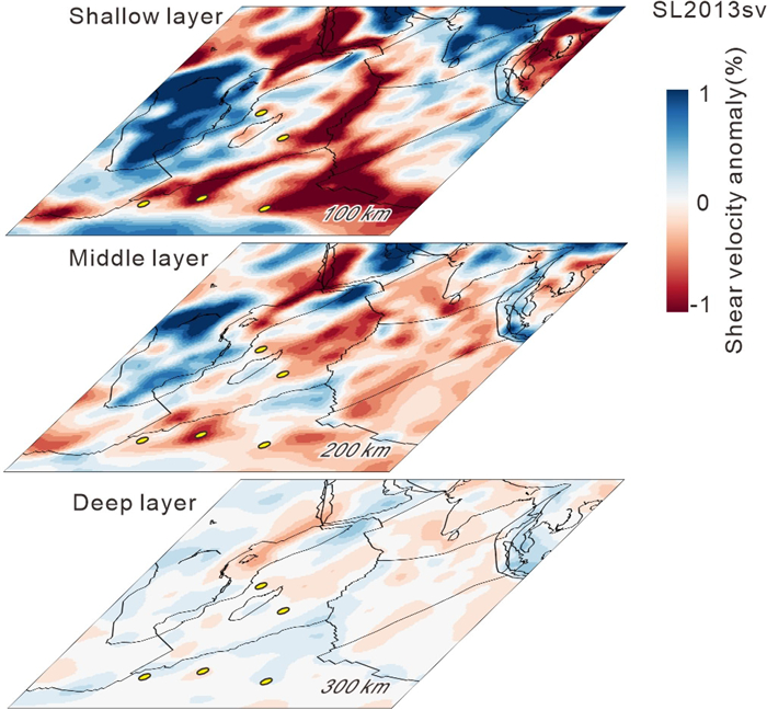
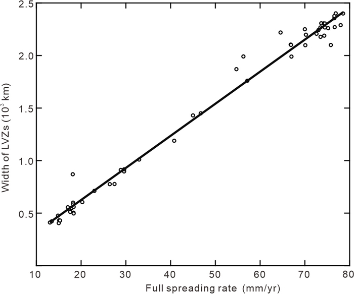
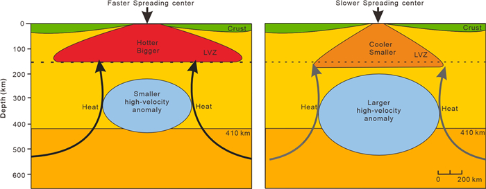
Mid-ocean ridges (MORs) are critical regions for plate tectonics, mantle upwelling, magma output and oceanic crust accretion. Understanding the upper mantle structure beneath MORs is essential for unraveling the geodynamic processes driving ridge evolution. However, the existing research work are mostly focused on a specific ridge segment, few knowledge about the 3D structure of the sub-ridge upper mantle has been revealed. This study focused on the Indian Ocean ridge system, utilizing upper mantle tomography data to analyze both low-velocity and high-velocity anomalies beneath MORs. The tomographic features of upper mantle beneath Indian Ocean varies a lot vertically, with the shallow layer showing the ridge activity, the middle layer indicating plume conduits, and the deep layer exhibiting rather homogeneous transition zone. The lateral extent of shallow low-velocity zones (LVZs) is related to spreading rate, with wider LVZs for faster spreading ridges. Large transform faults usually truncate the LVZs along ridge axis. Beneath the LVZs high-velocity anomalies can be observed for most of the ridge segments, the size of which seems decrease with increasing spreading rates. The study presents an overall image of the upper mantle for Indian Ocean, especially for the ridge systems. It provides direct evidence for the ridge evolution and its connection to the deep earth. The newly picked-up high-velocity anomalies under LVZ may require further confirmation, and whether it is the shadow of relic subducted slabs need more detail seismic investigations.

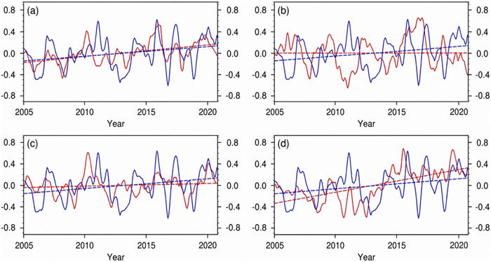
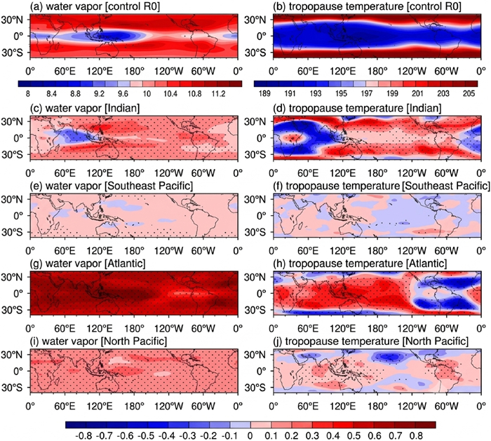
Rise in Stratospheric Water Vapor over the Past Two Decades: An Association with Tropical Atlantic Sea Surface Temperature
Yingli Niu, Fei Xie, Yan Xia, Na Liu, Yuanyuan Han
2026, 37(4): 1976-1985. doi: 10.1007/s12583-024-1988-6
Abstract:

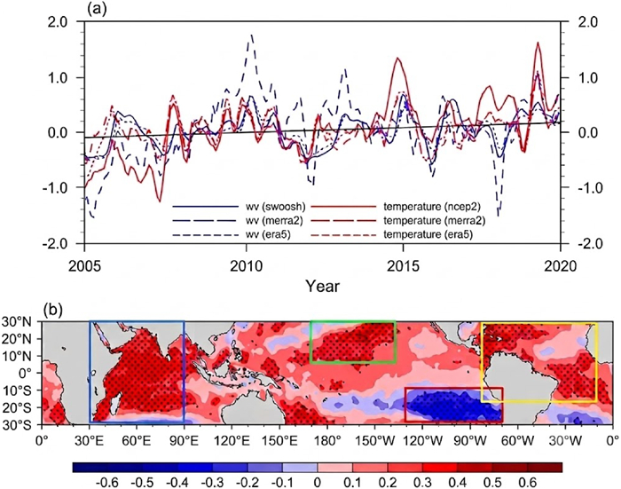
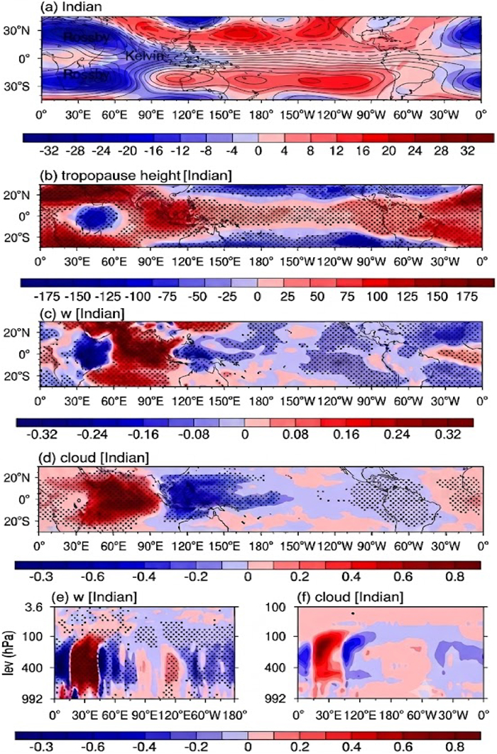
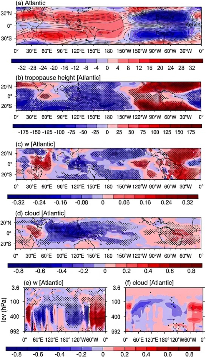
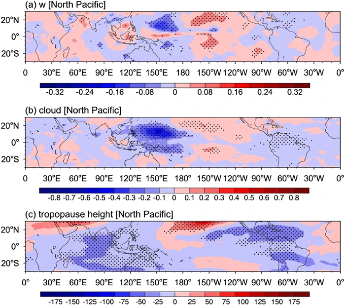
Variations in stratospheric water vapor (SWV) impact not only dynamic and chemical stratospheric processes but also the rate of global warming by influencing the Earth's energy budget. Multiple observations have indicated a significant increasing trend in SWV since 2005. Here, using both observations and idealized sensitivity experiments with a numerical model, we find that the warming in the tropical Atlantic is the main contributor to the increasing SWV trend since 2005. The warming of both the tropical Indian and Atlantic oceans elicits a Gill-Matsuno response, and the tropopause warming caused by Atlantic warming is located over the Indo-Pacific warm pool, which tends to efficiently increase the SWV after 2005. The North Pacific warming, which weakens the Hadley cell, results in a reduction in the tropical tropopause height and consequential tropopause warming, especially over the warm pool, which also contributes to the SWV increase.

Editorials
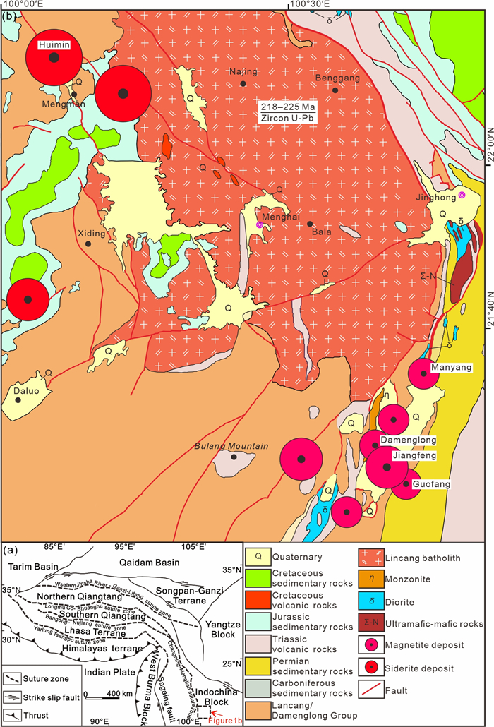
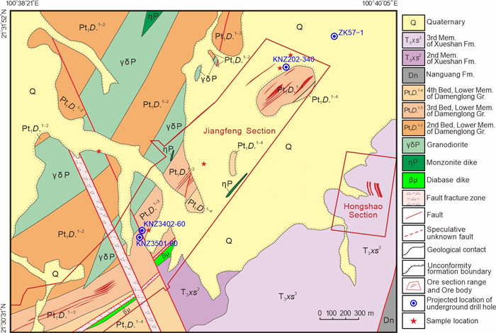
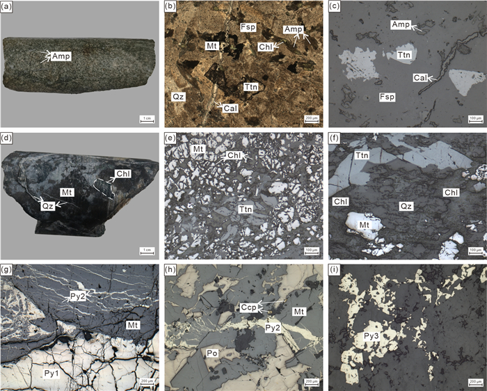
Late Triassic Magmatic-Hydrothermal Origin of the Jiangfeng Fe-Co Deposit (Yunnan, SW China): Constraints from Titanite U-Pb Dating and Sulfur Isotopes
Hui-Min Su, Shao-Yong Jiang, Shufu Chen, Xianda Jiang, Guolong Zheng, Xiayu Li
2026, 37(4): 1986-1994. doi: 10.1007/s12583-026-0516-2
Abstract:
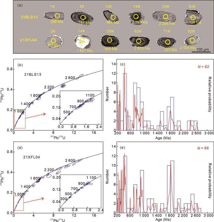
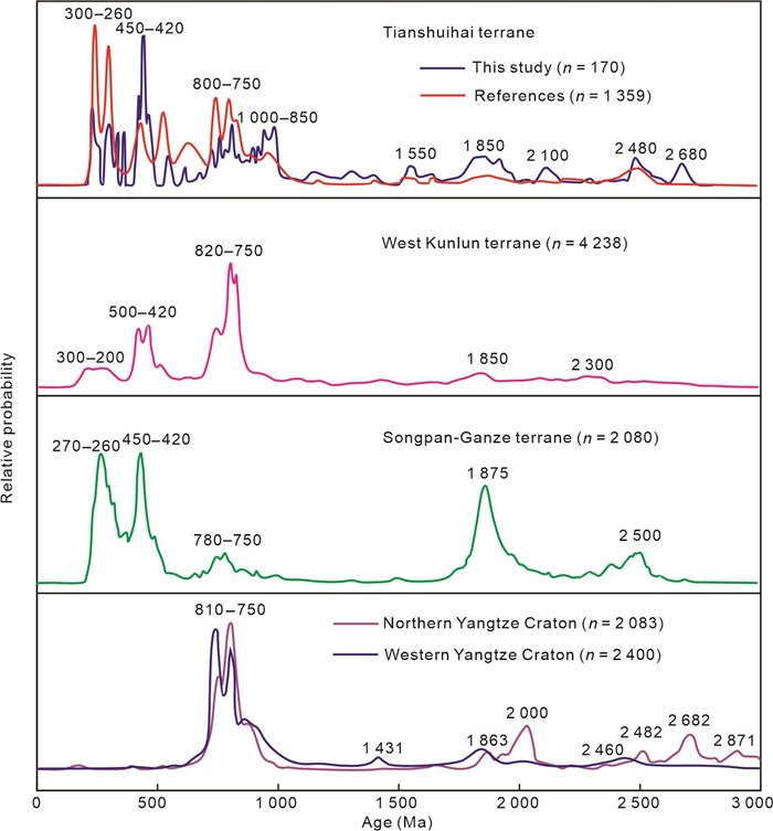
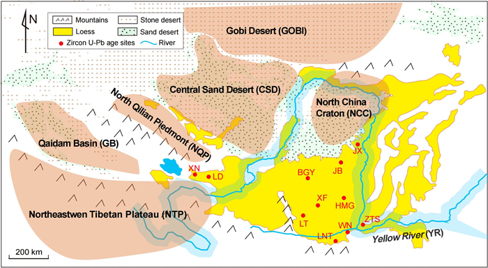
Detrital Zircon U-Pb Constraints on Late Triassic Flysch Sedimentation and Li-Pegmatite Sources in the Tianshuihai Terrane, West Kunlun, Northwestern Tibetan Plateau
Qing Du, Jiyuan Yin, Andrew C. Kerr, Guibin Zhang
2026, 37(4): 1995-2000. doi: 10.1007/s12583-026-0620-3
Abstract:
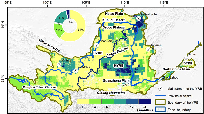
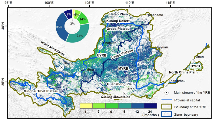
Vegetation Greening in the Yellow River Basin might Accelerate the Propagation of Drought
Haijun Qiu, Wen Liu, Yaru Zhu
2026, 37(4): 2001-2005. doi: 10.1007/s12583-026-0514-4
Abstract:
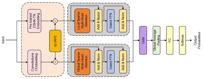
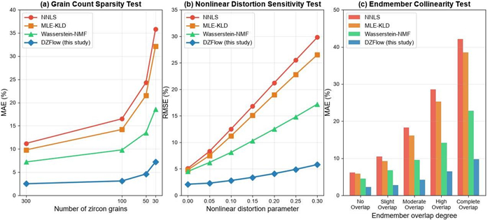
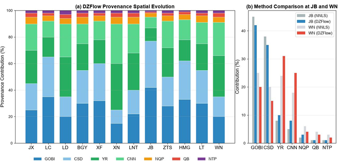
Quantitative Provenance Analysis of Detrital Zircon via Deep Temporal Networks
Xinyi Wu, Guanyu Chen, Jun Hu, Zhihao Deng, Zhiyuan Huang, Quanyu Wang
2026, 37(4): 2006-2012. doi: 10.1007/s12583-026-0517-1
Abstract:
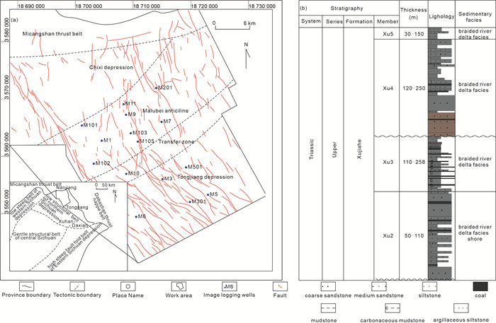
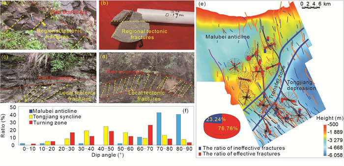
Fracture Development, Mechanisms, and Effectiveness in Tight Sandstone Reservoirs: Case Study of the Xujiahe Formation, Northeastern Sichuan Basin
Zhuoyi Li, Guoping Liu, Kewei Zu, Xing Zhang, Yunlong Xu, Chengxiang Wan, Jiasi Li, Xiaofei Zhao, Yuzhe Wang, Haoyu Wang, Tao Hu
2026, 37(4): 2013-2020. doi: 10.1007/s12583-026-0509-1
Abstract:
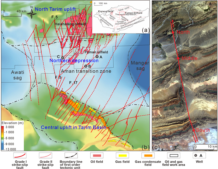
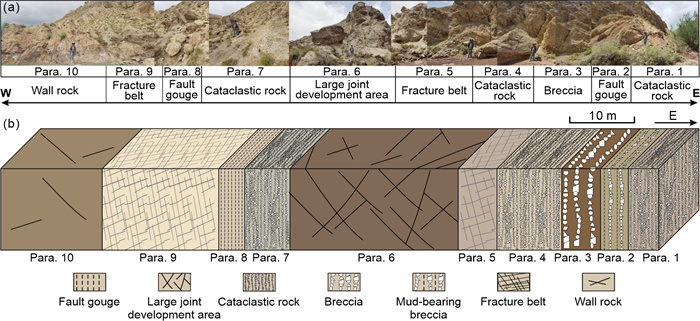
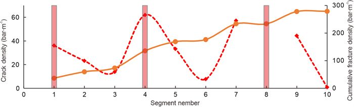
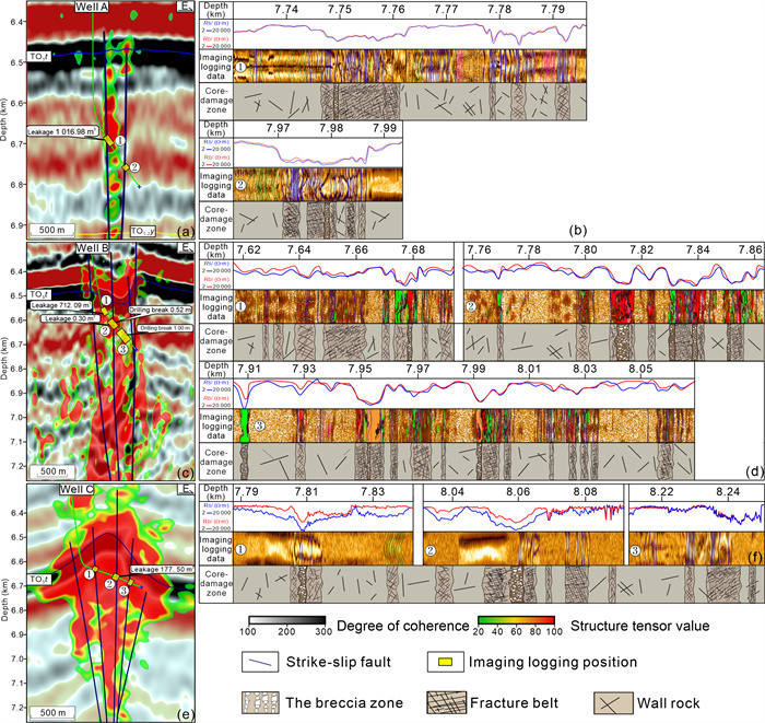
Internal Architecture of Strike-Slip Fault Zones in the Fuman Oilfield, Tarim Basin: Insights from Outcrops and Ultra-Deep Wells
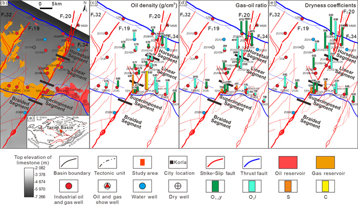
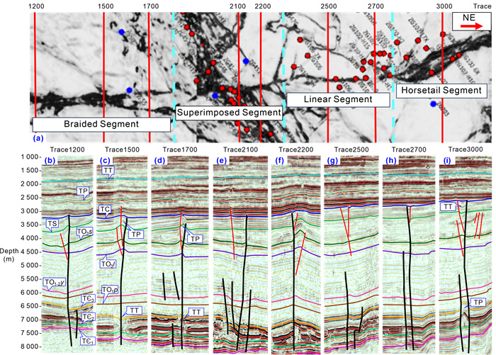
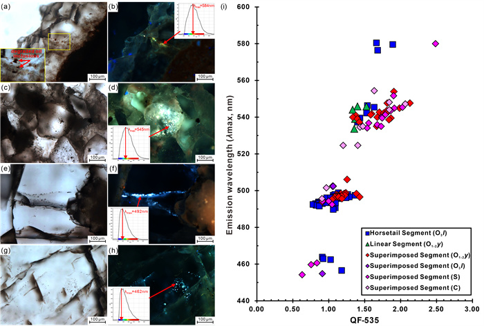
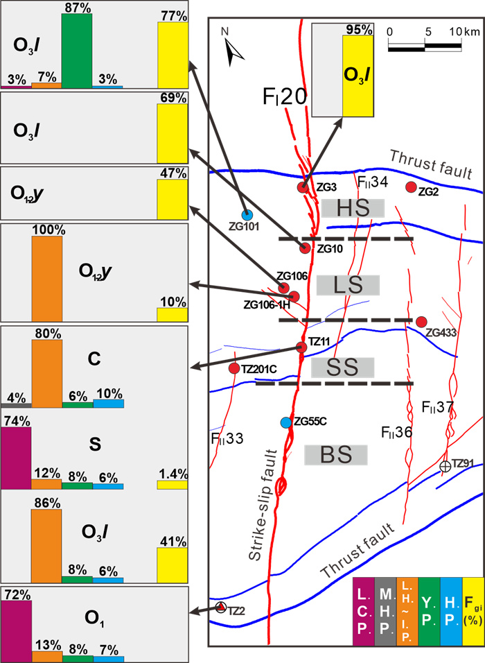
Yintao Zhang, Xingxing Zhao, Chong Sun, Yaoguang Sun, Hongwei Ping
2026, 37(4): 2021-2027. doi: 10.1007/s12583-026-0511-7
Abstract:
Stage-Dependent Differences in Vertical Fault Transmissibility Control Segmented Hydrocarbon Accumulation along Strike-Slip Faults
Haitao Zhao, Chunguang Shen, Hongwei Ping, Jianjie Li, Ying Yang, Tengfei Su
2026, 37(4): 2028-2036. doi: 10.1007/s12583-026-0513-5
Abstract:
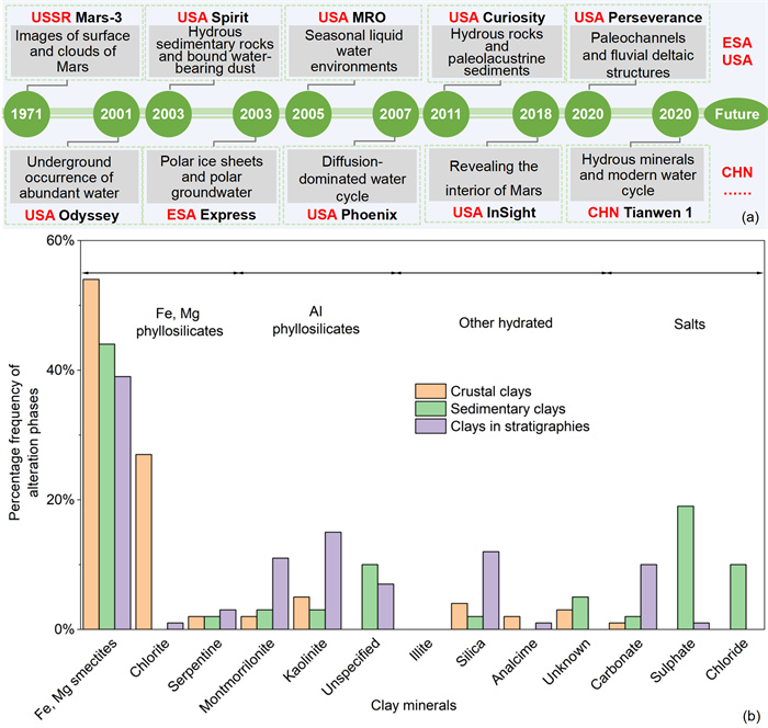
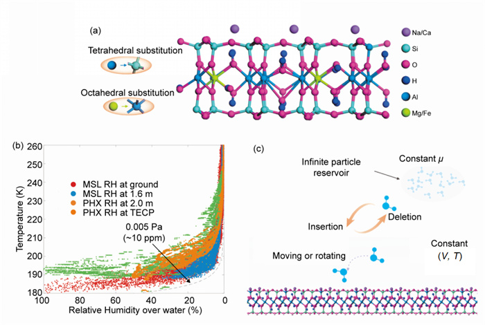
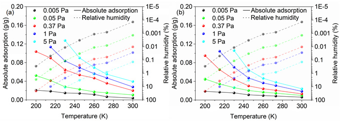
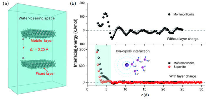
Water Retention in Martian Clays under Modern Martian Environments
Zihan Zhang, Jie Meng, Li Wang, Dongpo Wang, Changdong Li, Helge Hellevang, Gongji Zhang
2026, 37(4): 2037-2043. doi: 10.1007/s12583-026-0512-6
Abstract:
Key Construction Technologies for Large-Section Altered Rock Water Conveyance Tunnels with Integrated Advance Forecasting and Deformation Management
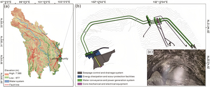
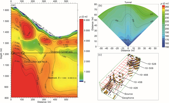
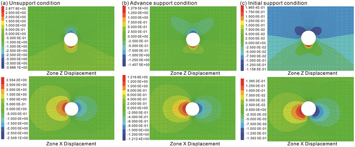
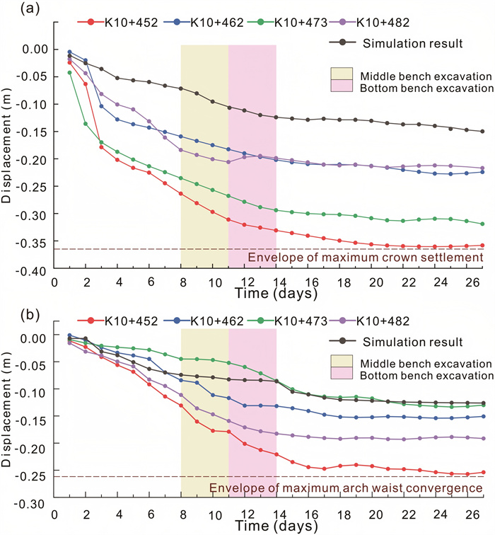
Liuyang Sun, Juanjuan Ma, Jiaxing Dong, Chenghong Han
2026, 37(4): 2044-2050. doi: 10.1007/s12583-026-0510-8
Abstract:
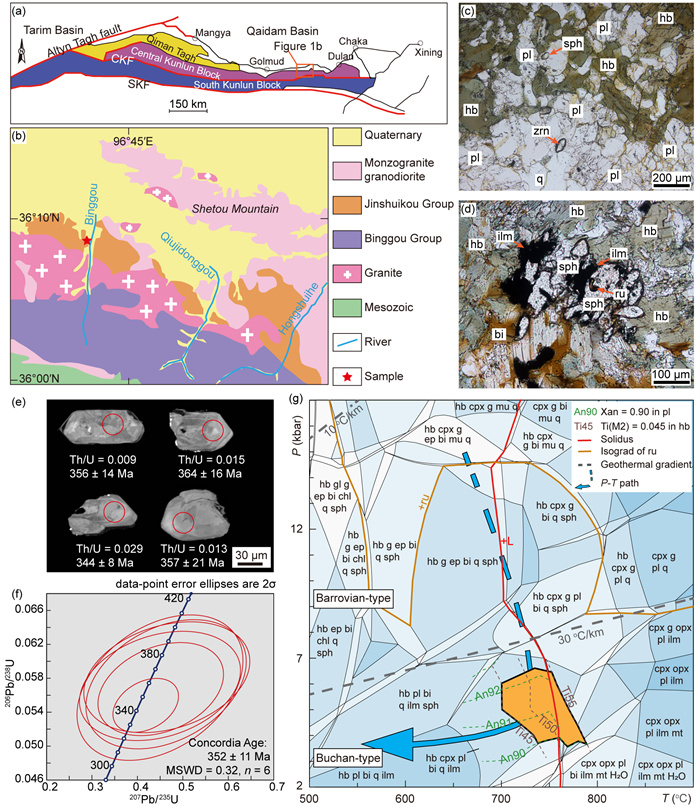
Carboniferous Buchan-Type Regional Metamorphism in the East Kunlun Orogenic Belt and Its Tectonic Implications
Xiaohui Liu, Zeng Lü
2026, 37(4): 2051-2055. doi: 10.1007/s12583-026-0515-3
Abstract:
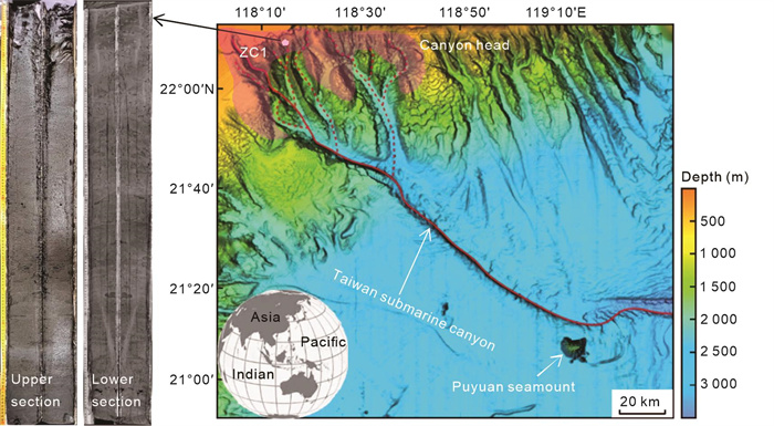
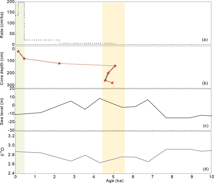
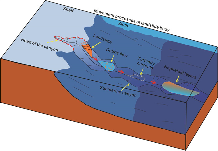
Sedimentological Record of Submarine Landslides at the Canyon Head and Dynamic Processes
Zhuangcai Tian, Jinjian Huang, Jingxin Wu, Yuan Wang, Lisha Hu, Xiujun Guo
2026, 37(4): 2056-2061. doi: 10.1007/s12583-026-0618-x
Abstract:
Development Mechanisms and Distribution Prediction of Natural Fractures in Carbonate Reservoirs under Mixed Sedimentary Settings
Feifan Lu, Wei Yang, Bolin Yan, Bingxi Zhang, Yanlin Liang, Yixin Dong, Chen Zhang
2026, 37(4): 2062-2068. doi: 10.1007/s12583-026-0619-9
Abstract: