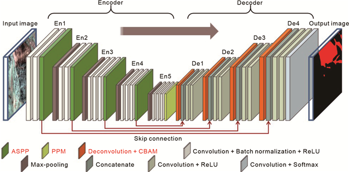
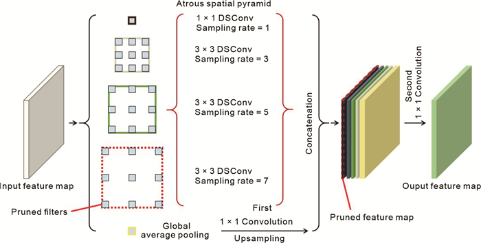
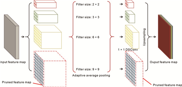
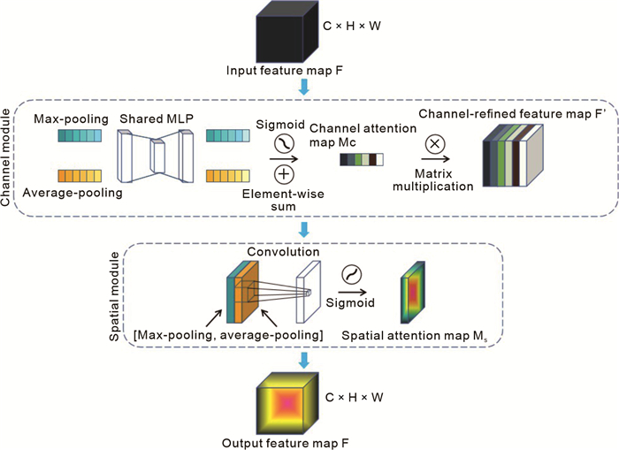
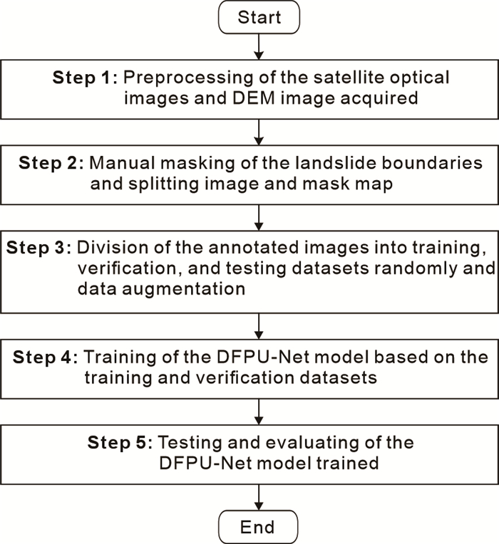
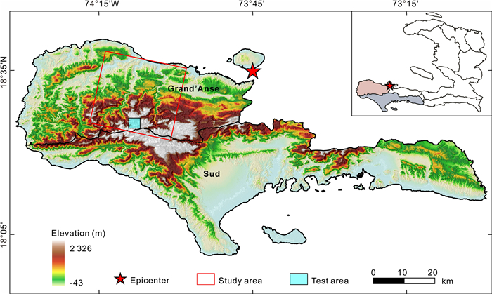
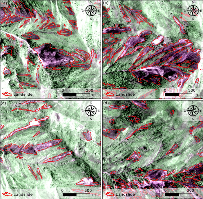
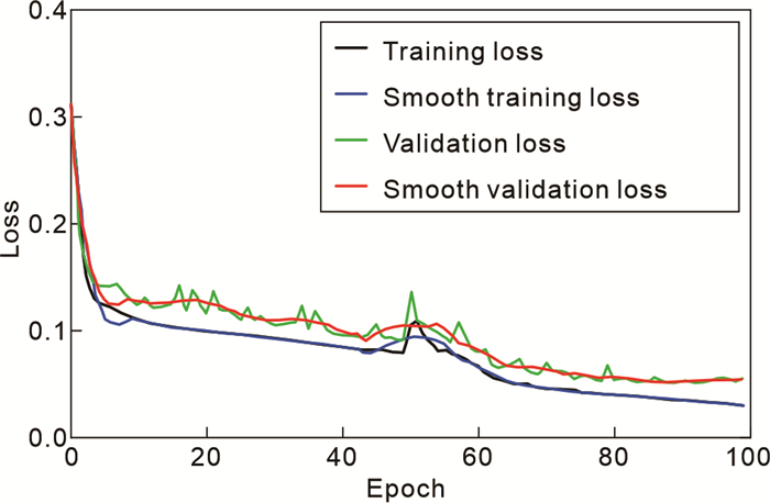
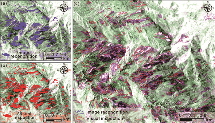
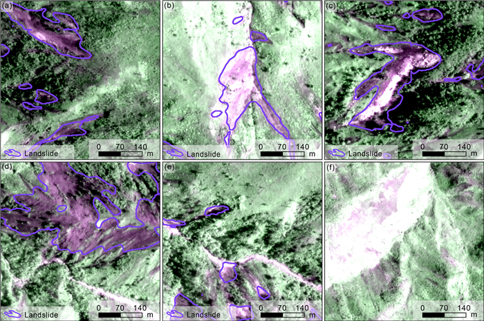
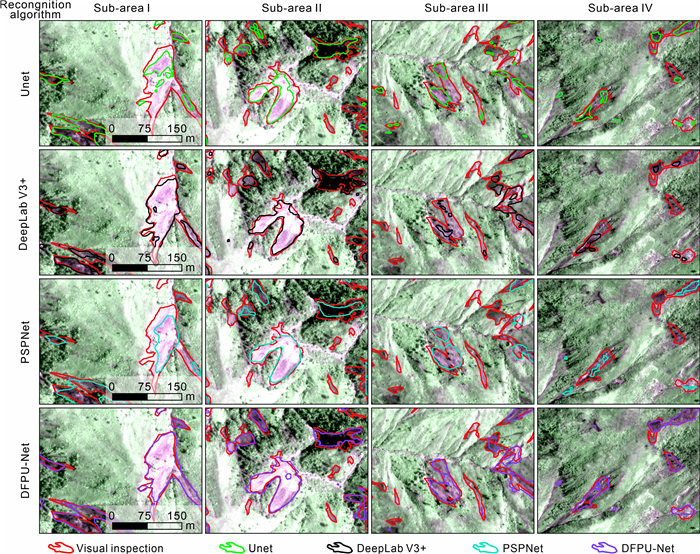
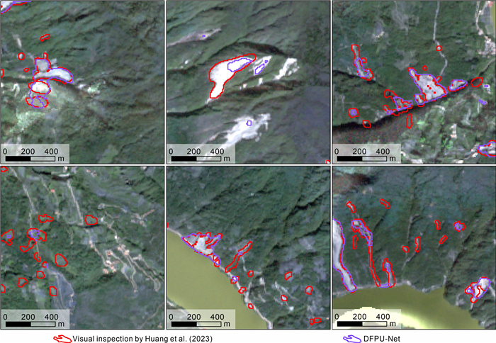
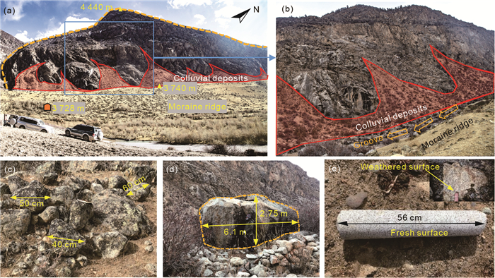
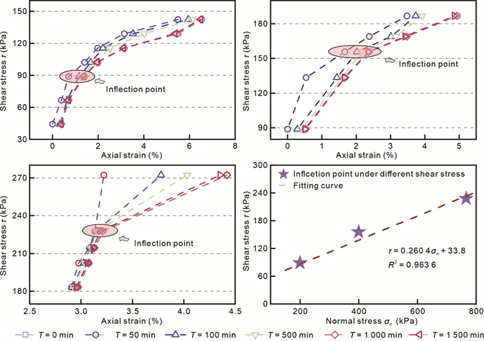
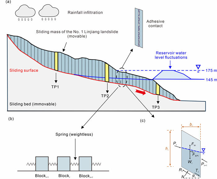
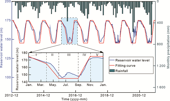
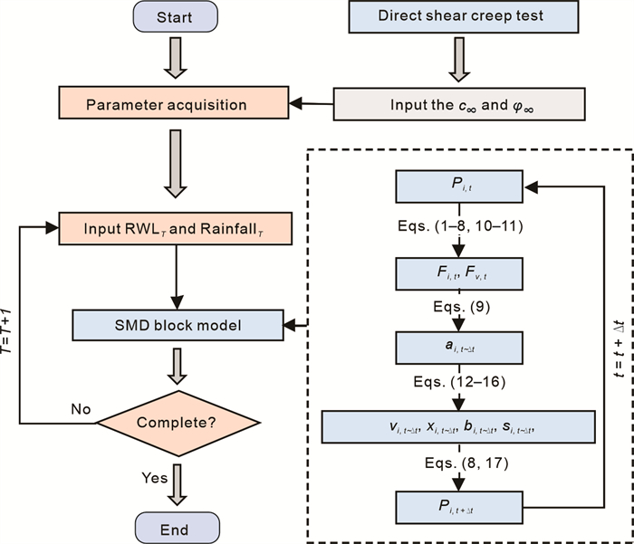
Landslides are widely distributed in mountainous regions around the world. Rapid mapping of earthquake-induced landslides in mountainous areas plays a crucial role in post-disaster assessment and rescue planning. In mountainous areas, it is challenging to identify small landslides using existing landslide mapping methods accurately. To address this challenge, this paper proposes a dual feature pyramid-based UNet (DFPU-Net) model, which utilizes the VGG16 model as the backbone feature extraction network. Meanwhile, two modified pyramid-structured modules, in terms of the atrous spatial pyramid pooling (ASPP) module and pyramid pooling module (PPM), are integrated into the backbone feature extraction network. Furthermore, the features of landslides extracted by the enhanced feature extraction network are screened by the deconvolution layers and convolutional block attention module (CBAM). To demonstrate the effectiveness of the proposed model, landslides in Grand'Anse and Sud departments, induced by the 2021 Haiti Mw7.3 earthquake, are mapped as a case study. The inputs adopted in this case study are satellite optical images, slope map, and normalized difference vegetation index (NDVI) map collected in this study region, and the estimated Precision, Recall, F1 score, Accuracy, and IoU of the landslide mapping results are 89.10%, 74.20%, 80.97%, 95.32%, and 68.02% respectively, indicating the effectiveness of the proposed model. The comparisons conducted show that the proposed model yields a higher Recall value than the existing models of UNet, DeepLab V3+, and PSPNet, thus, the superiority of the proposed model over the existing models is demonstrated.